Jegihorn
| Jegihorn | ||
|---|---|---|
|
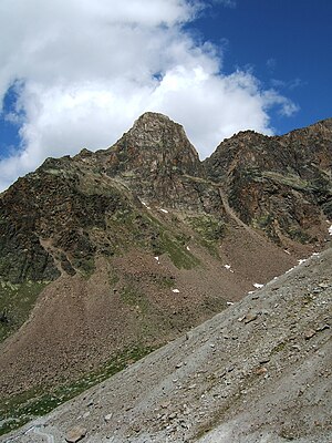
Jegihorn from the southeast, from the Weissmieshütte |
||
| height | 3206 m above sea level M. | |
| location | Canton of Valais , Switzerland | |
| Mountains | Valais Alps | |
| Dominance | 0.43 km → Yegi Tower | |
| Notch height | 113 m ↓ unnamed notch | |
| Coordinates | 641 076 / 111255 | |
|
|
||
| First ascent | probably local hunters | |
| Normal way | South flank ( F + ) | |
The Jegihorn (also Jägihorn ) is 3206.3 m above sea level. M. high mountain in the Valais Alps . It is located above Saas Grund on the eastern side of the Saas Valley . It forms the western end of the Jegigrates , the east-northeast in the Fletschhorn passes -Westflanke.
The starting point for an ascent is the Weissmieshütte ( 2726 m ), or the Kreuzboden middle station ( 2397 m ) of the Saas Grund – Hohsaas railway can be reached directly . The mountain can also be climbed as a day tour, especially when using the train.
The summit offers a comprehensive panorama of the four-thousand-meter peaks of the Mischabel group . It also provides a good insight into the ascent routes of the nearby three main peaks of the Weissmies group , Fletschhorn , Lagginhorn and Weissmies . Since it is by far the easiest summit from the Weissmieshütte, it is often climbed by beginner groups as an acclimatization for the 4,000-meter summit.
Summit routes
The normal route leads first from the south through the flank and then from the west to the summit structure, is largely marked and accessible even for experienced hikers. Allow around two hours for the ascent from the Weissmieshütte.
In the south flank there are several multi- pitch tours in III.–IV. Level of difficulty .
A via ferrata was built on the Jegihorn in 2000 . The so-called panorama via ferrata is one of the highest via ferratas in the Alps . The first part of the route does not lead directly to the Jegihorn, but is located on the flank of the Jegi ridge to the east. From there a rope bridge led over the last notch to the actual summit, which was destroyed in a rock fall in 2012. A simpler variant of the climb continues through the saddle to the summit.
Literature and map
- Michael Waeber: Area Guide Valais Alps . 13th edition, Bergverlag Rother , Munich 2003, ISBN 3-7633-2416-X
- Hiking map, ski tours 1: 25,000, Saas Fee . 2007, Rotten Verlag, ISBN 978-3-905756-25-8 (map base: national maps of Switzerland 1: 25,000)
Individual evidence
- ^ Hermann Biner: Mountaineering in Wallis, From Trient to the Nufenen Pass . SAC-Verlag 2002, p. 481.
- ↑ Mountain Wilderness Germany eV (Ed.): Summit of Wiring. ( Memento of the original from April 14, 2015 in the Internet Archive ) Info: The archive link was inserted automatically and not yet checked. Please check the original and archive link according to the instructions and then remove this notice. May 2013
Web links
- Description of the panoramic via ferrata on the Jegihorn
- Panorama from the Jegihorn on gipfelderschweiz.ch

