
Johann-Ludwig-Klarmann-Weg
| Johann-Klarmann-Weg | |
|---|---|
 Logo of the Johann-Ludwig-Klarmann Weg |
|
| Data | |
| length | 115 km |
| location |
Bavaria
|
| Supervised by | Steigerwald eV |
| Starting point |
Hassfurt 49 ° 59 '57.6 " N , 10 ° 27' 32.2" E |
| Target point |
Steinsfeld 49 ° 25 ′ 58.1 ″ N , 10 ° 18 ′ 23.3 ″ E |
| Type | trail |
| The highest point | Scheinberg 499 m |
The Johann-Ludwig-Klarmann-Weg is an approx. 115 km long hiking trail in Bavaria. It begins near Haßfurt and ends after a southern run near Steinsfeld. His name refers to the historian and author Johann-Ludwig Klarmann .
course
The path begins south of the village and then leads into the Steigerwald , where, similar to the Steigerwald Panorama Trail and the Celtic Adventure Trail, it crosses the Zabelstein with its ruins and its observation tower for a short time . Then the path crosses the Vollberg and the highest Franconian vineyard, the Stollberg . After a few more kilometers, he reaches the town of Ebrach , where the Steigerwald treetop path is located. The hiking trail then passes the village of Gräfenneuses, a district of Geiselwind with the Glößberg vantage point. Then the long-distance hiking trail, which continues to the south , reaches two sights with the Friedrichsberg and the Schwanberg , each of which has a castle. After a few more kilometers, the two highest mountains in the Steigerwald ( Hoher Landsberg and Scheinberg ) are crossed. The path then leaves the natural Steigerwald in the direction of Ochsenfurter Gau and a short time later reaches the city of Uffenheim . Then he reaches the destination Steinsfeld
Places on the hiking trail
- Hassfurt
- Einersheim market
- Iphofen
- Abtswind
- Castell
- Gräfenneuses
- Small greens
- Ebrach
- Handthal
- Michelau in the Steigerwald
- Uffenheim
- Gallmersgarten
- Burgbernheim
- Stone field
Attractions
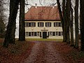
Friedrichsberg Castle

Kunigunden chapel

Zabelstein ruins

Hohenlandsberg castle ruins

Stollburg castle ruins

Treetop Walk Ebrach


.JPG)

See also
Individual evidence
- ↑ Guide-to-Bavaria - long-distance hiking trails in the Steigerwald - Klarmannweg. Retrieved March 29, 2020 .
- ^ Johann Ludwig Klarmann - German Digital Library. Retrieved March 29, 2020 .
- ^ BayernAtlas. Retrieved March 29, 2020 .