Juliaca
| Juliaca | |
|---|---|
|
Coordinates: 15 ° 29 ′ S , 70 ° 8 ′ W
Juliaca on the map of Peru
|
|
| Basic data | |
| Country | Peru |
| region | Puno |
| province | San Roman |
| City foundation | 1826 |
| Residents | 217,743 (2017) |
| - in the metropolitan area | 276.110 |
| City insignia | |
| Detailed data | |
| height | 3825 m |
| Waters | Río Coata |
| prefix | (+51) 84 |
| Time zone | UTC -5 |
| City Presidency | David Mamani Paricahua (2019-2022) |
| City patron | San Sebastian |
| Website | |
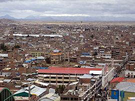
| View over the city of Juliaca | |
| Climate diagram Juliaca | |
Juliaca is a city in the south of the South American Andean state Peru with 217,743 inhabitants. It is the largest city and the capital of the province of San Román within the Puno region . The city is located in the district of the same name at an altitude of 3825 m 24 km west of Lake Titicaca on the Altiplano , an arid plateau with no drainage. The Río Coata , a tributary of Lake Titicaca, runs along the northern and eastern city limits.
economy
The city is known nationwide for its textile products, which is why it bears the name Ciudad Calcetera ("City of the knitters"). Tourists come mainly because of the cheap textile goods (sweaters, hats, bags).
In addition, Juliaca has the only airport in the province with Inca Manco Capac International Airport .
climate
The city bears the name Ciudad de Los Vientos ("City of the Wind") due to its free location on the plateau . Especially in winter, locals and visitors get to feel the freezing wind.
Individual evidence
- ↑ Peru: Region Puno - Provinces & Places . www.citypopulation.de. Retrieved December 23, 2019.


