Aargau Jura Park
| Aargau Jura Park | ||
|---|---|---|
|
|
||
| Location: | Aargau , Switzerland | |
| Next city: | Aarau | |
| Surface: | 245 km² | |
| Founding: | 2012 | |
The Aargau Jura Park has been a " Regional Nature Park of National Importance " since 2012 and is located in the rural area of the Jura landscape between the metropolitan regions of Basel and Zurich . With its high proportion of green space and extensive, species-rich forests, the nature park is an important local recreation area and a large, contiguous area to compensate for flora and fauna .
Location and geography
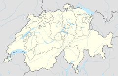
Located between the agglomerations of Zurich and Basel and the rivers Aare and Rhine , 28 municipalities (27 in the canton of Aargau , one in the canton of Solothurn ) form the 245 km 2 area of the nature park. The perimeter randomly formed by the affiliated municipalities resembles a dinosaur on the map , from which the park's heraldic animal, the “Jurasaurus Perimuk”, is derived. In general, the area is located in the vicinity of the upper Fricktal .
Geologically, the park perimeter to the north from the will Tafeljura and in the south from the north-eastern hills of the Jura mountains formed. While typical plateaus, arid valleys and gently rolling hills occur in the Table Jura, in the Chain Jura there are more thrusts, rugged rock edges, tectonic breaks and landslides. Various fossils such as ammonites , belemnites or shells from the time of the ancient sea of Tethys occur in the layers of the Jura . Dinosaur bones have even been found in the Frick region . The sediments of the former primeval sea also contain iron-bearing layers, which are extremely thick around the villages of Herznach and Wölflinswil in Switzerland and were mined until 1967.
Landscapes of national importance
In accordance with Article 5 of the Federal Act on Nature Conservation and Heritage Protection, Switzerland keeps a federal inventory of landscapes and natural monuments of national importance . Three such areas are partly located in the Aargau Jura Park:
- No. 1105, name: Baselbieter and Fricktaler Tafeljura , sub-areas of the nature park communities Gipf-Oberfrick, Kienberg, Schupfart, Wegenstetten, Wittnau, Wölflinswil
- No. 1107, name: Aargau and eastern Solothurn Folded Jura , parts of the nature park communities Auenstein, Biberstein, Densbüren, Kienberg, Küttigen, Oberhof, Schinznach, Thalheim, Veltheim
- No. 1108, name: Aargauer Tafeljura , parts of the nature park communities Bözen, Effingen, Elfingen, Gansingen, Laufenburg, Mettauertal, Mönthal, Villigen
Tasks and goals of the regional nature park
A regional nature park is a larger, partially populated rural area that is characterized by high natural and landscape values. Based on concepts of sustainable development, measures are developed or supported that contribute to the following goals:
- Preservation, care and enhancement of the natural, scenic and cultural heritage
- Maintaining a harmonious rural area with settlement typical of the landscape, and supporting sustainable socio-economic development
- Promote sustainable activities in the areas of tourism, mobility, energy, etc.
Sights and activities
In addition to the traditional cultural landscape, the species-rich beech and pine forests, high-stem gardens, the highest waterfall in the canton of Aargau in Sagimühlitäli, the Linner linden tree and the Fricktaler Höhenweg with its panoramic points such as the observation tower on the Cheisacherhöhe are among the scenic advantages.
The historic old towns on the Rhine - which, however, lie outside the narrower park area -, castle ruins, visitor vineyards, themed trails such as the “Flösserweg” or the family-friendly “Perimukweg”, the Sulz nail smithy, various “Roman vineyards”, the Biberstein organic swimming pool, the mine museum in Herznach as well the dinosaur museum and the knocking area in Frick are well-known sights of the region. The 180 km long “Genuss-Strasse” is a regional development project which, as a tourist route, connects many regional producers, direct marketers and restaurateurs.
literature
- Martin Arnold, Roland Gerth: The nature parks in Switzerland. AT Baden and Munich, 2011, ISBN 978-3-03800-563-6 .
- Dreiklang Association (Ed.): Landscape Guide Aare - Jura - Rhine. Wölflinswil, 2003, ISBN 978-3859325234 .
