
Frick AG
| AG is the abbreviation for the canton of Aargau in Switzerland and is used to avoid confusion with other entries of the name Frick . |
| Frick | |
|---|---|
 |
|
| State : |
|
| Canton : |
|
| District : | Laufenburg |
| BFS no. : | 4163 |
| Postal code : | 5070 |
| UN / LOCODE : | CH FCK |
| Coordinates : | 643 983 / 261 917 |
| Height : | 349 m above sea level M. |
| Height range : | 334–650 m above sea level M. |
| Area : | 9.96 km² |
| Residents: | 5607 (December 31, 2019) |
| Population density : | 563 inhabitants per km² |
|
Proportion of foreigners : (residents without citizenship ) |
26.0% (December 31, 2019) |
| Website: | www.frick.ch |
 Main road |
|
| Location of the municipality | |
  |
|
Frick ( Swiss German : fɾɪkχ ) is a municipality in the Swiss canton of Aargau . It belongs to the district of Laufenburg , is its most populous municipality and the regional center of the upper Fricktal .
geography
The village lies in the valley of the Sissle , which at this point widens into a wide and shallow basin. In the southwest lies the valley of the Bruggbach , which flows into the Sissle in the center of Frick. The valley basin, which has a diameter of around one kilometer, is framed by the wooded heights of the Table Jura . These usually have steeply rising flanks in the lower part and merge into plateaus in the upper part.
The settlement area of the village has grown together with the built-up area of the neighboring communities of Gipf-Oberfrick and Oeschgen since the 1970s . In the north lies the slope of the Kaistenberg at the end of a short side valley. The Frickberg rises to the east ( 650 m above sea level ). In the south lies the grain mountain range, which is 540 meters high and is used for agriculture. In contrast to the other hills, the climb to Wolberg ( 556 m above sea level ) in the west is gentle and even.
The area of the municipality is 996 hectares , of which 297 hectares are forested and 251 hectares are built over. The highest point is on the Frickberg, the lowest at 342 m above sea level. M. at the former sewage treatment plant on the Sissle, just before the motorway bridge. The neighboring communities are Eiken in the northwest, Oeschgen in the north, Kaisten in the northeast, Hornussen in the east, Ueken in the southeast, Gipf-Oberfrick in the south and Schupfart in the west.
history
Numerous finds prove a settlement during the late Bronze Age . During the Roman era , Frick was an important settlement on the Roman road between Vindonissa and Augusta Raurica . Iron ore was mined in this area from the 1st century, and a Roman estate has been located here since the 2nd century . Around 370 a new fortification was built on the church hill above an already existing fort from the early 4th century.
When the Romans withdrew at the beginning of the 5th century, the Alemannic immigrants mixed with the Romanized Celtic population. The Frickgau later became part of the Franconian Empire and from 843 belonged to the Kingdom of Burgundy . Fricho was first mentioned in a document in 1064. The place name comes from the Latin ferraricia , which means "iron ore area". In the Middle Ages, Frick was the center of power for the Counts of Homberg-Thierstein . After their extinction, the Habsburgs followed in 1232 . After the Waldshut War of 1468, the Habsburgs pledged the entire Fricktal to Burgundy . When the Burgundians were defeated by the Confederates during the Burgundian Wars , Frick came under Austrian rule again in 1477.
After the imperial reform of the Austrian Emperor Maximilian I in 1491, Frick was the capital of the Fricktal region within the Upper Austrian cameramen of Rheinfelden (from 1752 in the Breisgau district ). During the Swabian War of 1499, troops from Bern and Freiburg devastated the villages between Staffelegg and Frick. In the 17th century there were hardly any longer times of peace. The Rappenkrieg , a peasant uprising, lasted from 1612 to 1614. During the Thirty Years' War , which also hit the Fricktal between 1633 and 1638, the village and church were destroyed. As a result of the subsequent clashes between Austria and France , the Fricktal was severely weakened in economic terms and its development was thrown back. Foreign troops also moved through the region during the War of the Palatinate Succession (1688–1697). The iron ore production lost its importance completely. In order to stimulate economic development again, Emperor Leopold I granted the town of Frick market rights in 1701 .


In 1797 the Fricktal became a French protectorate after the Peace of Campo Formio . During the Second Coalition War , the front line between the armies of France and Austria ran here at times . When the canton of Fricktal was established on February 20, 1802 and joined the Helvetic Republic in August , Frick became a municipality in Switzerland and at the same time the capital of the new Helvetic district of Frick. On September 22nd of the same year, the representatives of some of the canton's municipalities met at Gasthaus Adler in Frick, where they declared Sebastian Fahrländer, the first governor of the new canton, to be deposed.
The municipality has belonged to the canton of Aargau since March 19, 1803. In 1804 the districts of Gipf and Oberfrick were separated, which have since formed the independent municipality of Gipf-Oberfrick . During the 19th century, Frick was a poor community. Over ten percent of the residents left the village and a large part emigrated overseas. Only when the Bözberg route opened on August 2, 1875 did the economy flourish again. The first industrial companies settled here at the beginning of the 20th century. The agriculture was first reported by the industry , and later by the services sector displaced. The population has tripled since the end of World War II.
Attractions
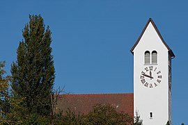
- The Catholic Church of St. Peter and Paul (1716/18) with ossuary (16th century)
- Frick achieved great fame through the discovery of the complete skeleton of a dinosaur . After the first bone was discovered in 1961, the remains of a Plateosaurus were uncovered in several excavations from 1976 in a clay pit . The skeleton and numerous fossils can be viewed in the dinosaur museum, which opened in 1991 . In the middle of the roundabout at the motorway exit is a several meter high dinosaur sculpture that advertises the museum. There is also a dinosaur nature trail, which provides information about the history of dinosaurs at eight stations over a distance of almost one kilometer. It leads from the dinosaur museum to the clay pit where important dinosaur finds were made.

Catholic Church
reformed Church

Schafferei (1719)

Spinning top with dinosaur


coat of arms
The blazon of the municipal coat of arms reads: "Red fox jumping in white." Initially, the municipality used the coat of arms of the former canton of Fricktal, a green linden leaf on a white background. However, other communities already carried this coat of arms. In order to avoid confusion, the municipality took over the coat of arms of the Lords of Frick, a ministerial family of the Habsburgs, in 1931.
population
The population developed as follows:
| year | 1768 | 1803 | 1850 | 1900 | 1930 | 1950 | 1960 | 1970 | 1980 | 1990 | 2000 | 2010 |
| Residents | 495 | 769 | 1112 | 937 | 1280 | 1589 | 2123 | 3112 | 3116 | 3622 | 4028 | 4854 |
On December 31, 2019, 5607 people lived in Frick, the proportion of foreigners was 26%. In the 2015 census, 37.9% described themselves as Roman Catholic and 18.6% as Reformed ; 43.5% were non-denominational or of other faiths. In the 2000 census, 85.1% stated German as their main language, 3.6% Italian , 3.2% Albanian , 2.0% Turkish , 1.7% Serbo-Croatian and 0.5% Spanish .
Politics and law
The assembly of those entitled to vote, the municipal assembly , exercises legislative power. The executing authority is the five-member municipal council . He is elected by the people in the majority procedure, his term of office is four years. The parish council leads and represents the parish. To this end, it implements the resolutions of the municipal assembly and the tasks assigned to it by the canton. The District Court of Laufenburg is the first instance responsible for legal disputes . Frick belongs to the Friedensrichterkreis X (Mettau).
Frick has had a partnership with the municipality of Frickingen in the German state of Baden-Württemberg since 1989 .
| Municipal council | Official title | Political party |
|---|---|---|
| Daniel Suter | Mayor | FDP |
| Christian Fricker | Vice-Captain | SP |
| Susanne Gmünder Bamert | Councilor | CVP |
| Gunthard Niederbäumer | Municipal council | FDP |
| Eugene Voronkov | Municipal council | FDP |
economy
According to the corporate structure statistics (STATENT) collected in 2015, there are over 3,600 jobs in Frick, of which 2% are in agriculture, 30% in industry and 68% in the service sector. The economic process is very diverse, there are around 300 small and medium-sized enterprises ( SMEs ). Frick is thus the dominant economic center of the upper Fricktal. However, there are also numerous commuters who work mainly in the Basel agglomeration .
Agriculture is practiced on some of the outer courtyards that are scattered throughout the municipality. Viticulture is of some importance : On the southern slopes of the Kaistenberg, an area of 4.1 hectares was planted with vines in 2018. Over a dozen different varieties are grown, with Blauburgunder , Chardonnay , Pinotage and Riesling × Sylvaner predominating. On the border with Hornussen, at the foot of the Frickberg, there is a 9-hole golf course with a driving range .
The Research Institute for Organic Agriculture (FiBL), which has existed since 1973, is one of the world's largest research institutes for organic agriculture . It has been based in Frick since 1997 and employs over 150 people. FiBL Germany was founded in 2001 with headquarters in Frankfurt and FiBL Austria in Vienna in 2004 . Frick has had market rights since 1701 , and the markets, which are held four times a year, attract many visitors from the region. There is also a Christmas market once a year.
traffic
Frick has a connection to the A3 motorway , which connects Basel and Zurich . The village is at the starting point of the pass roads over the Bözberg ( Hauptstrasse 3 ) to Brugg, the Benkerjoch (Kantonsstrasse 487), the Salhöhe (Kantonsstrasse 276) and the Staffelegg ( Hauptstrasse 24 ) to Aarau and the Kaistenberg (Kantonsstrasse 462) to Laufenburg.
Frick has a train station on the Bözberg line with direct express train connections to Basel and Zurich. The station is also one of the endpoints of the S1 line of the Basel S-Bahn to Basel SBB station . Postbus lines also run from here to Aarau (via Staffelegg or Benkerjoch), Brugg , Laufenburg and Stein-Säckingen . On weekends there is a night S-Bahn from Basel through the Fricktal to Brugg and night buses to Densbüren , Laufenburg- Eiken and Oberhof from Frick train station .
education
The community has four kindergartens and two school centers in which all levels of compulsory elementary school are taught ( primary school , secondary school , secondary school , district school ). There is also a music school and a special education school. The closest grammar schools are the Alte Kantonsschule and the Neue Kantonsschule , both in Aarau .
Personalities
- Walter de Gregorio (* 1965), journalist and FIFA official
- Felix Huber (* 1952), composer and pianist
- Casimir Mösch (1827–1898), geologist
- Jakob Müller (1916–2003), entrepreneur
- Arnold Theiler (1867–1936), veterinarian
Web links
- Official website of the municipality of Frick
- Dominik Sauerländer: Frick. In: Historical Lexicon of Switzerland .
Individual evidence
- ↑ Cantonal population statistics 2019. Department of Finance and Resources, Statistics Aargau, March 30, 2020, accessed on April 2, 2019 .
- ↑ Cantonal population statistics 2019. Department of Finance and Resources, Statistics Aargau, March 30, 2020, accessed on April 2, 2019 .
- ↑ a b Beat Zehnder: The community names of the canton of Aargau . In: Historical Society of the Canton of Aargau (Ed.): Argovia . tape 100 . Verlag Sauerländer, Aarau 1991, ISBN 3-7941-3122-3 , p. 159-162 .
- ^ National map of Switzerland, sheet 1069, Swisstopo.
- ↑ Standard area statistics - municipalities according to 4 main areas. Federal Statistical Office , November 26, 2018, accessed on May 11, 2019 .
- ^ Martin Hartmann, Hans Weber: The Romans in Aargau . Verlag Sauerländer, Aarau 1985, ISBN 3-7941-2539-8 , p. 249 .
- ^ Peter Felder: St. Peter and Paul Frick. (Swiss Art Guide, No. 247). Ed. Society for Swiss Art History GSK. Bern 1978, ISBN 978-3-85782-247-6 .
- ↑ Dinosaur Museum
- ^ Joseph Galliker, Marcel Giger: Municipal coat of arms of the Canton of Aargau . Lehrmittelverlag des Kantons Aargau, book 2004, ISBN 3-906738-07-8 , p. 159 .
- ↑ Population development in the municipalities of the Canton of Aargau since 1850. (Excel) In: Eidg. Volkszählung 2000. Statistics Aargau, 2001, archived from the original on October 8, 2018 ; accessed on May 8, 2019 .
- ↑ Resident population by religious affiliation, 2015. (Excel) In: Population and Households, Community Tables 2015. Statistics Aargau, accessed on May 11, 2019 .
- ↑ Swiss Federal Census 2000: Economic resident population by main language as well as by districts and municipalities. (Excel) Statistics Aargau, archived from the original on August 10, 2018 ; accessed on May 8, 2019 .
- ↑ circles of justice of the peace. Canton of Aargau, accessed on June 19, 2019 .
- ^ Frickingen - partner community in the Lake Constance district. Municipality of Frick, accessed on June 19, 2019 .
- ↑ Statistics of the corporate structure (STATENT). (Excel, 157 kB) Statistics Aargau, 2016, accessed on May 8, 2019 .
- ↑ Grape harvest control 2018 Canton Aargau. (PDF, 2.4 MB) Agricultural Center Liebegg, 2019, accessed on June 19, 2019 .
- ↑ Golf Fricktal
Eiken | Frick | Goose singing | Gipf-Oberfrick | Herznach | Hornussen | Kaisten | Laufenburg | Mettauertal | Münchwilen | Oberhof | Oeschgen | Rake hole | Armchairs | Ueken | Wittnau | Wölflinswil | Draw
Former municipalities: Etzgen | Ittenthal | Mettau | Oberhofen | Sulz | Wil
Canton of Aargau | Districts of the Canton of Aargau | Municipalities in the Canton of Aargau