
Kaisten AG
| AG is the abbreviation for the canton of Aargau in Switzerland and is used to avoid confusion with other entries of the name Kaisten . |
| Kaisten | |
|---|---|
 |
|
| State : |
|
| Canton : |
|
| District : | Laufenburg |
| BFS no. : | 4169 |
| Postal code : | 5082 |
| UN / LOCODE : | CH KAI |
| Coordinates : | 645 611 / 265687 |
| Height : | 333 m above sea level M. |
| Height range : | 289–723 m above sea level M. |
| Area : | 18.09 km² |
| Residents: | 2683 (December 31, 2019) |
| Population density : | 148 inhabitants per km² |
|
Proportion of foreigners : (residents without citizenship ) |
17.9% (December 31, 2019) |
| Website: | www.kaisten.ch |
 Ittenthal |
|
| Location of the municipality | |
  |
|
Kaisten ( Swiss German : ˈχæiʃdə ) is a municipality in the Swiss canton of Aargau . It belongs to the Laufenburg district and is located on the Upper Rhine on the border with Germany , in the northeast of the Fricktal region . In terms of area, Kaisten is the fifth largest municipality in the canton. In 2010 the neighboring Ittenthal was incorporated.
geography
The clustered village of Kaisten is located at the confluence of three streams, just under two kilometers south of the Rhine . The village center is located in a gorge between the Chinzhalde ( 434 m above sea level ) in the west and the Heuberg ( 558 m above sea level ) in the east, two hills of the Table Jura . A three and a half kilometer long valley extends south of the Klus, at the end of which is the village of Ittenthal . The valley is surrounded on three sides by Table Jura hills, from the Kaistenberg ( 501 m above sea level ) and the Frickberg ( 650 m above sea level ) in the west, from the Moos ( 622 m above sea level ) in the south and from the Schinberg ( 722 m above sea level ) in the east, whereby the Schinberg with its narrow ridge is rather untypical for the area and more like a hill of the folded Jura .
In the center of the village, a two kilometer long side valley branches off to the east from the main valley. In this is Oberkaisten, a once separate hamlet, which has now grown together with the main settlement. The side valley is bounded in the east by the Sulzerberg ( 524 m above sea level ). To the north of the Klus, the flat Kaisterfeld stretches towards the Rhine, the western part of which is covered by the Hardwald.
The area of the municipality is 1809 hectares , of which 810 hectares are forested and 185 hectares are built over. The highest point is on the summit of the Schinberg, the lowest at 290 m above sea level. M. on the Rhine. Neighboring communities are Laufenburg in the east, Hornussen and Frick in the south, Oeschgen in the southwest and Eiken and Sisseln in the west. Kaisten borders the German communities of Murg (Upper Rhine) and Laufenburg (Baden) in the north .
history
The area around Kaisten was populated early on. Individual finds date from the Bronze Age and a barrow from the Hallstatt Age was discovered. In 1967, a Roman brick kiln and brick stamps of the Legio XXI Rapax and Legio XI Claudia came to light during construction work . Between 259 and 277 the Alamanni occupied the area south of the Rhine until they were pushed back by the Romans. The Rhine formed the northern border of the Roman Empire, and a watchtower was built on the riverbank. Around 400 the Romans finally withdrew across the Alps. Soon after, the Alemanni settled the region.
The first written mention of Keiston took place in 1282. The place name comes from the late Latin (praedium) Cagistinacum, which means "country estate belonging to Cagistinus". From this the Old High German Chegistinacha developed and by shifting sounds and omitting the suffix, today's place name. The largest landowner was the aristocratic Säckingen monastery . The sovereignty lay with the Counts of Habsburg-Laufenburg until 1386 and then passed to the older line of the Habsburgs . After the Waldshut War of 1468, they pledged the entire Fricktal to Burgundy . When the Burgundians were defeated by the Confederates during the Burgundian Wars , Kaisten came back under Austrian rule in 1477.
After the imperial reform of the Austrian Emperor Maximilian I in 1491, Kaisten belonged to Upper Austria and was part of the Laufenburg cameramen (from 1752 in the Oberamt Breisgau ). In the 17th century there were hardly any longer times of peace. The Rappenkrieg , a peasant uprising, lasted from 1612 to 1614. The Thirty Years War , which also affected the Fricktal between 1633 and 1638, threw the village back in its economic development. Foreign troops also moved through the region during the War of the Palatinate Succession (1688–1697).

In 1797 the Fricktal became a French protectorate after the Peace of Campo Formio . During the Second Coalition War , the front line between the armies of France and Austria ran here . On February 20, 1802 Kaisten became a municipality in the Laufenburg district of the canton Fricktal , which joined the Helvetic Republic in August ; with that Kaisten had become Swiss. The municipality has belonged to the canton of Aargau since March 19, 1803.
In the Middle Ages and in the early modern period, iron smelting played an important role, and until the 20th century, the brickworks too. The once important viticulture came to an almost complete standstill around 1880 due to the phylloxera epidemic. As a result, the population decreased and did not begin to rise again until 1900, albeit very slowly. From the mid-1960s onwards, Kaisten developed from a farming village to an industrial village, when the chemical industry from Basel set up large production facilities in Kaisterfeld. The population has almost doubled since then.
On January 1, 2010, the neighboring Ittenthal was incorporated. After the municipal assemblies had passed a corresponding resolution in November 2008, this decision was confirmed at the ballot box on February 8, 2009. In Kaisten, 589 voters spoke out in favor of the merger, 271 against.
Attractions
The Roman Catholic Church stands a little above the village at the foot of the Fasnachtsberg. The current parish church of St. Michael dates from the beginning of the 18th century (the tower bears the year 1716), a previous building was first mentioned in a document in 1443. Inside there is a late Baroque pulpit, the crucifixion group, the Radiant Madonna and sculptures in the niches of the side altars. The last interior renovation was completed in 2017. The Wendelinskapelle stands on the road to Laufenburg . The Lourdes Chapel stands on the Fasnachtsberg.
The fountain in the middle of the village, designed by Erwin Rehmann from Laufenburg, is a popular meeting place and, in summer, a bathing opportunity for children. Because of its proximity to the former Eichhörnli restaurant, it is colloquially known as the Eichhörnli-Fountain.

St. Michael south side

inside view

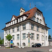
Volg, post office, rectory and church
Primary school building

Hofstatt sports hall

District school in the Laufenburg region


coat of arms
The blazon of the municipal coat of arms reads: "In yellow, red vine leaf with stem and branch." On the community seal from 1811 there is still a linden leaf. However, since this is a symbol for the entire Fricktal, the community switched to the Rebblatt in 1872. Over time, the individual leaf became a whole vine, making the coat of arms more and more similar to that of Zeiningen . In 1960, the municipal assembly declared the individual vine leaf to be binding.
population
The population developed as follows:
| year | 1803 | 1850 | 1900 | 1930 | 1950 | 1960 | 1970 | 1980 | 1990 | 2000 | 2010 |
| Residents | 875 | 1189 | 994 | 1031 | 1160 | 1177 | 1338 | 1634 | 1666 | 2054 | 2559 |
On December 31, 2019, 2683 people lived in Kaisten, the proportion of foreigners was 17.9%. In the 2015 census, 50.1% described themselves as Roman Catholic and 16.7% as Reformed ; 33.2% were non-denominational or of other faiths. In the 2000 census, 93.5% stated German as their main language, 1.4% Albanian , 1.3% Italian , 0.6% each French and English .
Politics and law

The assembly of those entitled to vote, the municipal assembly , exercises legislative power. The executing authority is the five-member municipal council . He is elected by the people in the majority procedure, his term of office is four years. The parish council leads and represents the parish. To this end, it implements the resolutions of the municipal assembly and the tasks assigned to it by the canton. The District Court of Laufenburg is the first instance responsible for legal disputes . Kaisten belongs to the Friedensrichterkreis X (Mettau).
Since September 2001 Kaisten has been on friendly terms with Kaisten of the same name in Lower Franconia.
| Municipal council | Official title | Political party |
|---|---|---|
| Arpad Major | Mayor | FDP |
| Stefan Moser | Vice-Captain | independent |
| Oliver Brem | Municipal council | independent |
| Willy Burkhalter | Municipal council | SP |
| Raphael Lemblé | Municipal council | FDP |
economy
According to the company structure statistics (STATENT) collected in 2015, there are around 860 jobs in Kaisten, 12% of them in agriculture, 59% in industry and 29% in the service sector. The BASF owns a plant for the production of antioxidant and light stabilizers. Kaisten plays an important role in the international electricity network; There has been a substation operated by Swissgrid in the municipality since 1957 , in which no fewer than ten high-voltage lines meet (“Stern von Laufenburg”). A large number of those in employment are commuters and work primarily in the larger communities in the area, sometimes also in the Basel agglomeration .
Viticulture is still of some importance today . On the southern slope of the Heuberg, in Oberkaisten and in Ittenthal, a total of 4.8 hectares was planted with vines in 2018. Eleven different varieties are grown, with Pinot Noir and Riesling × Sylvaner predominating.
traffic
Kaisten is very well developed in terms of traffic. Just under a kilometer north of the village, Hauptstrasse 7 runs along the Rhine between Basel and Winterthur . Kantonsstrasse 462 runs through the village itself from Laufenburg to Frick . Ittenthal is accessed through Kantonsstrasse 464. The Eiken and Frick connections to the A3 motorway are each five kilometers away. The connection to the public transport network is provided by three postbus lines that run from Laufenburg train station via Frick to Aarau (line 135), Ittenthal (line 144) and Stein-Säckingen (line 143). On weekends there is a night bus from Frick via Kaisten and Laufenburg to Eiken .
education
Kaisten has a kindergarten with three departments and a primary school . Ittenthal's primary school was given up as part of the community merger. The district school , the secondary school and the Realschule can be attended in the Laufenburg school center Blauen. The closest grammar schools are in Aarau ( old canton school and new canton school ); Due to an intercantonal agreement, young people from parts of the Fricktal can also complete the grammar school in Muttenz ( Canton Basel-Landschaft ) or in Basel .
Personalities
- Werner Winter (1924–2001), predator trainer
- Beny Rehmann (1936–2014), trumpeter and band leader
Web links
- Official website of the municipality of Kaisten
- Dominik Sauerländer: Kaisten. In: Historical Lexicon of Switzerland .
Individual evidence
- ↑ Cantonal population statistics 2019. Department of Finance and Resources, Statistics Aargau, March 30, 2020, accessed on April 2, 2019 .
- ↑ Cantonal population statistics 2019. Department of Finance and Resources, Statistics Aargau, March 30, 2020, accessed on April 2, 2019 .
- ↑ a b Beat Zehnder: The community names of the canton of Aargau . In: Historical Society of the Canton of Aargau (Ed.): Argovia . tape 100 . Verlag Sauerländer, Aarau 1991, ISBN 3-7941-3122-3 , p. 218-221 .
- ↑ a b National map of Switzerland, sheets 1049 and 1069, Swisstopo.
- ↑ Standard area statistics - municipalities according to 4 main areas. Federal Statistical Office , November 26, 2018, accessed on May 11, 2019 .
- ^ Martin Hartmann, Hans Weber: The Romans in Aargau . Verlag Sauerländer, Aarau 1985, ISBN 3-7941-2539-8 , p. 176 .
- ↑ Aargauer Zeitung : From now on together through community life. February 8, 2009.
- ^ Joseph Galliker, Marcel Giger: Municipal coat of arms of the canton of Aargau . Lehrmittelverlag des Kantons Aargau, book 2004, ISBN 3-906738-07-8 , p. 188 .
- ↑ Population development in the municipalities of the Canton of Aargau since 1850. (Excel) In: Eidg. Volkszählung 2000. Statistics Aargau, 2001, archived from the original on October 8, 2018 ; accessed on May 8, 2019 .
- ↑ Resident population by religious affiliation, 2015. (Excel) In: Population and Households, Community Tables 2015. Statistics Aargau, accessed on May 11, 2019 .
- ↑ Swiss Federal Census 2000: Economic resident population by main language as well as by districts and municipalities. (Excel) Statistics Aargau, archived from the original on August 10, 2018 ; accessed on May 9, 2019 .
- ↑ circles of justice of the peace. Canton of Aargau, accessed on June 19, 2019 .
- ↑ Kaisten-Kaisten partnership certificate. (PDF, 1.3 MB) Kaisten community, September 2, 2001, accessed on May 9, 2019 .
- ↑ Statistics of the corporate structure (STATENT). (Excel, 157 kB) Statistics Aargau, 2016, accessed on May 9, 2019 .
- ↑ Star of Laufenburg. Swissgrid , 2018, accessed on May 9, 2019 .
- ↑ Grape harvest control 2018 Canton Aargau. (PDF, 2.4 MB) Agricultural Center Liebegg, 2019, accessed on June 19, 2019 .
Eiken | Frick | Goose singing | Gipf-Oberfrick | Herznach | Hornussen | Kaisten | Laufenburg | Mettauertal | Münchwilen | Oberhof | Oeschgen | Rake hole | Armchairs | Ueken | Wittnau | Wölflinswil | Draw
Former municipalities: Etzgen | Ittenthal | Mettau | Oberhofen | Sulz | Wil
Canton of Aargau | Districts of the Canton of Aargau | Municipalities in the Canton of Aargau