
Zeiningen
| Zeiningen | |
|---|---|
 |
|
| State : |
|
| Canton : |
|
| District : | Rheinfelden |
| BFS no. : | 4263 |
| Postal code : | 4314 |
| Coordinates : | 632 461 / 265 721 |
| Height : | 342 m above sea level M. |
| Height range : | 305-599 m above sea level M. |
| Area : | 11.37 km² |
| Residents: | 2381 (December 31, 2019) |
| Population density : | 209 inhabitants per km² |
|
Proportion of foreigners : (residents without citizenship ) |
16.8% (December 31, 2019) |
| Website: | www.zeiningen.ch |
 Zeiningen |
|
| Location of the municipality | |
  |
|
Zeiningen ( Swiss German : ˈtsæinigə ) is a municipality in the Swiss canton of Aargau . It belongs to the Rheinfelden district , is located in the west of the Fricktal region around three kilometers southwest of the border with Germany and borders the canton of Basel-Landschaft .
geography
The village is located on the Möhlinbach , at the point where the narrow Möhlin valley emerges into the wide loess plain of the Rhine . In the northeast, Zeiningen has a large share of the Möhliner Feld. This is a terminal moraine that was formed during the Riss Ice Age around 140,000 years ago and formed the most north-westerly point of the Alpine glaciation. As a result of the erosion , an extended, elevated plain was created, which slopes down around 50 meters towards the Möhlintal. When the glacier retreated, the small Ägelsee was formed . The Möhliner Feld is known as the “granary” of the Fricktal.
The Möhlintal runs from southeast to northwest and is bounded by the steep foothills of the Table Jura . To the east of the village lies the Zeiningerberg ( 571 m above sea level ), on the flattened top of which is the striking “Bönistein”. The Spitzgraben, located in the far east, separates the Zeiningerberg from the Chriesiberg. To the west of the village rises the 636 meter high Sonnenberg, which is in front of the Kleine Sonnenberg ( 571 m above sea level ). The two kilometer long side valley of the Maienbächli stretches to the south, which is bordered by the steep slopes of the Schönenberg ( 599 m above sea level ) and the Felsenhaus ( 582 m above sea level ).
The area of the municipality is 1137 hectares , of which 502 hectares are forested and 137 hectares are built over. The highest point is at 599 meters on the plateau of the Schönenberg, the lowest at 320 meters on the Möhlinbach. The municipality of Zeiningen is part of the Aargau Jura Park, a "Regional Nature Park of National Importance". Neighboring communities in Aargau are Möhlin in the northwest, Wallbach in the northeast, Mumpf in the east and Zuzgen in the southeast. Neighboring communities in the canton of Basel-Landschaft are Buus in the south and Maisprach in the southwest.
history
Excavations at the “Bönistein”, a mighty rocky hill on the eastern edge of the Zeiningerberg, have shown that hunters and gatherers lived in this area more than 10,000 years ago during the Mesolithic period. The Bönistein is classified as a cultural asset of national importance. After the end of Roman rule, the Alemanni mixed with the Romanized Raurikern . It is believed that the Säckingen monastery owned goods here as early as the 7th century.
Ceînigen was first mentioned in a document in 1222. The place name comes from the Old High German Zeiningun and means "among the people of Zeino". First rulers were the Counts of Homberg-Tierstein, from 1232 the Habsburgs , who pledged the entire Fricktal to Burgundy after the Waldshut War of 1468 . When the Burgundians were defeated by the Confederates during the Burgundian Wars , Zeiningen came under Austrian rule again in 1477.
After the imperial reform of the Austrian Emperor Maximilian I in 1491, Zeiningen belonged to Upper Austria and was in the Möhlinbach countryside , a subordinate administrative unit of the Rheinfelden cameramen . In 1586 a fire destroyed twenty houses. In the 17th century there were hardly any longer times of peace. The Rappenkrieg , a peasant uprising, lasted from 1612 to 1614. The Thirty Years War , which also affected the Fricktal between 1633 and 1638, threw the village back in its economic development. Foreign troops also moved through the region during the War of the Palatinate Succession (1688–1697).

In 1740 another major fire destroyed 40 houses. In 1797 the Fricktal became a French protectorate after the Peace of Campo Formio . During the Second Coalition War , the front line between the armies of France and Austria ran here . On February 20, 1802, Zeiningen became a municipality in the Rheinfelden district of the Fricktal canton , which joined the Helvetic Republic in August . The municipality has belonged to the canton of Aargau since February 19, 1803.
Dozens of impoverished villagers emigrated in the second half of the 19th century. The main reason was the bankruptcy of the "Zeininger Bohrgesellschaft", which between 1850 and 1890 had looked in vain for coal on the Sonnenberg and the Zeiningerberg . Many had invested their savings in shares, which then turned out to be completely worthless. In 1869 Zeiningen was supposed to pay 50,000 francs for the construction of the Bözbergbahn ; when the route was subsequently changed, the municipality refused the amount. During the 20th century, Zeiningen gradually changed from a farming community to a residential community in the Basel agglomeration . Since the early 1970s, the population has increased by over two thirds.
coat of arms
The blazon of the municipal coat of arms reads: "In yellow on a green three-mountain green vine with four blue grapes and three green leaves on a brown vine." The oldest known variant of the coat of arms appears on a pane of glass that was created in 1776 and can be seen in the parish church of St. Agatha. Over time, the shield's color changed from blue to red and finally to yellow in 1953. The brown hue contradicts the heraldic color rules; nevertheless, the community assembly in 2002 rejected a correction.
Attractions
The parish church of St. Agatha was first mentioned in 1236. In 1776 a new building was built in the late Baroque style , which is now a federal monument. In 1930/32 the church was expanded and received a new tower. A comprehensive renovation took place in 1972/75.

St. Agatha's Church

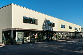
Old gym and old village schoolhouse
Brugglismatt school building

Farmhouse

Farmhouse


population
The population developed as follows:
| year | 1768 | 1850 | 1900 | 1930 | 1950 | 1960 | 1970 | 1980 | 1990 | 2000 | 2010 | 2015 |
| Residents | 650 | 983 | 953 | 986 | 1043 | 1086 | 1201 | 1335 | 1611 | 1797 | 2218 | 2277 |
On December 31, 2019, 2381 people lived in Zeiningen, the proportion of foreigners was 16.8%. In the 2015 census, 41.5% described themselves as Roman Catholic , 19.7% as Reformed and 3.0% as Christian Catholic ; 35.8% were non-denominational or of other faiths. 94.3% said German as their main language in the 2000 census , 1.5% Albanian , 1.1% Italian and 0.8% English .
Politics and law

The assembly of those entitled to vote, the municipal assembly , exercises legislative power. The executing authority is the five-member municipal council . He is elected by the people in the majority procedure, his term of office is four years. The parish council leads and represents the parish. To this end, it implements the resolutions of the municipal assembly and the tasks assigned to it by the canton. The Rheinfelden District Court is the first instance responsible for legal disputes . Zeiningen belongs to the Friedensrichterkreis XIV (Rheinfelden).
economy
According to the company structure statistics (STATENT) collected in 2015, there are around 560 jobs in Zeiningen, of which 12% are in agriculture, 20% in industry and 68% in the service sector. Industrial companies are active in metal construction, electrical engineering and measurement technology. Most of the employed people are commuters and work in the larger communities of the Fricktal and in the agglomeration of the city of Basel .
Viticulture has always been of great importance . On the southwest slope of the Zeiningerberg, an area of 4.6 hectares was planted with vines in 2018. Over a dozen different varieties are grown, with Blauburgunder , Riesling × Sylvaner and Sauvignon Blanc predominating.
traffic
Zeiningen is a little over a kilometer south of Hauptstrasse 3 between Basel and Zurich . The canton road 494 leads through the village into the upper part of the Möhlintal. The closest connection to the A3 motorway is near Rheinfelden . The motorway crosses the Möhlintal on a viaduct on the northern edge of the village. The connection to the public transport network is made by a post bus line from Möhlin train station to Wegenstetten . On weekends a night bus runs from Möhlin through the Möhlintal and Fischingertal back to Möhlin.
education
The community has a kindergarten and two school houses in which primary school is taught. The district school and the secondary school can be attended in Möhlin , the secondary school in Wegenstetten. On the basis of an inter-cantonal agreement, young people from parts of the Fricktal can complete high school in Muttenz ( Canton Basel-Landschaft ) or in Basel .
Personalities
- Roland Brogli (1951–2017), Government Councilor (CVP)
- Bernhard Burgener (* 1957), media entrepreneur, President FC Basel, lives in Zeiningen
- Peter Gasser (* 1947), photographer
literature
- Dominik Sauerländer: Zeiningen. In: Historical Lexicon of Switzerland .
- Edith Hunziker, Peter Hoegger: The art monuments of the canton of Aargau . Ed .: Society for Swiss Art History . Volume IX, Rheinfelden district. Bern 2011, ISBN 978-3-906131-94-8 , pp. 440-456 .
Web links
Individual evidence
- ↑ Cantonal population statistics 2019. Department of Finance and Resources, Statistics Aargau, March 30, 2020, accessed on April 2, 2019 .
- ↑ Cantonal population statistics 2019. Department of Finance and Resources, Statistics Aargau, March 30, 2020, accessed on April 2, 2019 .
- ↑ a b Beat Zehnder: The community names of the canton of Aargau . In: Historical Society of the Canton of Aargau (Ed.): Argovia . tape 100 . Verlag Sauerländer, Aarau 1991, ISBN 3-7941-3122-3 , p. 485-486 .
- ↑ a b National map of Switzerland, sheets 1048 and 1068, Swisstopo.
- ↑ Standard area statistics - municipalities according to 4 main areas. Federal Statistical Office , November 26, 2018, accessed on May 11, 2019 .
- ^ Joseph Galliker, Marcel Giger: Municipal coat of arms of the Canton of Aargau . Lehrmittelverlag des Kantons Aargau, book 2004, ISBN 3-906738-07-8 , p. 325 .
- ↑ Population development in the municipalities of the Canton of Aargau since 1850. (Excel) In: Eidg. Volkszählung 2000. Statistics Aargau, 2001, archived from the original on October 8, 2018 ; accessed on May 11, 2019 .
- ↑ Resident population by religious affiliation, 2015. (Excel) In: Population and Households, Community Tables 2015. Statistics Aargau, accessed on May 11, 2019 .
- ↑ Swiss Federal Census 2000: Economic resident population by main language as well as by districts and municipalities. (Excel) Statistics Aargau, archived from the original on August 10, 2018 ; accessed on May 11, 2019 .
- ↑ circles of justice of the peace. Canton of Aargau, accessed on June 19, 2019 .
- ↑ Statistics of the corporate structure (STATENT). (Excel, 157 kB) Statistics Aargau, 2016, accessed on May 11, 2019 .
- ↑ Grape harvest control 2018 Canton Aargau. (PDF, 2.4 MB) Agricultural Center Liebegg, 2019, accessed on June 19, 2019 .