
Stein AG
| AG is the abbreviation for the canton of Aargau in Switzerland and is used to avoid confusion with other entries of the name Stein . |
| stone | |
|---|---|
 |
|
| State : |
|
| Canton : |
|
| District : | Rheinfelden |
| BFS no. : | 4260 |
| Postal code : | 4332 |
| UN / LOCODE : | CH STN |
| Coordinates : | 638 569 / 265 974 |
| Height : | 300 m above sea level M. |
| Height range : | 281–492 m above sea level M. |
| Area : | 2.83 km² |
| Residents: | 3145 (December 31, 2019) |
| Population density : | 1111 inhabitants per km² |
|
Proportion of foreigners : (residents without citizenship ) |
39.8% (December 31, 2019) |
| Website: | www.gemeinde-stein.ch |
 View of Stein from the Mumpferflue |
|
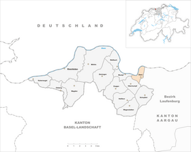
| Location of the municipality | |
  |
|
Stein ( Swiss German : ʃtæi ) is a municipality in the Swiss canton of Aargau . It belongs to the Rheinfelden district and is located in the center of the Fricktal region on the Upper Rhine , on the border with Germany .
geography
The village is on the left bank of the Rhine , across from the German city of Bad Säckingen . The river, spanned by two bridges, changes its flow direction twice over a distance of only two kilometers, first from west to south, then back to west. The old village center is at the second bend in the river. The newer parts of the village extend east and north into the flat Sisslerfeld. The Eikerberg rises south of the village center and the railway line and the motorway with the Mumpferflue in the north-west. This hill of the Table Jura has very steep flanks towards the Rhine and then turns into a flat and extensive plateau.
The area of the municipality is 283 hectares , of which 63 hectares are forested and 121 hectares are built over. The highest point is 490 m above sea level. M. on the plateau of the Eickerberg, the deepest at 285 m above sea level. M. on the Rhine. Neighboring communities in Switzerland are Mumpf in the west, Obermumpf in the south, Münchwilen in the southeast and Sisseln in the northeast. In the north, Stein borders the German city of Bad Säckingen.
history
The first documentary mention of Stein comes from the year 1281. Any earlier documents were probably lost in the town of Säckingen in 1272 . The place name comes from the Old High German (ze) stone and means "near the rock". The village belonged to the oldest possession of the Säckingen women's monastery and for centuries it was a very small settlement. The rulers and patrons of the monastery were the Habsburgs , who pledged the entire Fricktal to Burgundy after the Waldshut War of 1468 . When the Burgundians were defeated by the Confederates during the Burgundian Wars , Stein came back under Austrian rule in 1477.
After the imperial reform of the Austrian Emperor Maximilian I in 1491, Stein belonged to Front Austria and was located in the Fricktal region, a subordinate administrative unit of the Rheinfelden cameramen (from 1752 in the Upper Office of Breisgau ). The village was about a kilometer south of the Rhine bridge to Säckingen. The wooden bridge, which has existed since at least the 13th century, was destroyed by floods in 1408, 1480 and 1570. In 1573 a new building was built with stone pillars that still exist today. In the 17th century there were hardly any longer times of peace. The Rappenkrieg , a peasant uprising that broke out in the neighboring village of Mumpf , lasted from 1612 to 1614.
The Thirty Years' War , which also affected the Fricktal between 1633 and 1638, set the village back in its economic development. In 1633 the bridge was destroyed by Swedish troops; it could only be rebuilt twenty years later. But the bridge was destroyed again in 1678, this time by the French during the Dutch War . Foreign troops also moved through the region during the War of the Palatinate Succession (1688–1697). The bridge was not passable again until 1699. As early as 1680 Austria had pledged its lordly rights over Stein, Hornussen , Niederzeihen , Hellikon and Zuzgen to the Säckingen monastery. It was not until 1740 that the pledge could be bought back at a price of 15,000 guilders .

In 1797 the Fricktal became a French protectorate after the Peace of Campo Formio . During the Second Coalition War , the front line between the armies of France and Austria ran here . The Peace of Lunéville meant that the city of Säckingen had to cede its areas on the left bank of the Rhine and most of these came to the municipality of Stein. On February 20, 1802, stone became a municipality in the Frick district of the Fricktal canton , which joined the Helvetic Republic in August . The municipality has belonged to the canton of Aargau since February 19, 1803.
On August 2, 1875, the community received a connection to the railway network with the opening of the Bözbergbahn and Stein-Säckingen station. On August 1, 1892, the branch line followed through the High Rhine Valley to Koblenz . Rapid growth began in the second half of the 20th century. In 1957, the pharmaceutical company Ciba-Geigy AG (now Novartis ) opened a huge production facility. In 1966 the large Rhine power station in Säckingen with a weir over the entire river was put into operation. Between 1950 and 2000 the population more than tripled. In 1979 a new Rhine crossing was opened with the Fridolinsbrücke .
coat of arms
The blazon of the municipal coat of arms reads: "In red, a diagonally overturned white fiddle ." Around 1840 the community had a talking coat of arms, which was supposed to symbolize the “Stein am Rhein”, but did not meet heraldic requirements at all: A white wavy band in green above a white ashlar stone in the base of the shield, the wavy band also had the inscription “Rhine”. In 1939 a historically justified model was used and (initially unofficially) the Fidel coat of arms of the once wealthy gentlemen von Stein . The definitive introduction took place in 1965.
Attractions


population
The population developed as follows:
| year | 1768 | 1850 | 1900 | 1930 | 1950 | 1960 | 1970 | 1980 | 1990 | 2000 | 2010 |
| Residents | 149 | 375 | 566 | 738 | 756 | 1060 | 1763 | 1798 | 1891 | 2414 | 2818 |
On December 31, 2019, 3,145 people lived in Stein, the proportion of foreigners was 39.8%. In the 2015 census, 33.6% described themselves as Roman Catholic and 17.0% as Reformed ; 49.4% were non-denominational or of another faith. In the 2000 census, 86.6% stated German as their main language, 3.6% Italian , 3.0% Albanian , 2.0% Serbo-Croatian and 0.9% Turkish .
Politics and law
The assembly of those entitled to vote, the municipal assembly , exercises legislative power. The executing authority is the five-member municipal council . He is elected by the people in the majority procedure, his term of office is four years. The parish council leads and represents the parish. To this end, it implements the resolutions of the municipal assembly and the tasks assigned to it by the canton. The Rheinfelden District Court is the first instance responsible for legal disputes . Stein belongs to the Friedensrichterkreis XIV (Rheinfelden).
economy
According to the corporate structure statistics (STATENT) collected in 2015, there are around 3700 jobs in Stein, less than 1% of them in agriculture, 58% in industry and 41% in the service sector. By far the largest company is Novartis, with a huge production facility for pharmaceutical products. Syngenta has research facilities here, as well as numerous small and medium-sized commercial and service companies. The Stein community has a high proportion of commuters from the region.
traffic
Stein has excellent transport links. Hauptstrasse 3 runs through the village between Basel and Zurich , where Hauptstrasse 7 branches off through the Rhine Valley in the direction of Winterthur . The closest connection to the A3 motorway is four kilometers away at Eiken .
Two bridges lead over the Rhine to Bad Säckingen ; on the one hand the Säckinger wooden bridge , the oldest and longest covered wooden bridge in Europe (today only accessible to pedestrians and cyclists), on the other hand the Fridolin bridge for motorized traffic.
The station Stein-Säckingen is an express stop at the Bözberg railway line . Here the S1 line of the Basel S-Bahn, coming from Basel, splits into two branches to Frick and Laufenburg . Two post bus lines to Frick and Laufenburg take care of the fine distribution . On weekends, a night S-Bahn runs from Basel through the Fricktal to Brugg and a night bus from Möhlin through the Möhlintal and Fischingertal back to Möhlin.
The "Rhine Route" of the cycle route network marked by SwitzerlandMobility runs through Stein .
education
The community has three kindergartens and two school houses in which the primary school , the junior high school and the secondary school are taught. The district school can be attended in Rheinfelden . On the basis of an inter-cantonal agreement, young people from parts of the Fricktal can complete high school in Muttenz ( Canton Basel-Landschaft ) or in Basel .
Personalities
- Adolf Reinle (1920–2006), art historian
- Walter Saxer (1896–1974), mathematician
literature
- Dominik Sauerländer: Stein (AG). In: Historical Lexicon of Switzerland .
- Edith Hunziker, Peter Hoegger: The art monuments of the canton of Aargau . Ed .: Society for Swiss Art History . Volume IX, Rheinfelden district. Bern 2011, ISBN 978-3-906131-94-8 , pp. 414-422 .
Web links
Individual evidence
- ↑ Cantonal population statistics 2019. Department of Finance and Resources, Statistics Aargau, March 30, 2020, accessed on April 2, 2019 .
- ↑ Cantonal population statistics 2019. Department of Finance and Resources, Statistics Aargau, March 30, 2020, accessed on April 2, 2019 .
- ↑ a b Beat Zehnder: The community names of the canton of Aargau . In: Historical Society of the Canton of Aargau (Ed.): Argovia . tape 100 . Verlag Sauerländer, Aarau 1991, ISBN 3-7941-3122-3 , p. 408-409 .
- ^ National map of Switzerland, sheets 1049 and 1069, Swisstopo.
- ↑ Standard area statistics - municipalities according to 4 main areas. Federal Statistical Office , November 26, 2018, accessed on May 11, 2019 .
- ^ Joseph Galliker, Marcel Giger: Municipal coat of arms of the Canton of Aargau . Lehrmittelverlag des Kantons Aargau, book 2004, ISBN 3-906738-07-8 , p. 282 .
- ↑ Population development in the municipalities of the Canton of Aargau since 1850. (Excel) In: Eidg. Volkszählung 2000. Statistics Aargau, 2001, archived from the original on October 8, 2018 ; accessed on May 11, 2019 .
- ↑ Resident population by religious affiliation, 2015. (Excel) In: Population and Households, Community Tables 2015. Statistics Aargau, accessed on May 11, 2019 .
- ↑ Swiss Federal Census 2000: Economic resident population by main language as well as by districts and municipalities. (Excel) Statistics Aargau, archived from the original on August 10, 2018 ; accessed on May 11, 2019 .
- ↑ circles of justice of the peace. Canton of Aargau, accessed on June 19, 2019 .
- ↑ Statistics of the corporate structure (STATENT). (Excel, 157 kB) Statistics Aargau, 2016, accessed on May 11, 2019 .