
Olsberg AG
| AG is the abbreviation for the canton of Aargau in Switzerland and is used to avoid confusion with other entries of the name Olsberg . |
| Olsberg | |
|---|---|
 |
|
| State : |
|
| Canton : |
|
| District : | Rheinfelden |
| BFS no. : | 4257 |
| Postal code : | 4305 |
| Coordinates : | 625 953 / 263388 |
| Height : | 374 m above sea level M. |
| Height range : | 296–571 m above sea level M. |
| Area : | 4.61 km² |
| Residents: | 363 (December 31, 2019) |
| Population density : | 79 inhabitants per km² |
|
Proportion of foreigners : (residents without citizenship ) |
13.2% (December 31, 2019) |
| Website: | www.olsberg.ch |
 Olsberg |
|
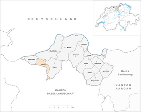
| Location of the municipality | |
  |
|
Olsberg ( Swiss German : Olschprg ˈɔlʃˌpəɾɡ ) is a municipality in the Swiss canton of Aargau . It belongs to the Rheinfelden district , lies in the west of the Fricktal region around three kilometers south of the border with Germany and borders the canton of Basel-Landschaft .
geography
The village lies in the valley of the Violenbach , in the transition zone between the Tafeljura and the Upper Rhine Plain . It is divided in two ways. The stream that flows through the village in a north-westerly direction is also the canton border. The smaller part of the village in the south, also called "Ländli", belongs to the municipality of Arisdorf in the canton of Basel-Landschaft. The northern part of the Aargau part of the village lies at the foot of the 469-meter-high Schönenberg. There is an exclave three kilometers south-southeast of the village center . This is uninhabited and covers part of the eastern slope of the Eileten ( 626 m above sea level ) with the Bowald.
The area of the municipality is 461 hectares , of which 280 hectares are forested and 26 hectares are built over. The highest point is 571 m above sea level. M. in the northwest of the Bowald exclave, the deepest at 316 m above sea level. M. am Violenbach. Neighboring communities are Kaiseraugst in the west, Rheinfelden in the north, Magden in the east and Arisdorf in the south. The exclave also borders on Hersberg and Nusshof .
history

The first traces of settlement date from the Neolithic about 4000 years ago and were discovered on the «Hölzli». During Roman times, there was at least one manor that supplied the town of Augusta Raurica , a few kilometers away . During excavations, a stove, ceramic pieces and a coin came to light. The building was inhabited from the middle of the 1st to at least the second half of the 3rd century. The Alemanni settled here around the 8th or 9th century. Olsperg was first mentioned in a document in 1236 in connection with the founding of the Cistercian monastery Hortus Dei, today's Olsberg monastery , which shaped the fate of the village for more than five hundred years. The place name comes from the Old High German Olesbërg and means "Mount of Olives", so it clearly has a religious reference.
In the Middle Ages, the border between the Frickgau and the Sisgau ran along the Violenbach. The larger part of the village in Frickgau became part of Rheinfelden County in the 11th century . From 1218 it was owned by the Hohenstaufen and from 1273 imperial estate until it came to the Habsburgs in 1442 . The smaller part of the village in Sisgau came into the possession of the city of Basel in 1461 , was an independent municipality of Olsberg BL until 1882 and then merged with Arisdorf . After the Waldshut War of 1468, the Habsburgs pledged the entire Fricktal to Burgundy . When the Burgundians were defeated by the Confederates during the Burgundian Wars , Olsberg came under Austrian rule again in 1477.
As a result of the imperial reform of the Austrian Emperor Maximilian I , Olsberg belonged to Upper Austria from 1491 and was in the Möhlinbach region , a subordinate administrative unit of the Rheinfelden cameraman (from 1752 in the Breisgau Upper Office ). In 1525, during the Peasants' War , the monastery was plundered by the residents of Olsberg and several neighboring villages and subsequently remained orphaned until 1558. In the 17th century there were hardly any longer times of peace. The Rappenkrieg , a peasant uprising, lasted from 1612 to 1614. The Thirty Years' War , which also affected the Fricktal between 1633 and 1638, set Olsberg back in its economic development. Swedish troops looted the monastery twice in 1632 and also raided the village. Foreign troops also moved through the region during the War of the Palatinate Succession (1688–1697).
In 1797 the Fricktal became a French protectorate after the Peace of Campo Formio . During the Second Coalition War , the front line between the armies of France and Austria ran here . On February 20, 1802, Olsberg became a municipality in the Rheinfelden district of the Fricktal canton , which joined the Helvetic Republic in August . The municipality has belonged to the canton of Aargau since February 19, 1803. After the monastery had already been converted into a secular women's monastery in 1790, the newly founded canton of Aargau finally abolished the monastery in 1803 and set up a higher education institution for women. In 1846 an educational institution was set up, which has been modernized to this day. Between 1900 and 1970 the population of Olsberg decreased by over a fifth. But then the village increasingly turned into a popular residential community, as more and more people from the Basel region moved here.
coat of arms
The blazon of the municipal coat of arms reads: "Under a red and white shield head in green and white rose." The coat of arms was introduced in 1953 and is a reminder of the importance the monastery once held. The red and white head of the shield is the symbol of the Cistercian order , while the rose is reminiscent of the "God's garden", as the nuns called their monastery.
Attractions

Less than a kilometer west of the village is the Olsberg Monastery , a former Cistercian convent that was founded in 1236 and closed in 1803. The complex includes the collegiate church, the convent building, the rectory, the monastery barn and other ancillary buildings. Today the convent building serves as a school home for children with learning and behavioral difficulties.
Since 2006, the Argentine cellist Sol Gabetta has organized the SOLsberg chamber music festival in the collegiate church every year.
population
The population developed as follows:
| year | 1768 | 1850 | 1900 | 1930 | 1950 | 1960 | 1970 | 1980 | 1990 | 2000 | 2010 |
| Residents | 128 | 248 | 259 | 244 | 230 | 218 | 205 | 265 | 314 | 374 | 370 |
On December 31, 2019, 363 people lived in Olsberg, the proportion of foreigners was 13.2%. In the 2015 census, 34.8% described themselves as Reformed , 14.9% as Roman Catholic and 7.6% as Christian Catholic ; 42.7% were non-denominational or of other faiths. In the 2000 census, 96.3% said their main language was German and 1.6% French .
Politics and law
The assembly of those entitled to vote, the municipal assembly , exercises legislative power. The executing authority is the five-member municipal council . He is elected by the people in the majority procedure, his term of office is four years. The parish council leads and represents the parish. To this end, it implements the resolutions of the municipal assembly and the tasks assigned to it by the canton. The Rheinfelden District Court is the first instance responsible for legal disputes . Olsberg belongs to the Friedensrichterkreis XIV (Rheinfelden).
A community partnership has existed with the German city of Olsberg in the Hochsauerlandkreis since 1974 .
economy
According to the company structure statistics (STATENT) collected in 2015, there are around 110 jobs in Olsberg, 25% of them in agriculture, 4% in industry and 71% in the service sector. By far the largest employer is the school home in Olsberg Abbey . Most of the employed people are commuters and work in the larger communities of the Fricktal and in the agglomeration of the city of Basel .
traffic
Olsberg is away from through traffic, but can be easily reached via cantonal road 498 between Magden and Augst . A side street leads to Arisdorf . There is a junction for the A2 motorway . The connection to the public transport network is made by the Postbus line between Magden and Giebenach , there are connections to Rheinfelden train station and Pratteln .
education
The community has a kindergarten and a primary school . The Realschule and the Secondary School can be attended in Magden , the District School in Rheinfelden . On the basis of an inter-cantonal agreement, young people from parts of the Fricktal can complete high school in Muttenz ( Canton Basel-Landschaft ) or in Basel .
literature
- Dominik Sauerländer: Olsberg (municipality). In: Historical Lexicon of Switzerland .
- Edith Hunziker, Peter Hoegger: The art monuments of the canton of Aargau . Ed .: Society for Swiss Art History . Volume IX, Rheinfelden district. Bern 2011, ISBN 978-3-906131-94-8 , pp. 379-403 .
Web links
Individual evidence
- ↑ Cantonal population statistics 2019. Department of Finance and Resources, Statistics Aargau, March 30, 2020, accessed on April 2, 2019 .
- ↑ Cantonal population statistics 2019. Department of Finance and Resources, Statistics Aargau, March 30, 2020, accessed on April 2, 2019 .
- ↑ a b Beat Zehnder: The community names of the canton of Aargau . In: Historical Society of the Canton of Aargau (Ed.): Argovia . tape 100 . Verlag Sauerländer, Aarau 1991, ISBN 3-7941-3122-3 , p. 337-339 .
- ^ National map of Switzerland, sheet 1068, Swisstopo.
- ↑ Standard area statistics - municipalities according to 4 main areas. Federal Statistical Office , November 26, 2018, accessed on May 11, 2019 .
- ^ Martin Hartmann, Hans Weber: The Romans in Aargau . Verlag Sauerländer, Aarau 1985, ISBN 3-7941-2539-8 , p. 193 .
- ↑ Hunziker, Hoegger: The monuments of the Canton of Aargau. Pp. 379-380.
- ^ Joseph Galliker, Marcel Giger: Municipal coat of arms of the Canton of Aargau . Lehrmittelverlag des Kantons Aargau, book 2004, ISBN 3-906738-07-8 , p. 245 .
- ↑ Background. SOLsberg, accessed January 30, 2013 .
- ↑ Population development in the municipalities of the Canton of Aargau since 1850. (Excel) In: Eidg. Volkszählung 2000. Statistics Aargau, 2001, archived from the original on October 8, 2018 ; accessed on May 11, 2019 .
- ↑ Resident population by religious affiliation, 2015. (Excel) In: Population and Households, Community Tables 2015. Statistics Aargau, accessed on May 11, 2019 .
- ↑ Swiss Federal Census 2000: Economic resident population by main language as well as by districts and municipalities. (Excel) Statistics Aargau, archived from the original on August 10, 2018 ; accessed on May 11, 2019 .
- ↑ circles of justice of the peace. Canton of Aargau, accessed on June 19, 2019 .
- ↑ Sister cities. City of Olsberg, accessed on June 19, 2019 .
- ↑ Statistics of the corporate structure (STATENT). (Excel, 157 kB) Statistics Aargau, 2016, accessed on May 11, 2019 .