
Hornussen AG
| AG is the abbreviation for the canton of Aargau in Switzerland and is used to avoid confusion with other entries of the name Hornussen . |
| Hornussen | |
|---|---|
 |
|
| State : |
|
| Canton : |
|
| District : | Laufenburg |
| BFS no. : | 4167 |
| Postal code : | 5075 |
| Coordinates : | 647055 / 261 220 |
| Height : | 383 m above sea level M. |
| Height range : | 350–649 m above sea level M. |
| Area : | 7.27 km² |
| Residents: | 981 (December 31, 2019) |
| Population density : | 135 inhabitants per km² |
|
Proportion of foreigners : (residents without citizenship ) |
19.1% (December 31, 2019) |
| Website: | www.hornussen.ch |
 Hornussen in winter |
|
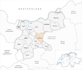
| Location of the municipality | |
  |
|
Hornussen ( Swiss German : ˈhɔrnusːə ) is a municipality in the Swiss canton of Aargau . It belongs to the Laufenburg district and lies west of the Bözberg Pass in the upper Fricktal .
geography
The street village Hornussen is located in the valley of the Sissle , which flows from the Bözberg towards the west. The Zeiherbach, which flows into the Sissle at Hornussen, flows from the southeast. The village is surrounded on all sides by wooded hills of the Table Jura . In the southeast, between the valleys of the Sissle and the Zeiherbach, rises the 473 meter high Müliberg. In the southwest, the 535 meter high Hinterberg separates the community from the Uekental. In the northwest lies the Frickberg ( 650 m above sea level ), in the north the Moos ( 622 m above sea level ) and in the northeast the March ( 625 m above sea level ). Between the village and the moss lies a plateau called Grossberg at an average altitude of 540 meters.
The area of the municipality is 727 hectares , of which 292 hectares are forested and 98 hectares are built over. The highest point is on the summit of the Frickberg, the lowest at 360 m above sea level. M. on the Sissle. Neighboring communities are Kaisten in the north, Laufenburg and Elfingen in the northeast, Bözen in the east, Zeihen in the southeast, Ueken in the south and Frick in the west.
history

The discovery of a 5000-year-old stone ax from the Neolithic period indicates early settlement. The Bözbergpass was already an important transition between the Aare and Rhine valleys during Roman times . A Roman road led from Augusta Raurica to Vindonissa . The Alemanni founded the village between the 6th and 8th centuries.
Hornescon was first mentioned in a document in 1281. The place name comes from the Old High German Horskwininghofun and means "at the farms of the Horskwin clan". A Habsburg toboggan called the village the Dinghof of the Säckingen women's monastery . Any older documents were probably destroyed in the monastery fire in 1272. The Habsburgs, patrons of the monastery and owners of high jurisdiction , pledged the entire Fricktal to Burgundy after the Waldshut War of 1468 . When the Burgundians were defeated by the Confederates during the Burgundian Wars , Hornussen came under Austrian rule again in 1477.

After the imperial reform of Emperor Maximilian I in 1491, Hornussen belonged to Upper Austria and was located in the Fricktal region, a subordinate administrative unit of the Rheinfelden cameramen (from 1752 in the Breisgau Upper Office ). There was a subordinate at the village level; Time and again there were disputes over competence with the Säckingen monastery, which was still the largest landowner. From 1514, Hornussen was on the border with the Bernese Aargau , after the city of Bern took possession of the neighboring village of Bözen . In the 17th century there were hardly any longer times of peace. The Rappenkrieg , a peasant uprising, lasted from 1612 to 1614. The Thirty Years War , which also affected the Fricktal between 1633 and 1638, threw the village back in its economic development. Foreign troops also moved through the region during the War of the Palatinate Succession (1688–1697). In 1680 Austria pledged its sovereign rights over Hornussen, Niederzeihen , Stein , Hellikon and Zuzgen to the Säckingen monastery. It was not until 1740 that the pledge could be bought back at a price of 15,000 guilders .
In the second half of the 18th century the road over the Bözberg was expanded. With the opening of the last section in 1779, the entire length of the road was now passable for horse-drawn vehicles. In 1797 the Fricktal became a French protectorate after the Peace of Campo Formio . During the Second Coalition War , the front line between the armies of France and Austria ran here . On February 20, 1802 Hornussen became a municipality in the Frick district of the Fricktal canton , which joined the Helvetic Republic in August . Hornussen had become Swiss. The municipality has belonged to the canton of Aargau since March 19, 1803.
On August 2, 1875, Hornussen was connected to the railway network when the Bözberg line between Brugg and Basel was opened. As the horse-drawn carts stopped working, numerous innkeepers and horse owners and their families lost their income. Within 25 years the population has decreased by more than a fifth. Many residents also emigrated because viticulture had lost its former importance due to powdery mildew and phylloxera . For most of the 20th century, when agriculture was slowly being replaced by small businesses and service providers, the population stagnated. In 1993 the station was closed because regional traffic between Frick and Brugg was switched to bus operation. Since the opening of the Bözberg motorway in 1996, construction activity has intensified and the number of residents has risen continuously.
Investigations into the merger of the municipalities of Bözen, Effingen , Elfingen and Hornussen have been underway since June 2017 . The community assembly approved the project on June 27, 2019, and the referendum on November 24, 2019 confirmed this result with 186 votes in favor to 99 against. The merger to form the municipality of Böztal is planned for the beginning of 2022.
coat of arms
The blazon of the municipal coat of arms reads: "White ploughshare overturned in red under a white shield head covered with three five-pointed red stars." The oldest known representation of a municipal coat of arms dates from 1915. At that time it was almost overloaded with symbols: In red a white bar with three five-pointed red stars, the ploughshare in the base of the shield and a yellow sun and a crescent moon in the shield head. In 1965 the municipal council decided to omit the sun and the crescent moon in order to simplify the coat of arms.
Attractions

population
The population developed as follows:
| year | 1768 | 1800 | 1850 | 1900 | 1930 | 1950 | 1960 | 1970 | 1980 | 1990 | 2000 | 2010 |
| Residents | 387 | 550 | 766 | 590 | 581 | 631 | 632 | 619 | 616 | 668 | 816 | 885 |
On December 31, 2019, 981 people lived in Hornussen, the proportion of foreigners was 19.1%. In the 2015 census, 39.4% described themselves as Roman Catholic and 21.5% as Reformed ; 39.1% were non-denominational or of another faith. In the 2000 census, 91.3% stated German as their main language, 2.5% Italian , 1.8% Albanian , 1.3% Serbo-Croatian and 0.9% French .
Politics and law
The assembly of those entitled to vote, the municipal assembly , exercises legislative power. The executing authority is the five-member municipal council . He is elected by the people in the majority procedure, his term of office is four years. The parish council leads and represents the parish. To this end, it implements the resolutions of the municipal assembly and the tasks assigned to it by the canton. The District Court of Laufenburg is the first instance responsible for legal disputes . Hornussen belongs to the Friedensrichterkreis X (Mettau).
| Municipal council | Official title |
|---|---|
| George Winet | Mayor |
| David Guy | Vice-Captain |
| Bruno Brack | Municipal council |
| Philipp Wirz | Municipal council |
| Gottfried Herzog | Municipal council |
economy
According to the company structure statistics (STATENT) collected in 2015, there are around 200 jobs in Hornussen, of which 20% are in agriculture, 39% in industry and 41% in the service sector. Most of the employed are commuters and work in the larger communities in the Fricktal or in the Brugg region .
Viticulture has always been of great importance . On the steeply sloping southern slope of the Grossberg, an area of 8.3 hectares was planted with vines in 2018. Over a dozen varieties are planted, with Pinot Noir and Riesling × Sylvaner predominating. On the border with Frick, at the foot of the Frickberg, there is a 9-hole golf course with a driving range .
traffic
Hornussen is located on the main road 3 from Brugg over the Bözbergpass to Frick . A post bus line runs between the train stations in these two places ; the Hornussen station on the Bözberg line was decommissioned in 1993. The A3 motorway runs directly on the northern edge of the village . The closest motorway connection is two kilometers to the west near Frick. On weekends there is a night bus from Frick via Hornussen and Zeihen to Densbüren .
education
The community has a kindergarten and a school house where primary school is taught. All upper levels ( district school , secondary school and junior high school ) can be attended in Frick . The closest grammar schools are the Alte Kantonsschule and the Neue Kantonsschule , both in Aarau .
literature
- Dominik Sauerländer: Hornussen. In: Historical Lexicon of Switzerland .
- Div. Authors: Hornussen - history of a Fricktaler village . Ed .: Local council Hornussen. Hornussen 1991.
Web links
Individual evidence
- ↑ Cantonal population statistics 2019. Department of Finance and Resources, Statistics Aargau, March 30, 2020, accessed on April 2, 2019 .
- ↑ Cantonal population statistics 2019. Department of Finance and Resources, Statistics Aargau, March 30, 2020, accessed on April 2, 2019 .
- ↑ a b Beat Zehnder: The community names of the canton of Aargau . In: Historical Society of the Canton of Aargau (Ed.): Argovia . tape 100 . Verlag Sauerländer, Aarau 1991, ISBN 3-7941-3122-3 , p. 203-205 .
- ^ National map of Switzerland, sheet 1069, Swisstopo.
- ↑ Standard area statistics - municipalities according to 4 main areas. Federal Statistical Office , November 26, 2018, accessed on May 11, 2019 .
- ↑ Marco Fischer: Community merger Böztal receives a yes in all four communities. Aargauer Zeitung , November 24, 2019, accessed on November 25, 2019 .
- ^ Joseph Galliker, Marcel Giger: Municipal coat of arms of the Canton of Aargau . Lehrmittelverlag des Kantons Aargau, book 2004, ISBN 3-906738-07-8 , p. 180 .
- ↑ Population development in the municipalities of the Canton of Aargau since 1850. (Excel) In: Eidg. Volkszählung 2000. Statistics Aargau, 2001, archived from the original on October 8, 2018 ; accessed on May 8, 2019 .
- ↑ Resident population by religious affiliation, 2015. (Excel) In: Population and Households, Community Tables 2015. Statistics Aargau, accessed on May 11, 2019 .
- ↑ Swiss Federal Census 2000: Economic resident population by main language as well as by districts and municipalities. (Excel) Statistics Aargau, archived from the original on August 10, 2018 ; accessed on May 8, 2019 .
- ↑ circles of justice of the peace. Canton of Aargau, accessed on June 19, 2019 .
- ↑ Statistics of the corporate structure (STATENT). (Excel, 157 kB) Statistics Aargau, 2016, accessed on May 8, 2019 .
- ↑ Grape harvest control 2018 Canton Aargau. (PDF, 2.4 MB) Agricultural Center Liebegg, 2019, accessed on June 19, 2019 .
- ↑ Golf Fricktal
Eiken | Frick | Goose singing | Gipf-Oberfrick | Herznach | Hornussen | Kaisten | Laufenburg | Mettauertal | Münchwilen | Oberhof | Oeschgen | Rake hole | Armchairs | Ueken | Wittnau | Wölflinswil | Draw
Former municipalities: Etzgen | Ittenthal | Mettau | Oberhofen | Sulz | Wil
Canton of Aargau | Districts of the Canton of Aargau | Municipalities in the Canton of Aargau