Sissle
| Sissle | ||
|
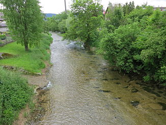
Sissle near Oeschgen |
||
| Data | ||
| Water code | CH : 447 | |
| location | District of Laufenburg , Canton of Aargau | |
| River system | Rhine | |
| Drain over | Rhine → North Sea | |
| source | South slope Dreierberg, Schinznach-Dorf , ( Fold Jura ) 47 ° 27 ′ 16 ″ N , 8 ° 6 ′ 38 ″ E |
|
| Source height | 647 m above sea level M. | |
| muzzle |
Upper Rhine near Sisseln Coordinates: 47 ° 33 '15 " N , 7 ° 58' 54" E ; CH1903: 640 869 / 267 197 47 ° 33 '15 " N , 7 ° 58' 54" O |
|
| Mouth height | 290 m above sea level M. | |
| Height difference | 357 m | |
| Bottom slope | 20 ‰ | |
| length | 18.3 km | |
| Catchment area | 128 km² | |
| Discharge at the Eiken A Eo gauge : 123 km² Location: 3.8 km above the mouth |
NNQ (2011) MNQ 1977–2014 MQ 1977–2014 Mq 1977–2014 MHQ 1977–2014 HHQ (1999) |
0 l / s 754 l / s 1.82 m³ / s 14.8 l / (s km²) 3.03 m³ / s 102 m³ / s |
| Left tributaries | Zeiherbach , Staffeleggbach , Bruggbach , Kellergrabenbach | |
| Right tributaries | Sagenmülibach , Effingerbach | |
| Communities | Frick , Oeschgen , Sisseln , Eiken | |
The Sissle is a creek around 18 kilometers long in the canton of Aargau in Switzerland . It is a tributary of the Rhine and drains the eastern part of the Fricktal . The largest town on the stream is Frick .
The stream rises in the municipal areas of Schinznach and Thalheim at an altitude of 650 m above sea level. M. on the southern slope of the Dreierberg and northern slope of the Zeiher Homberg, in the middle of the Jura . Shortly after the source, the stream breaks through a gorge between the Dreierberg and the Zeiher Homberg and then falls off quickly. It passes the Talmatt and delimits the Zeiher district of Iberg. After about two and a half kilometers, the Sissle passes the west portal of the Bözberg tunnel with the Effingen train station at a height of 450 meters . There it had to be canalized as a result of the construction of the railway line.
From here on, the gradient is rather flat and the stream initially follows the A3 motorway freely flowing, but canalised to Hornussen . The canalized section extends to Eiken , where the stream changes its direction of flow from northwest to north and enters the Rhine plain. In Frick , it takes on the Bruggbach coming from Wittnau on the left. The last two and a half kilometers the Sissle meanders strongly and flows into the Upper Rhine near the village of Sisseln , at an altitude of 290 meters.
Individual evidence
- ↑ a b c d Geoserver of the Swiss Federal Administration ( information )
- ^ Hydrometry of the Canton of Aargau
