
Thalheim AG
| AG is the abbreviation for the canton of Aargau in Switzerland and is used to avoid confusion with other entries of the name Thalheim . |
| Thalheim | |
|---|---|
 |
|
| State : |
|
| Canton : |
|
| District : | Brugg |
| BFS no. : | 4117 |
| Postal code : | 5112 |
| UN / LOCODE : | CH THI |
| Coordinates : | 649 828 / 254 062 |
| Height : | 451 m above sea level M. |
| Height range : | 410-800 m above sea level M. |
| Area : | 9.92 km² |
| Residents: | 812 (December 31, 2019) |
| Population density : | 82 inhabitants per km² |
|
Proportion of foreigners : (residents without citizenship ) |
7.0% (December 31, 2019) |
| Website: | www.gemeinde-thalheim.ch |
 Thalheim |
|
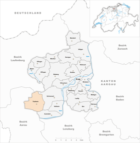
| Location of the municipality | |
  |
|
Thalheim ( Swiss German : ˈtɑlə ) is a municipality in the Swiss canton of Aargau . It belongs to the Brugg district and is located about eight kilometers southwest of the district capital in the Schenkenbergertal , about halfway between Basel and Zurich .
geography
The village is located at the end of the Schenkenbergertal , which stretches in an east-west direction from the Aare near Schinznach-Dorf to Staffelegg . The valley is bordered by two mountain ranges of the Folded Jura . The Gislifluh ( 772 m above sea level ) and the Homberg ( 776 m above sea level ) form the southern chain. Immediately to the north of the village rise three mountains, separated by two valleys. From east to west these are the Kastelnberg ( 523 m above sea level ), the Schenkenberg (631 meters) and the Hard ( 776 m above sea level ). After a few hundred meters, the Milchbrunnental bends west and separates the Hard from the Würz ( 801 m above sea level ). The eastern valley runs north and merges into undulating terrain that marks the transition to the Table Jura . The Zeiher Homberg ( 782 m above sea level ) forms the northern border.
Various streams have their source in Thalheim: On the one hand the Gländbach , the Hegibach , the Gäckertbach and Rischelebach, which flow together with the Talbach towards the Aare , on the other hand, north of the watershed, the Sissle and the Zeiherbach , which cross the municipality on Homberg through the Fricktal into the Upper Rhine drain. The actual village of Thalheim consists of two clearly separated parts, the younger lower village and the older upper village. There are also around a dozen courtyards that are spread across the entire municipality. The larger ones are Hof Schenkenberg, Egghof above the village, Rischeln ( 630 m above sea level ) in the extreme south-west and Kilholz in the north.
The area of the municipality is 992 hectares , of which 437 hectares are forested and 63 hectares are built over. The highest point is the summit of the Würz at 801 meters, the lowest is at 415 meters on the eastern border of the municipality. The municipality of Thalheim is part of the Aargau Jura Park, a “Regional Nature Park of National Importance”. Neighboring communities are Zeihen in the north, Schinznach in the northeast, Auenstein in the southeast, Biberstein in the south, Küttigen in the southwest and Densbüren in the west.
history

Today's municipality of Thalheim was settled by the Alamanni , as the grave finds near Staffelegg show. The first mention of Frichgove Taleheim took place in 1064 along with Frick and Remigen in a document which Henry IV. The Monastery Ottmarsheim exhibited. All three places belonged to the Frickgau at that time . The place name is a combination of Old High German valley and home , which means "place of residence in the valley".
On behalf of the Habsburgs , Schenkenberg Castle was built at the beginning of the 13th century (first documented mention in 1243). In the 15th century, the Schenkenberg rule extended over a large part of what is now the Brugg district. In 1460, the city of Bern conquered the rule, which was now part of the subject areas in the Bernese Aargau . Thalheim formed its own judicial district within the office of Schenkenberg , which was administered from the castle. In 1528 the Bernese introduced the Reformation . Due to dilapidation, the castle had to be abandoned in 1720 and the governor moved to the nearby Wildenstein Castle near Veltheim . Schenkenberg Castle fell into ruin, served as a quarry for several decades and came into the possession of the Aargau Association for Homeland Security in 1918. A schoolhouse is mentioned for the first time in 1640.
In March 1798 the French took Switzerland, ousted the «Gracious Lords» of Bern and proclaimed the Helvetic Republic . Thalheim has been part of the canton of Aargau since then. At the end of the 19th century, the once important viticulture fell into a serious crisis when the vineyards were destroyed by phylloxera and powdery mildew . Many residents lost their livelihoods and had to move from their homes. Between 1850 and 1980 the population decreased by more than half. Since then there has been an increase again, even if the village has not regained its former size to this day. During the Second World War , several dozen Polish soldiers were interned in Thalheim, who built the Polenstrasse .
Attractions


The Schenkenberg ruins on the summit of the mountain of the same name are around 30 minutes' walk from the village center. Today it is the largest castle ruin in the Canton of Aargau and classified as a monument of national importance. The still towering remains of the keep and hall, two round towers, utility building, the gate and the extensive curtain wall are visible.
The Thalheim church is in a slightly elevated position, surrounded by a cemetery. The walls of today's nave are partly in the Romanesque style. In 1543 an extension and renovation took place. The baptismal font , which is worth seeing , was donated in 1675 by Schenkenberger Obervogt Samuel Thormann. The rectory built in 1731/32 dominates the village square and points to the Bernese past. Immediately in front of it is the octagonal village fountain from 1856, which is made of Tuscany granite.
The Gislifluh lies above the village on the first Jura chain. It can be reached from Thalheim via a hiking trail that leads through the Gländloch and over the top of the Gatter pass.
coat of arms
The blazon of the municipal coat of arms reads: "In white, blue grapes on a green stem with two green leaves." The grapes are a reference to the once important viticulture, which used to be the livelihood of the village. On the municipal seal from 1872 a large two-leaf grape can be seen, on the one from 1872, on the other hand, a vine on Dreiberg with four grapes. In order to avoid confusion with the coat of arms of Zeiningen , the municipal assembly decided in 1959 to reintroduce the older coat of arms.
population
The population developed as follows:
| year | 1764 | 1850 | 1900 | 1930 | 1950 | 1960 | 1970 | 1980 | 1990 | 2000 | 2010 |
| Residents | 461 | 1117 | 845 | 672 | 653 | 604 | 583 | 555 | 641 | 744 | 733 |
On December 31, 2019, 812 people lived in Thalheim, the proportion of foreigners was 7%. In the 2015 census, 58.6% described themselves as Reformed and 14.6% as Roman Catholic ; 26.8% were non-denominational or of other faiths. In the 2000 census, 98.5% stated German as their main language.
Politics and law
The assembly of those entitled to vote, the municipal assembly , exercises legislative power. The executing authority is the five-member municipal council . He is elected by the people in the majority procedure, his term of office is four years. The parish council leads and represents the parish. To this end, it implements the resolutions of the municipal assembly and the tasks assigned to it by the canton. The Brugg District Court is the first instance responsible for legal disputes . Thalheim belongs to the Friedensrichterkreis VIII (Brugg).
economy
According to the corporate structure statistics (STATENT) collected in 2015, there are around 250 jobs in Thalheim, of which 23% are in agriculture, 32% in industry and 45% in the service sector. Most of the workers are commuters and work in the nearby cities of Aarau , Brugg and Lenzburg .
Even if viticulture is no longer of the paramount importance it used to be, it is still being cultivated: In 2018, an area of 4.4 hectares was planted with vines on the southern slopes of the Hard and Schenkenbergs, with the Pinot Noir as the dominant variety.
traffic
Thalheim is located on the canton road 474 from Schinznach-Bad through the Schenkenbergertal to the Staffelegg -Passhöhe, which meets the main road 24 from Aarau to Frick . The motorway connections in all directions can be reached in less than 15 minutes. In the center of the village, Polenstrasse branches off up to Berghof Schenkenberg. Thalheim is the terminus of a post bus line to Brugg train station , and on weekends also a night bus that runs from there. The closest train station is in Wildegg .
education
The community has a kindergarten and a school house where primary school is taught. The Realschule and the secondary school can be attended in Veltheim , the district school in Schinznach-Dorf . The closest grammar schools are the Alte Kantonsschule and the Neue Kantonsschule , both in Aarau.
particularities
- For historical reasons, Thalheim has its own electricity supply, which supplies the village and northern farms such as Kilholz with electricity. The Staffelegg and Rischeln farms are supplied with electricity by Aarauer Eniwa AG . The hamlets of Schlatt and Berg are directly connected to the AEW network.
- A dialect is spoken in Thalheim up to the present day, which - unlike most other Aargau dialects - like Zurich German has reversed the dulling of Old High German / aː / to / ɔː /.
- In Thalheim, Bärzelitag is celebrated on January 2nd ; In this custom, the figures go through the village with camels and send New Year's greetings to the citizens.
- The residents of Thalheim regularly take part in the T (h) alheim meetings .
Personalities
- Roland Frauchiger (* 1960), politician
- Abraham Tillier (1634–1704), councilor
- Johann Anton Tillier (1637–1705), councilor
literature
- Felix Müller: Thalheim. In: Historical Lexicon of Switzerland .
- Michael Stettler , Emil Maurer : The art monuments of the canton of Aargau . In: Society for Swiss Art History (Ed.): Art Monuments of Switzerland . Volume II: The districts of Lenzburg and Brugg. Birkhäuser Verlag, Basel 1953, DNB 750561750 .
Web links
Individual evidence
- ↑ Cantonal population statistics 2019. Department of Finance and Resources, Statistics Aargau, March 30, 2020, accessed on April 2, 2019 .
- ↑ Cantonal population statistics 2019. Department of Finance and Resources, Statistics Aargau, March 30, 2020, accessed on April 2, 2019 .
- ↑ a b Beat Zehnder: The community names of the canton of Aargau . In: Historical Society of the Canton of Aargau (Ed.): Argovia . tape 100 . Verlag Sauerländer, Aarau 1991, ISBN 3-7941-3122-3 , p. 423-424 .
- ↑ a b National map of Switzerland, sheets 1069 and 1089, Swisstopo.
- ↑ Standard area statistics - municipalities according to 4 main areas. Federal Statistical Office , November 26, 2018, accessed on June 12, 2019 .
- ^ R. Reich: Basler Zeitschrift für Geschichte und Altertumskunde . 1904 limited preview in Google Book search
- ^ Caroline Belart: General information on Polenstrasse. In: Annual journal of the Historical Society of the Canton of Aargau, Vol. 118, 2006, pp. 47–63.
- ^ Joseph Galliker, Marcel Giger: Municipal coat of arms of the Canton of Aargau . Lehrmittelverlag des Kantons Aargau, book 2004, ISBN 3-906738-07-8 , p. 291 .
- ↑ Population development in the municipalities of the Canton of Aargau since 1850. (Excel) In: Eidg. Volkszählung 2000. Statistics Aargau, 2001, archived from the original on October 8, 2018 ; accessed on June 12, 2019 .
- ↑ Resident population by religious affiliation, 2015. (Excel) In: Population and Households, Community Tables 2015. Statistics Aargau, accessed on June 12, 2019 .
- ↑ Swiss Federal Census 2000: Economic resident population by main language as well as by districts and municipalities. (Excel) Statistics Aargau, archived from the original on August 12, 2018 ; accessed on June 12, 2019 .
- ↑ circles of justice of the peace. Canton of Aargau, accessed on June 18, 2019 .
- ↑ Statistics of the corporate structure (STATENT). (Excel, 157 kB) Statistics Aargau, 2016, accessed on June 12, 2019 .
- ↑ Grape harvest control 2018 Canton Aargau. (PDF, 2.4 MB) Agricultural Center Liebegg, 2019, accessed on June 12, 2019 .
- ↑ Electricity supply on the municipality website
- ↑ Sabine Kuster: Is Aargau losing its dialects? Aargauer Zeitung , October 2, 2009, accessed on January 1, 2015 .
- ↑ Maja Sommerhalder: Caution, thorny hugs on Bärzelistag. Aargauer Zeitung , June 18, 2010, accessed on January 1, 2015 .
Auenstein | Birr | Birrhard | Brugg | Bözberg | Bözen | Effingen | Elfingen | Habsburg | Hausen | Lupfig | Mandach | Mönthal | Garbage | Remigen | Riniken | Rüfenach | Schinznach | Thalheim | Veltheim | Villigen | Villnachern | Windisch
Former communities:
Altenburg |
Gallenkirch |
Hottwil |
Lauffohr |
Linn |
Oberbözberg |
Upper flax |
Pure |
Joke |
Schinznach-Bad |
Schinznach village |
Stilli |
Umiken |
Untersözberg
Canton of Aargau | Districts of the Canton of Aargau | Municipalities in the Canton of Aargau