
Villigen
| Villigen | |
|---|---|
 |
|
| State : |
|
| Canton : |
|
| District : | Brugg |
| BFS no. : | 4121 |
| Postal code : | 5234 Villigen 5233 Stilli |
| Coordinates : | 658 456 / 264293 |
| Height : | 365 m above sea level M. |
| Height range : | 325–700 m above sea level M. |
| Area : | 11.21 km² |
| Residents: | 2145 (December 31, 2019) |
| Population density : | 191 inhabitants per km² |
|
Proportion of foreigners : (residents without citizenship ) |
27.6% (December 31, 2019) |
| Website: | www.villigen.ch |
 View from the Geissberg |
|
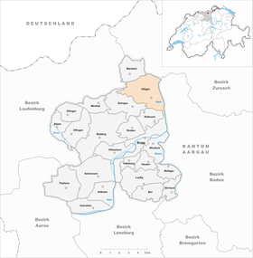
| Location of the municipality | |
  |
|
Villigen (the V spoken like an F; Swiss German : [ ˈfiligə ]) is a municipality in the Swiss canton of Aargau . It belongs to the Brugg district and is located about five kilometers north of the district capital in the Aare valley . On January 1, 2006, the neighboring town of Stilli was incorporated into Villigen.
geography

The village lies between the western bank of the Aare and the eastern slope of the Geissberg ( 700 m above sea level ). The Geissberg is a typical elevation of the Table Jura with an extensive plateau slightly sloping to the east and steep slopes on three sides. In the west and south, the municipal boundary of Villigen runs exactly along the edge of the terrain, while the slopes lie on the territory of the neighboring municipalities. In the north, the Geissberg merges into the Rotberg ( 633 m above sea level ). On the eastern slope four short, steep, almost semicircular foothills protrude into the river plain. From north to south these are the Tüeliboden ( 495 m above sea level ), the Gugelen ( 452 m above sea level ), the Besserstein ( 549 m above sea level ) and the Buck ( 526 m above sea level ).
The old village center lies between the Gugelen and the Besserstein, on the south side of which the Reinerbach flows past. On the banks of the Aare, around one and a half kilometers north of the mouth of the Limmat , the village of Stilli is located in Switzerland's so-called moated castle . Its former municipal area comprised a three-kilometer-long and 25 to 210-meter wide strip of banks along the Aare, with the river bed taking up more than a third of the area. The former municipal boundary ran along the 40-meter-high embankment above the river valley. In the Aare lies the small island of Fischergrieni, which was created by alluvial debris.
The area of the municipality is 1121 hectares , of which 544 hectares are forested and 167 hectares are built over. The highest point is at 700 meters on the northwest corner of the Geissberg, the lowest at 325 meters on the Aare. The municipality of Villigen is part of the Aargau Jura Park, a “Regional Nature Park of National Importance”. Neighboring communities are Mandach and Böttstein in the north, Würenlingen in the east, Untersiggenthal in the south-east, Brugg and Rüfenach in the south, Remigen in the south-west and Mettauertal in the north-west.
history
The oldest traces of settlement found near Villigen are around 5000 years old and come from the Neolithic Age , ceramic shards from the Bronze Age are around 3000 years old . Around the year 200 a Roman manor was built, which was destroyed in the raids of the Alamanni around 259/270. The remains of a Roman watchtower came to light on the Rotberg. The coins discovered there date from the period between 260 and 375. During excavation work, an Alemannic burial ground from the 6th and 7th centuries was found. In the Middle Ages, unknown nobles built two castles near Villigen. The one on the Oelberg was inhabited from around 1100 to 1150 and was abandoned, Besserstein Castle was built at the beginning of the 13th century. In 1247 a Heinricus de Viligen appeared in a document; this is the oldest known mention of the village. The place name comes from the Old High German Filingun and means "among the people of Filo (short form of Filibertus)".
Villigen was part of the Rein farm , which belonged to the Murbach monastery in Alsace (at that time a farm was used to describe the manorial rule over a larger area). In the 13th century, the Habsburgs combined their sovereign rights west and north of Brugg in the Bözberg court. In addition to Villigen, this also included Oberbözberg , Unterbözberg , Lauffohr , Linn , Mönthal , Rein, Remigen , Riniken , Rüfenach and Stilli . In these villages the Habsburgs exercised blood jurisdiction , in Mönthal, Remigen and Villigen they also exercised lower jurisdiction . King Rudolf I bought the Rein Hof in 1291 and was not only the chief judge, but also the most important landlord. In 1345 Queen Agnes of Hungary donated the farm to the Wittichen monastery in the Kinzig valley . In 1458, pasture areas were set aside for Stilli, which exactly corresponded to the municipal boundaries valid until the end of 2005.
When the city of Bern conquered the area west of the Aare in 1460 , nothing changed in the rights of the monastery. This, however, had to accept the introduction of the Reformation in 1528. In 1544 the monastery sold the Rein farm to Count Hartmann von Hallwyl . In 1566 the judicial district of Bözberg was separated and the court cases of the Rein court were now heard in Stilli. Between 1588 and 1599 the city of Brugg acquired two thirds of the farm and Bern the remaining third. In March 1798 the French took Switzerland, ousted the «Gracious Lords» of Bern and proclaimed the Helvetic Republic . The Rein farm came to the new canton of Aargau. In 1799 the front line ran through the middle of the lower Aare valley during the Second Coalition War . There were several French army camps in the region. The villagers suffered great hardship through requisitions and looting.


In 1803 the canton of Aargau dissolved Hof Rein and raised the individual villages to independent communities. Until the beginning of the 20th century, Villigen was dominated by agriculture. Viticulture , which has been in operation since at least the 13th century, fell sharply around 1880 due to the phylloxera that was introduced. In the second half of the 19th century, around 200 impoverished villagers emigrated overseas. The population stagnated until around 1960, but then doubled within thirty years. This development is mainly due to the opening of the Swiss Institute for Nuclear Physics SIN in 1968, which twenty years later merged with the Federal Institute for Reactor Research in Würenlingen in the Paul Scherrer Institute . In September 2003 the voters of Villigen approved the incorporation of the previous neighboring community of Stilli. The parish merger took effect on January 1, 2006.
Attractions
The remains of Besserstein Castle are located on the rock head of the Geissberg, which towers steeply to the west of the village . There are no fewer than ten fountains in the village itself, which is why Villigen is also known as the “village of beautiful fountains”. Two of them, the Halseisenbrunnen and Schmittenbrunnen, which were built in the late Renaissance style in 1583 and 1814 , are now a listed building, as is the Reformed Church .
coat of arms
The blazon of the municipal coat of arms reads: "Overturned, turned yellow bear paws cut in blue over a green mountain of three, accompanied by three five-pointed yellow stars." The coat of arms goes back to that of the Lords of Villingen, Habsburg ministers in the 13th and 14th centuries. The oldest known depiction dates from 1548, but the bear's paw grows from the lower edge of the shield up into the field. On the municipal seal of 1872, the bear paw appeared the other way around, together with the three stars, the meaning of which is not known. In 1988 the local council stipulated that the outside of the paw should be shown.
population
The population developed as follows:
| year | 1764 | 1850 | 1900 | 1930 | 1950 | 1960 | 1970 | 1980 | 1990 | 2000 | 2010 |
| Residents | 460 | 733 | 591 | 601 | 630 | 621 | 779 | 914 | 1247 | 1430 | 2010 |
On December 31, 2019, 2145 people lived in Villigen, the proportion of foreigners was 27.6%. In the 2015 census, 30.7% described themselves as Reformed and 30.4% as Roman Catholic ; 38.9% were non-denominational or of other faiths. In the 2000 census, 89.8% stated German as their main language, 1.7% each Albanian and Italian , 1.6% Portuguese and 1.0% French .
Politics and law
The assembly of those entitled to vote, the municipal assembly , exercises legislative power. The executing authority is the five-member municipal council . He is elected by the people in the majority procedure, his term of office is four years. The parish council leads and represents the parish. To this end, it implements the resolutions of the municipal assembly and the tasks assigned to it by the canton. The Brugg District Court is the first instance responsible for legal disputes . Villigen belongs to the Friedensrichterkreis VIII (Brugg).
economy

Compared to the neighboring communities, Villigen has a relatively large number of jobs, namely over 1500 according to the company structure statistics (STATENT) collected in 2015. Of these, 3% are in agriculture, 11% in industry and 86% in the service sector. By far the largest employer is the Paul Scherrer Institute (PSI), a multidisciplinary research center for natural and engineering sciences. There is also a small furniture factory as well as several commercial and service companies. About one and a half kilometers northwest of the village is the Gabenchopf quarry on the eastern slope of the Geissberg . The degraded there stones ( limestone and marl ) are a four kilometer long conveyor belt on the Aare away for LafargeHolcim - cement plant in Würenlingen transported. Viticulture is carried out on the slopes above Villigen on an area of 17 hectares .
Viticulture continues to be of great importance . On the southern slopes of the Geissberg foothills, an area of 14.9 hectares was planted with vines in 2018. Over a dozen different varieties are planted, with Pinot Noir and Riesling × Sylvaner dominating.
traffic
Villigen and Stilli are on Kantonsstrasse 441/442, which runs from Brugg along the western bank of the Aare to Böttstein and Klingnau . At Stilli, a bridge built in 1970 leads over the Aare to Würenlingen . The connection to the public transport network is via the post bus line from Brugg train station to Döttingen , with additional courses between Brugg and PSI. The line between Brugg and Bad Zurzach also runs through Stilli, and there is a line from PSI via Untersiggenthal to Gibstorf . On weekends there is a night bus from Brugg via Villigen and Remigen to Riniken .
education
The community has a kindergarten and a school house where primary school is taught. All upper levels ( Realschule , Secondary School and District School ) can be attended in Brugg . The closest grammar schools are the Baden Cantonal School and the Wettingen Cantonal School .
Personalities
- Esther Süss (* 1974), mountain biker
literature
- Felix Müller: Villigen. In: Historical Lexicon of Switzerland .
- Michael Stettler , Emil Maurer : The art monuments of the canton of Aargau . Ed .: Society for Swiss Art History . Volume II: The districts of Lenzburg and Brugg. Birkhäuser Verlag, Basel 1953, DNB 750561750 .
Web links
Individual evidence
- ↑ Cantonal population statistics 2019. Department of Finance and Resources, Statistics Aargau, March 30, 2020, accessed on April 2, 2019 .
- ↑ Cantonal population statistics 2019. Department of Finance and Resources, Statistics Aargau, March 30, 2020, accessed on April 2, 2019 .
- ↑ a b Beat Zehnder: The community names of the canton of Aargau . In: Historical Society of the Canton of Aargau (Ed.): Argovia . tape 100 . Verlag Sauerländer, Aarau 1991, ISBN 3-7941-3122-3 , p. 447-448 .
- ↑ a b National map of Switzerland, sheet 1070, Swisstopo.
- ↑ Standard area statistics - municipalities according to 4 main areas. Federal Statistical Office , November 26, 2018, accessed on June 8, 2019 .
- ^ Joseph Galliker, Marcel Giger: Municipal coat of arms of the Canton of Aargau . Lehrmittelverlag des Kantons Aargau, book 2004, ISBN 3-906738-07-8 , p. 305 .
- ↑ Population development in the municipalities of the Canton of Aargau since 1850. (Excel) In: Eidg. Volkszählung 2000. Statistics Aargau, 2001, archived from the original on October 8, 2018 ; accessed on June 8, 2019 .
- ↑ Resident population by religious affiliation, 2015. (Excel) In: Population and Households, Community Tables 2015. Statistics Aargau, accessed on June 8, 2019 .
- ↑ Swiss Federal Census 2000: Economic resident population by main language as well as by districts and municipalities. (Excel) Statistics Aargau, archived from the original on August 10, 2018 ; accessed on June 8, 2019 .
- ↑ circles of justice of the peace. Canton of Aargau, accessed on June 18, 2019 .
- ↑ Statistics of the corporate structure (STATENT). (Excel, 157 kB) Statistics Aargau, 2016, accessed on June 8, 2019 .
- ↑ Grape harvest control 2018 Canton Aargau. (PDF, 2.4 MB) Agricultural Center Liebegg, 2019, accessed on June 12, 2019 .
Auenstein | Birr | Birrhard | Brugg | Bözberg | Bözen | Effingen | Elfingen | Habsburg | Hausen | Lupfig | Mandach | Mönthal | Garbage | Remigen | Riniken | Rüfenach | Schinznach | Thalheim | Veltheim | Villigen | Villnachern | Windisch
Former communities:
Altenburg |
Gallenkirch |
Hottwil |
Lauffohr |
Linn |
Oberbözberg |
Upper flax |
Pure |
Joke |
Schinznach-Bad |
Schinznach village |
Stilli |
Umiken |
Untersözberg
Canton of Aargau | Districts of the Canton of Aargau | Municipalities in the Canton of Aargau