
Klingnau
| Klingnau | |
|---|---|
 |
|
| State : |
|
| Canton : |
|
| District : | Zurzach |
| BFS no. : | 4309 |
| Postal code : | 5313 |
| Coordinates : | 661074 / 270 304 |
| Height : | 329 m above sea level M. |
| Height range : | 312-535 m above sea level M. |
| Area : | 6.71 km² |
| Residents: | 3542 (December 31, 2019) |
| Population density : | 528 inhabitants per km² |
|
Proportion of foreigners : (residents without citizenship ) |
29.2% (December 31, 2019) |
| Website: | www.klingnau.ch |
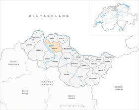
 Klingnau |
|
| Location of the municipality | |
  |
|
Klingnau ( Swiss German : ˈχlɪŋˌnɑʊ ) is a small town and municipality in the Swiss canton of Aargau . It belongs to the Zurzach district and is located in the lower Aare valley , around four kilometers south of the border with Germany .
geography
The urban area of Klingnau lies on the east side of the Klingnau reservoir in the level of the Aare valley and on the Acheberg ( 535 m above sea level ), a hill of the Table Jura . The partially wooded southwest slope of the range of hills is steep and gradually turns into a high plateau. In the southeast, the Blitzberg ( 500 m above sea level ) juts out into the plain as a striking spur. The western part of the gently sloping hill from the Acheberg over the Rüti to the Hard belongs to the municipality of Klingnau, while the larger area of the plateau is in the area of Koblenz . In the northwest, the municipal boundary extends from the Aare north of the Klingnau power plant at the SBB Aare Bridge Koblenz, right along the embankment to Koblenz train station . There is the northernmost border point of Klingnau above the valley of the Apelööbach about 250 meters from the Rhine . The easternmost point of the municipality is located in the clearing clearing on the Acheberg, where the border line is right next to the hamlet of the same name.
The historic town center of Klingnau with the two rows of houses north and south of the town church is located on a terrace on the right of the Aare. The younger city quarters are grouped around the old town on the river plain and on the Acheberg. In the southeast, the settlement has grown together with the neighboring municipality of Döttingen at the mouth of the Surb .
The area of the municipality is 671 hectares , of which 233 hectares are forested and 137 hectares are built over. The highest point is at 535 meters on the Acheberg plateau, the lowest at 318 meters on the banks of the Klingnau reservoir. Neighboring communities are Koblenz in the north, Rietheim in the northeast, Bad Zurzach in the east, Döttingen in the south, Böttstein in the southwest and Leuggern in the west.
history
In the 13th century, Klingnau was conveniently located in terms of transport, as goods were reloaded there from the Aare ships onto carts to Zurzach . In order to also benefit from land transport, the von Klingen family had a bridge built over the Aare . The founding date of Klingnau is December 26th, 1239 ( St. Stephen's Day ). At that time Ulrich II von Klingen, who came from Thurgau and had married the heir, Ita, from the noble family von Tegerfelden , and the St. Blasien monastery signed an exchange contract for goods on the lower Aare. Ulrich von Klingen ceded the agricultural area in the Beznau to the monastery and in return received a stretch of land to the right of the Aare with a twelve-meter-high gravel hill a few kilometers downstream on which he had a town and a castle built.
Chlingenowe was first mentioned as a town on May 8, 1243 . The old high German place name means "land of blades near the water". Originally, the administration of the Sanktblasischen goods on the Aare, Surb and Limmat was carried out by the Döttingen Provost, which was moved to the new town of Klingnau after 1239. Ulrich's son Walther von Klingen sold the property (town, Aare bridge and Tegerfelden Castle ) in 1269 for 1,100 silver marks to the diocese of Constance ; in the same year he founded the monastery of Sion , which was assigned to the Hermit Order of St. William of Malavalle .
In addition to the St. Blasien Monastery, the Bishop of Constance also had rights in the city. The Hochstift Konstanz suffered from a debt crisis at that time, so that property had to be pledged or traded on the right to repurchase. So Klingnau came through the bishop Heinrich III. from Brandis on November 16, 1371 to Peter von Thorberg and on July 22, 1390 to Bodman , who kept it for 16 years. In addition, the Habsburgs , the Order of St. John and the Zurzach Canon Monastery had powers in Klingnau.


In 1415 the Confederates conquered the Habsburg Aargau and Klingnau was now part of the County of Baden , a common rule . The Confederates succeeded in largely gaining all the rights of the bishop and other rulers by 1712. In the 15th century, the bridge was torn away but not rebuilt, which meant that the ferry from Döttingen to Klingnau gained in importance. In 1586 a fire destroyed the entire upper town. In 1689, the government of Front Austria had to move into exile in Klingnau for a year and a half during the War of the Palatinate Succession . The town could hardly develop economically because it was always overshadowed by Zurzach with the internationally important Zurzach trade fair . Only viticulture gained a certain importance, so the area under cultivation in 1780 was around 115 hectares. The Sion Monastery remained independent until 1725, when the Oberried Monastery and the Quantity Monastery became part of St. Blasien.
In March 1798 the French took Switzerland and proclaimed the Helvetic Republic . Klingnau initially belonged to the short-lived canton of Baden . During the Second Coalition War in 1799, the front line between France and Austria ran in close proximity. In 1814 the Austrians set up a hospital in the provost's office and in the monastery , later the castle and, at times, the town hall were also occupied by sick people. A total of up to 2500 sick soldiers were housed (the town itself had almost 1000 inhabitants at the time) as well as 200 people as medical and surveillance personnel for the Austrians. Around 3,000 soldiers and 28 Klingnau residents died of typhus . The soldiers found their final resting place in the "Kaiserliche Gottesacker", where in 1815 a cross with an inscription was erected in memory.
Klingnau has belonged to the then newly formed canton of Aargau since 1803. In the second half of the 19th century, industrialization also began in the Aare valley . On August 18, 1859 opened Swiss Northeastern Railway , the Turgi-Koblenz-Waldshut railway line . Between 1900 and 1980 the furniture industry was the most important branch of industry. At the beginning of the 20th century, the entire Klingnau vineyard was destroyed by phylloxera brought in from North America , and it wasn't until 1922 that viticulture began again. The Klingnau power plant with the Klingnau reservoir was built between 1931 and 1935.

Exchange agreement between the St. Blasien Monastery and Baron Ulrich von Klingen for the island of Beznau and a hill (today's town of Klingnau)

Klingnau in the Topographia Helvetiae by Matthäus Merian 1642

The Klingnau town charter from 1500, which was essentially valid until 1798


Attractions
The medieval old town, located on a hilltop, consists of two closely built rows of houses, which are lenticularly arranged around a central square. In the middle of the square is the town church , the oldest preserved part of which is the Gothic choir from 1480. The rows of houses consist of three-storey town houses, which were given their current form in the 18th and 19th centuries. Klingnau Castle forms the north-western end of the old town . City founder Ulrich von Klingen had a residential tower built here, which later received several extensions and served as the seat of the bailiffs of the Diocese of Constance . In 1582, the castle was completely rebuilt due to great disrepair.
The steep slope towards the Aare is dominated by the Propstei Klingnau , the administrative seat of the Benedictine monastery of Sankt Blasien . The complex was built between 1745 and 1754 according to the plans of the master builder Johann Caspar Bagnato . It is a listed building and serves as a school building and seat of the municipal administration. The Loreto Chapel, built between 1660 and 1662, is located on the Acheberg in a forest clearing . One after the Second World War by wood sculptor Beat Gasser created Stationenweg combines Klingnau with the chapel. Klingnau has also had a reformed village church since 1935 .
There is a diverse fauna of water birds on Lake Klingnau , which can be observed from a lookout tower built in 2003 and from a former military bunker.
coat of arms

The blazon of the municipal coat of arms reads: "Red, black, yellow lined and decorated miter, in the base of the shield accompanied by two six-pointed yellow stars." The coat of arms was first shown on the city seal, which was made shortly before 1300. The miter reminds of the bishops of Constance who ruled the city for centuries.
population

The population developed as follows:
| year | 1480 | 1586 | 1800 | 1850 | 1900 | 1930 | 1950 | 1960 | 1970 | 1980 | 1990 | 2000 | 2010 |
| Residents | 400-500 | 700 | 1000 | 1300 | 1134 | 1352 | 1778 | 2192 | 2545 | 2433 | 2581 | 2710 | 3103 |
On December 31, 2019, 3542 people lived in Klingnau, the proportion of foreigners was 29.2%. In the 2015 census, 44.9% described themselves as Roman Catholic and 18.5% as Reformed ; 36.6% were non-denominational or of other faiths. In the 2000 census, 89.2% stated German as their main language, 3.6% Italian , 2.6% Albanian and 0.8% each Portuguese and Serbo-Croatian .
Politics and law
The assembly of those entitled to vote, the municipal assembly , exercises legislative power. The executing authority is the five-member municipal council . He is elected by the people in the majority procedure, his term of office is four years. The parish council leads and represents the parish. To this end, it implements the resolutions of the municipal assembly and the tasks assigned to it by the canton. The Zurzach District Court is the first instance responsible for legal disputes . Klingnau belongs to the XVII (Zurzach) judges' circle.
economy
According to the company structure statistics (STATENT) collected in 2015, there are around 1,100 jobs in Klingnau, 4% of them in agriculture, 45% in industry and 51% in the service sector. Many people in employment are commuters and work in the neighboring communities of the lower Aare valley or in the Brugg / Baden region . The production of De Sede furniture , metal goods and kitchens as well as the construction industry, precision mechanics and apparatus engineering are predominant .
Viticulture is also of some importance . On the sunny southern slopes of Acheberg and Blitzberg, an area of 10.6 hectares is planted with vines. Above all, the varieties Blauburgunder and Riesling as well as some special varieties are grown .
traffic

The main road 5 runs along the railway line from Koblenz through the lower Aare valley towards Brugg . Until the construction of the bypass road in 1987, through traffic ran right through the old town.
The town has a stop at the SBB - Turgi-Koblenz-Waldshut railway line , with direct trains to Baden , Waldshut and Bad Zurzach . The stop was opened in December 2002, before passengers had to get on and off in Döttingen . On weekends, a night bus runs from Baden via the Surbtal and Klingnau to Bad Zurzach.
The Klignauer Uferweg No. 525, which is marked as an "obstacle-free path" and is barrier-free from the Döttingen train station and the Klingnau stop , leads over the side dams of the Klingnau Lake and leads around the lake with almost no height differences. This route is part of the series of Swiss routes for people with reduced mobility set up by the SwitzerlandMobility Foundation .
education
The community has four school buildings (including the former provost), in which the kindergarten and all levels of the compulsory elementary school ( Realschule , Secondary school , district school ) are taught. The closest grammar schools are the Baden Cantonal School and the Wettingen Cantonal School .
Personalities
- Walther von Klingen (1240–1286), minstrel
- Steinmar (urk. 1253–1293), minstrel
- Henry III. von Brandis († 1383), Bishop of Constance
- Mangold von Brandis († 1385), Bishop of Constance
- Sebastian Peregrin Zwyer (1597–1661), diplomat and politician
- Rustenus Heer (1715–1769) Benedictine, priest, librarian and historian
- Leopold Höchle (1791–1864), Abbot of Wettingen (-Mehrerau)
- Franz Xaver Eggspühler (1861–1930), National Councilor
- Kuno Raeber (1922–1992), poet and novelist
- Alfred Willimann (1900–1957), artist
See also
literature
- Christoph Herzig: Klingnau (municipality). In: Historical Lexicon of Switzerland .
- Peter Ziegler: Klingnau (coming). In: Historical Lexicon of Switzerland .
- Louis Dreyer: Chlingenowe - Klingnau . Baden-Verlag, Baden 1989, ISBN 3-85545-040-4 .
- Otto Mittler : History of the City of Klingnau . Aarau 1967.
Web links
- Official website of the community of Klingnau
- Illustration by Daniel Meisner from 1624: Klingenaw; Et In Unâ Sede Quiescunt ( digitized version )
Individual evidence
- ↑ Cantonal population statistics 2019. Department of Finance and Resources, Statistics Aargau, March 30, 2020, accessed on April 2, 2019 .
- ↑ Cantonal population statistics 2019. Department of Finance and Resources, Statistics Aargau, March 30, 2020, accessed on April 2, 2019 .
- ↑ a b Beat Zehnder: The community names of the canton of Aargau . In: Historical Society of the Canton of Aargau (Ed.): Argovia . tape 100 . Verlag Sauerländer, Aarau 1991, ISBN 3-7941-3122-3 , p. 229-231 .
- ↑ a b National map of Switzerland, sheet 1050, Swisstopo.
- ↑ Standard area statistics - municipalities according to 4 main areas. Federal Statistical Office , November 26, 2018, accessed on June 14, 2019 .
- ↑ Otto Mittler: History of the City of Klingnau.
- ↑ The artificial lake with the great natural diversity , Birdlife Aargau
- ^ Joseph Galliker, Marcel Giger: Municipal coat of arms of the Canton of Aargau . Lehrmittelverlag des Kantons Aargau, book 2004, ISBN 3-906738-07-8 , p. 192 .
- ↑ Population development in the municipalities of the Canton of Aargau since 1850. (Excel) In: Eidg. Volkszählung 2000. Statistics Aargau, 2001, archived from the original on October 8, 2018 ; accessed on June 14, 2019 .
- ↑ Resident population by religious affiliation, 2015. (Excel) In: Population and Households, Community Tables 2015. Statistics Aargau, accessed on June 14, 2019 .
- ↑ Swiss Federal Census 2000: Economic resident population by main language as well as by districts and municipalities. (Excel) Statistics Aargau, archived from the original on August 12, 2018 ; accessed on June 14, 2019 .
- ↑ circles of justice of the peace. Canton of Aargau, accessed on June 14, 2019 .
- ↑ Statistics of the corporate structure (STATENT). (Excel, 157 kB) Statistics Aargau, 2016, accessed on June 13, 2019 .
- ↑ Grape harvest control 2018 Canton Aargau. (PDF, 2.4 MB) Agricultural Center Liebegg, 2019, accessed on June 14, 2019 .
- ↑ Klingnauer Uferweg, on schweizmobil.ch, accessed on October 21, 2019.
- ↑ Götz Timcke: Barrier-free hiking in Aargau, on ag.ch, accessed on October 21, 2019.
Bad Zurzach | Baldingen | Böbikon | Böttstein | Döttingen | Endingen | Fisibach | Full-Reuenthal | Kaiserstuhl | Klingnau | Koblenz | Leibstadt | Lengnau | Leuggern | Mellikon | Rekingen | Rietheim | Rümikon | Schneisingen | Siglistorf | Tegerfelden | Wislikofen
Former municipality: Mellstorf | Oberleibstadt | Unterendingen | Unterleibstadt
Canton of Aargau | Districts of the Canton of Aargau | Municipalities in the Canton of Aargau