
Leibstadt
| Leibstadt | |
|---|---|
 |
|
| State : |
|
| Canton : |
|
| District : | Zurzach |
| BFS no. : | 4311 |
| Postal code : | 5325 |
| UN / LOCODE : | CH LBT |
| Coordinates : | 655 424 / 271237 |
| Height : | 342 m above sea level M. |
| Height range : | 300-537 m above sea level M. |
| Area : | 6.40 km² |
| Residents: | 1377 (December 31, 2019) |
| Population density : | 215 inhabitants per km² |
|
Proportion of foreigners : (residents without citizenship ) |
34.9% (December 31, 2019) |
| Website: | www.leibstadt.ch |
 Leibstadt shortly after sunrise |
|
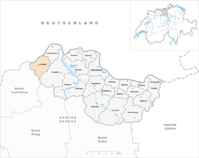
| Location of the municipality | |
  |
|
Leibstadt (in the local dialect Löipschlet [ ˈlœɪpʃlət ]) is a municipality in the Swiss canton of Aargau . It belongs to the Zurzach district , lies on the Upper Rhine on the border with Germany and is known as the municipality where the Leibstadt nuclear power plant is located .
geography
Geologically, the community consists of two parts: in the north the approximately one kilometer wide Rhine plain, in the south the foothills of the Table Jura . The Wandfluh in the southwest is very steep and criss-crossed by individual limestone rocks. In the south there is a flat plateau that extends up to a height of 509 meters. The 462 meter high Hochwacht forms the southeastern border. The settlement area extends over a kilometer and a half from north to south. In the north, near the banks of the High Rhine, lies the Bernau district. The village center is on the edge of the plain, just before the southern slopes of Brüehalde and Winterberg, two steep protruding hills. The southern third of the village lies between these hills in a deeply cut valley.
The area of the municipality is 640 hectares , of which 218 hectares are forested and 112 hectares are built over. The highest point is at 530 meters on the Wandfluh, the lowest at 302 meters on the banks of the Rhine. Neighboring communities are Full-Reuenthal in the northeast, Leuggern in the east, Mettauertal in the southwest, Schwaderloch in the west and the German Dogern in the north.
history
Ancient and Middle Ages
The earliest traces of settlement in the Leibstadt area come from the Helvetians , a Celtic tribe who lived around 500 BC. BC took possession of the area. From around 15 BC The Romans consolidated their rule. From 259 to 277 the Alemanni occupied the area south of the Rhine before they were pushed back by the Romans. The Rhine formed the northern border of the Roman Empire, there was a watchtower near Bernau. At the beginning of the 5th century, the Romans finally withdrew across the Alps . The Alemanni colonized the region and gradually assimilated the Romanized Celts. The village of Leibstadt probably originated in the 8th century.
In 1231 the Free von Bernau bequeathed their property to the Order of St. John . Leibesteit was first mentioned in a document in 1240. The place name comes from the Old High German (ze) leibesteti and means "at the home of Leip". The Johanniter initially assigned their newly acquired property to the Kommende Bubikon in the Zurich Oberland , and in 1250 they founded the Kommende Leuggern . This developed into the religious and political center of the parish of Leuggern, which included the present-day communities of Leuggern, Böttstein, Full-Reuenthal and Leibstadt. The blood jurisdiction lay with the Habsburgs .
The conquest of Aargau by the Confederates in 1415 had decisive consequences for Leibstadt. A border was drawn along the village stream. Unterleibstadt in the west belonged to Upper Austria , Oberleibstadt in the east remained part of the parish of Leuggern and became part of the county of Baden , a common rule of the Confederates. The border ran right through Bernau Castle and the mill. During the Swabian War of 1499, Leibstadt suffered severe devastation and looting. Bernau Castle burned down and was later rebuilt. From 1529 to 1531, troops of the reformed city of Bern occupied the parish, but the population remained Catholic.
The Johanniterkommende exercised lower jurisdiction in Oberleibstadt and part of Unterleibstadt . Above all in Unterleibstadt, however, there were repeated disputes over competence with the Austrian officials of the Laufenburg camera rule and with the owners of the Bernau rule. The rulership changed hands at regular intervals and included Unterleibstadt, Bernau Castle, Gansingen and Schwaderloch .
Modern times
In March 1798 the French took Switzerland and the parish came to the short-lived canton of Baden in the Helvetic Republic . The municipalities of Böttstein and Leuggern were created. During the Second Coalition War in 1799, the front line between the French and Austrians ran through the middle of the Aare valley east of Leibstadt. The population suffered great hardship through requisitions and compulsory billeting. After 1803 by the Act of Mediation of Napoleon Bonaparte dissolved Baden, the Canton of Aargau and had risen in the canton, the villages of the parish were reunited in a single community. With an area of over 30 square kilometers, it was the largest in the canton. Leibstadt remained divided: While Oberleibstadt belonged to the Zurzach district , Unterleibstadt was a municipality in the Laufenburg district .

In 1816, the Great Council decided to split the large community into the communities of Böttstein, Leuggern and Oberleibstadt. He was of the opinion that such a large community without an actual center was not economically viable. Until 1832, Full and Reuenthal also belonged to Oberleibstadt, and since then these villages have formed an independent municipality. Bernau Castle burned down in 1844. The arbitrary border through the middle of the village was increasingly impractical, as Unter- and Oberleibstadt worked together in many areas (for example, the school and the fire department were run together). On May 3, 1866, the Great Council decided to separate Unterleibstadt from the Laufenburg district and reunite with Oberleibstadt. The two communities were united on August 1, 1866 to form the new Leibstadt community, which still exists today.
The population of Leibstadt lived largely from agriculture until the early 20th century , and industrialization was slow to take hold. On August 1, 1892, the Koblenz – Stein-Säckingen railway was opened . However, this has been closed to passenger traffic on the Koblenz – Laufenburg section since May 28, 1994. With the construction of the Rheinkraftwerk Albbruck-Dogern , the passenger ferry to Dogern was replaced by a road that runs over the weir and a bridge over the upper water canal (the road is only permitted for pedestrians and cyclists). The construction gave the community an economic upswing - not only during construction, but also afterwards, as it receives water interest for the Rhine dammed up in its municipality .


In 1964, Elektrowatt and RWE presented plans for the first time to the public to build a nuclear power plant in Leibstadt. Construction began in 1973. After the Three Mile Island reactor accident in 1979, new safety regulations led to another delay in the construction of the power plant. The power plant was finally opened in 1984 after eleven years of construction and in the end cost five instead of two billion francs. Thanks to the abundant flow of tax revenue, Leibstadt was able to repay all debts and was even the most tax-efficient municipality in the canton for a number of years.
Attractions
The Loreto Chapel , built in 1672, is in the Bernau district . It served the Barons von Roll zu Bernau as a family crypt. After the chapel was sold in 1801, it later came into the possession of the municipality of Oberleibstadt. The cemetery next to the chapel has existed since 1869. In 1955 and 1956, the chapel was completely renovated with financial support from the canton, local residents, local communities and private individuals. A second restoration of the Loreto Chapel was carried out in 1987/88 with costs borne by the Leibstadt community and the “Pro Leibstadt” foundation. The Aargau government council placed the chapel under monument protection in 1963.
- Parish Church of St. Fridolin in Leibstadt

Northwest side of St. Fridolin 
Southwest side of St. Fridolin 
inside view


coat of arms
The blazon of the municipal coat of arms reads: "Angled bar divided in red, white and black." Until 1930 the community did not have its own coat of arms and then adopted that of the Free von Bernau.
population
The population developed as follows:
| year | 1798 | 1850 | 1900 | 1930 | 1950 | 1960 | 1970 | 1980 | 1990 | 2000 | 2010 |
| Residents | 470 | 911 | 838 | 909 | 772 | 832 | 1001 | 1254 | 1197 | 1298 | 1321 |
On December 31, 2019, 1,377 people lived in Leibstadt, the proportion of foreigners was 34.9%. In the 2015 census, 49.6% described themselves as Roman Catholic and 12.5% as Reformed ; 37.9% were non-denominational or of other faiths. In the 2000 census, 84.7% stated German as their main language, 8.8% Albanian , 1.9% each Italian and Turkish and 1.0% Serbo-Croatian .
Politics and law
The assembly of those entitled to vote, the municipal assembly , exercises legislative power. The executing authority is the five-member municipal council . He is elected by the people in the majority procedure, his term of office is four years. The parish council leads and represents the parish. To this end, it implements the resolutions of the municipal assembly and the tasks assigned to it by the canton. The Zurzach District Court is the first instance responsible for legal disputes . Leibstadt belongs to the Peace Judges' Circle XVII (Zurzach).
economy
According to the corporate structure statistics (STATENT) collected in 2015, Leibstadt had around 1150 jobs, of which 5% in agriculture, 62% in industry and 33% in the service sector. By far the most important employer and taxpayer is the Leibstadt nuclear power plant with 400 jobs. There is also a wood-based materials center, a mill and numerous small service companies.
traffic
Hauptstrasse 7 runs through Leibstadt between Basel and Winterthur . In the center of the village, Hauptstrasse 17 branches off towards Zurich . The village is accessed by two post bus lines. One leads from Laufenburg station via Leibstadt to Döttingen , the other from Leibstadt to Koblenz station . Leibstadt train station on the Koblenz – Stein-Säckingen railway has been closed to passenger traffic since 1994.
education
In Leibstadt there is a kindergarten , a primary school and an upper school center with the secondary school . The secondary school and the district school can be attended in Leuggern . The closest grammar schools are the Baden Cantonal School and the Wettingen Cantonal School .
Personalities
- August Erne (1905–1987), racing cyclist
- Gillian White (* 1939), sculptor
literature
- Christoph Herzig: Leibstadt. In: Historical Lexicon of Switzerland .
- Christoph Herzig: Unterleibstadt. In: Historical Lexicon of Switzerland .
- Sarah Brian Scherer, Dominik Sauerländer, Andreas Steigmeier : The parish of Leuggern, history of Böttstein, Full-Reuenthal, Leibstadt and Leuggern . 2001.
- Otto Vögele: The community of Leibstadt, on the 125th anniversary 1866 - 1991 . 1991.
Web links
Individual evidence
- ↑ Cantonal population statistics 2019. Department of Finance and Resources, Statistics Aargau, March 30, 2020, accessed on April 2, 2019 .
- ↑ Cantonal population statistics 2019. Department of Finance and Resources, Statistics Aargau, March 30, 2020, accessed on April 2, 2019 .
- ↑ a b Beat Zehnder: The community names of the canton of Aargau . In: Historical Society of the Canton of Aargau (Ed.): Argovia . tape 100 . Verlag Sauerländer, Aarau 1991, ISBN 3-7941-3122-3 , p. 242-243 .
- ^ National map of Switzerland, sheet 1050, Swisstopo.
- ↑ Standard area statistics - municipalities according to 4 main areas. Federal Statistical Office , November 26, 2018, accessed on June 13, 2019 .
- ^ Joseph Galliker, Marcel Giger: Municipal coat of arms of the Canton of Aargau . Lehrmittelverlag des Kantons Aargau, book 2004, ISBN 3-906738-07-8 , p. 198 .
- ↑ Population development in the municipalities of the Canton of Aargau since 1850. (Excel) In: Eidg. Volkszählung 2000. Statistics Aargau, 2001, archived from the original on October 8, 2018 ; accessed on June 13, 2019 .
- ↑ Resident population by religious affiliation, 2015. (Excel) In: Population and Households, Community Tables 2015. Statistics Aargau, accessed on June 13, 2019 .
- ↑ Swiss Federal Census 2000: Economic resident population by main language as well as by districts and municipalities. (Excel) Statistics Aargau, archived from the original on August 12, 2018 ; accessed on June 13, 2019 .
- ↑ circles of justice of the peace. Canton of Aargau, accessed on June 14, 2019 .
- ↑ Statistics of the corporate structure (STATENT). (Excel, 157 kB) Statistics Aargau, 2016, accessed on June 13, 2019 .
Bad Zurzach | Baldingen | Böbikon | Böttstein | Döttingen | Endingen | Fisibach | Full-Reuenthal | Kaiserstuhl | Klingnau | Koblenz | Leibstadt | Lengnau | Leuggern | Mellikon | Rekingen | Rietheim | Rümikon | Schneisingen | Siglistorf | Tegerfelden | Wislikofen
Former municipality: Mellstorf | Oberleibstadt | Unterendingen | Unterleibstadt
Canton of Aargau | Districts of the Canton of Aargau | Municipalities in the Canton of Aargau