
Siglistorf
| Siglistorf | |
|---|---|
 |
|
| State : |
|
| Canton : |
|
| District : | Zurzach |
| BFS no. : | 4319 |
| Postal code : | 5462 |
| Coordinates : | 670 856 / 266 469 |
| Height : | 444 m above sea level M. |
| Height range : | 428–603 m above sea level M. |
| Area : | 5.51 km² |
| Residents: | 634 (December 31, 2019) |
| Population density : | 115 inhabitants per km² |
|
Proportion of foreigners : (residents without citizenship ) |
20.3% (December 31, 2019) |
| Website: | www.siglistorf.ch |
 Siglistorf |
|
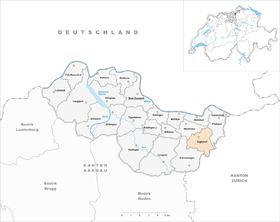
| Location of the municipality | |
  |
|
Siglistorf ( Swiss German : ˈsɪgliʃˌtɔrf ) is a municipality in the Swiss canton of Aargau . It belongs to the Zurzach district and lies on the border with the canton of Zurich and just under three kilometers south of the border with Germany .
geography
The village lies in a valley that is bordered by gravel terraces typical of the Central Plateau , which were created in the early Pleistocene by means of medium moraine material . This is traversed from southeast to north by the Tägerbach, which flows into the Upper Rhine near Mellikon . The hills that flank the valley are very steep in the lower area and merge into extensive plateaus. The hill in the east is called simply mountain and reaches a height of 603 meters, in the west the fire rises ( 588 m above sea level ). In the center of the village, a short side valley branches off towards the southwest. The Buechstock ( 596 m above sea level ) rises between the two valleys in the south .
The area of the municipality is 551 hectares , of which 285 hectares are forested and 38 hectares are built over. The highest point is at 601 meters on the mountain plateau, the lowest at 420 meters on the Tägerbach. Neighboring communities are Wislikofen in the northwest, Fisibach in the northeast, Bachs and Oberweningen in the southeast, Schleinikon and Niederweningen in the south and Schneisingen in the southwest.
history
Siglistorf was first mentioned in a document in 1113. At that time, the nobles von Waldhausen donated the Wislikofen priory and donated extensive property in the region to the St. Blasien monastery for this purpose. The place name comes from the Old High German Sigilinesthorf and means "village of Sigilin". The lower courts came in the 13th century Constance Diocese and the bishop's jurisdiction was Klingnau allocated. The blood jurisdiction and therefore the sovereignty lay first with the Counts of Kyburg , from 1273 at the Habsburgs .
The Swiss conquered Aargau in 1415 and Siglistorf was now part of the Ehrendingen office of the County of Baden , a common rule . The village was on an important trade route at the time, which led from southern Germany via Schaffhausen , Kaiserstuhl and Baden to Geneva . This connection was particularly important for the transport of salt from the Salzkammergut . In March 1798 the French took Switzerland and proclaimed the Helvetic Republic . Schneisingen was initially a municipality in the short-lived canton of Baden , since 1803 it has belonged to the canton of Aargau.
Siglistorf remained an agricultural village until well into the 20th century, supplemented by forestry. Until 1970 the population fluctuated between 250 and 300. The settlement of small businesses was also associated with an increase in population. Within the next forty years, the population increased by almost two and a half times. This also involved a significant expansion of the infrastructure.
Attractions


coat of arms
The blazon of the municipal coat of arms reads: "In blue on a green three-mountain, leaping yellow deer facing left." Until 1930 the municipality did not have its own coat of arms. Since the monastery of St. Blasien had exercised rulership rights in Siglistorf for centuries, its heraldic animal was adopted, but turned it to the right ( heraldic left) and added a mountain of three .
population
The population developed as follows:
| year | 1850 | 1900 | 1930 | 1950 | 1960 | 1970 | 1980 | 1990 | 2000 | 2010 |
| Residents | 394 | 292 | 251 | 312 | 278 | 264 | 352 | 546 | 519 | 627 |
On December 31, 2019, 634 people lived in Siglistorf, the proportion of foreigners was 20.3%. In the 2015 census, 39.6% described themselves as Roman Catholic and 24.1% as Reformed ; 36.3% were non-denominational or of other faiths. In the 2000 census, 92.7% said their main language was German and 4.8% Albanian .
Politics and law
The assembly of those entitled to vote, the municipal assembly , exercises legislative power. The executing authority is the five-member municipal council . He is elected by the people in the majority procedure, his term of office is four years. The parish council leads and represents the parish. To this end, it implements the resolutions of the municipal assembly and the tasks assigned to it by the canton. The Zurzach District Court is the first instance responsible for legal disputes . Siglistorf belongs to the XVII (Zurzach) judges' circle.
economy
According to the company structure statistics (STATENT) collected in 2015, Siglistorf has around 190 jobs, 10% of them in agriculture, 36% in industry and 54% in the service sector. Most of the employed are commuters and work in the Baden region or in the Zurich agglomeration .
traffic
Siglistorf is a bit away from the large through traffic on Kantonsstrasse 431 from Schneisingen to Mellikon . A little north of the village center, Kantonsstrasse 283 branches off to Kaiserstuhl . The village is connected to the public transport network by a post bus line from Baden train station via Niederweningen to Kaiserstuhl.
In 2019, the electorate rejected the nationwide introduction of a 30 km / h speed zone on all municipal roads.
education
The community has a kindergarten and a school house where primary school is taught. All upper levels ( Realschule , Secondary School and District School ) can be attended in Bad Zurzach . The closest grammar schools are the Baden Cantonal School and the Wettingen Cantonal School .
Web links
- Official website of the municipality of Siglistorf
- Christoph Herzig: Siglistorf. In: Historical Lexicon of Switzerland .
Individual evidence
- ↑ Cantonal population statistics 2019. Department of Finance and Resources, Statistics Aargau, March 30, 2020, accessed on April 2, 2019 .
- ↑ Cantonal population statistics 2019. Department of Finance and Resources, Statistics Aargau, March 30, 2020, accessed on April 2, 2019 .
- ↑ a b Beat Zehnder: The community names of the canton of Aargau . In: Historical Society of the Canton of Aargau (Ed.): Argovia . tape 100 . Verlag Sauerländer, Aarau 1991, ISBN 3-7941-3122-3 , p. 396-397 .
- ↑ Higher gravel north of the camps. In: strati.ch. Retrieved July 18, 2020 .
- ↑ Gerhart Wagner: Ice Age Middle Moraines in Aargau . 2005, p. 20-21 , doi : 10.5169 / SEALS-173105 .
- ^ National map of Switzerland, sheet 1050, Swisstopo.
- ↑ Standard area statistics - municipalities according to 4 main areas. Federal Statistical Office , November 26, 2018, accessed on June 15, 2019 .
- ^ Joseph Galliker, Marcel Giger: Municipal coat of arms of the Canton of Aargau . Lehrmittelverlag des Kantons Aargau, book 2004, ISBN 3-906738-07-8 , p. 276 .
- ↑ Population development in the municipalities of the Canton of Aargau since 1850. (Excel) In: Eidg. Volkszählung 2000. Statistics Aargau, 2001, archived from the original on October 8, 2018 ; accessed on June 15, 2019 .
- ↑ Resident population by religious affiliation, 2015. (Excel) In: Population and Households, Community Tables 2015. Statistics Aargau, accessed on June 15, 2019 .
- ↑ Swiss Federal Census 2000: Economic resident population by main language as well as by districts and municipalities. (Excel) Statistics Aargau, archived from the original on August 12, 2018 ; accessed on June 15, 2019 .
- ↑ circles of justice of the peace. Canton of Aargau, accessed on June 15, 2019 .
- ↑ Statistics of the corporate structure (STATENT). (Excel, 157 kB) Statistics Aargau, 2016, accessed on June 15, 2019 .
- ↑ No majority for area-wide Tempo 30 zone. In: aargauerzeitung.ch . October 20, 2019, accessed October 26, 2019 .
Bad Zurzach | Baldingen | Böbikon | Böttstein | Döttingen | Endingen | Fisibach | Full-Reuenthal | Kaiserstuhl | Klingnau | Koblenz | Leibstadt | Lengnau | Leuggern | Mellikon | Rekingen | Rietheim | Rümikon | Schneisingen | Siglistorf | Tegerfelden | Wislikofen
Former municipality: Mellstorf | Oberleibstadt | Unterendingen | Unterleibstadt
Canton of Aargau | Districts of the Canton of Aargau | Municipalities in the Canton of Aargau