
Rümikon
| Rümikon | |
|---|---|
 |
|
| State : |
|
| Canton : |
|
| District : | Zurzach |
| BFS no. : | 4317 |
| Postal code : | 5464 |
| Coordinates : | 670 643 / 268 739 |
| Height : | 342 m above sea level M. |
| Height range : | 332-520 m above sea level M. |
| Area : | 2.94 km² |
| Residents: | 339 (December 31, 2019) |
| Population density : | 115 inhabitants per km² |
|
Proportion of foreigners : (residents without citizenship ) |
34.5% (December 31, 2019) |
| Website: | www.ruemikon.ch |
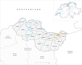
 Rümikon |
|
| Location of the municipality | |
  |
|
Rümikon ( Swiss German : ˈrʏmikχə ) is a municipality in the Swiss canton of Aargau . It belongs to the Zurzach district and is located on the Upper Rhine on the border with Germany .
geography
The village lies in the narrow strip of shore between the south bank of the Rhine and the north edge of the Table Jura . The Rhine initially flows in a south-westerly direction and after a narrow bend towards the west. The Tägerbach flows into the river at the western boundary of the municipality. The terrain rises evenly away from the river bank towards the hills. These form a continuous chain from the Ebni ( 486 m above sea level ) in the west via the Bruch ( 510 m above sea level ) in the southeast to the Rietbuck ( 455 m above sea level ) in the northeast.
The area of the municipality is 294 hectares , of which 127 hectares are forested and 26 hectares are built over. The highest point is at 510 meters on the Bruch, the lowest at 333 meters on the Rhine. Neighboring communities are Hohentengen in the north, Fisibach in the east, Wislikofen in the south and Mellikon in the west.
history
In the municipality of Rümikon, more precisely on the Tägerbach and in the Sandgraben, there were once two Roman watchtowers that, from 370 onwards, secured the northern border of the empire. The Romans finally withdrew as early as the first decade of the 5th century. The first control room was on a raised terrace on the eastern border of the municipality and is partially still in good condition; a second was at the mouth of the Tägerbach.
Rümiken was first mentioned in a document in 1113. The place name comes from the Old High German Rumaninghofun and means "at the courts of the Ruman clan". The fishing played an important role in the lives of the villagers, as the agriculture on the narrow shoreline was not profitable enough. Already in the early 15th century the vischeren ze rümigkon (the fishermen of Rümikon) were explicitly mentioned. The confederates conquered Aargau in 1415 and replaced the Habsburgs as sovereigns and holders of blood jurisdiction . Rümikon now belonged to the office of Ehrendingen of the county of Baden , a common rule .

By skillful negotiation, the Rümiker were able to acquire the sole fishing rights in 1498. They were allowed to fish across the width of the Rhine and not, as is usually the case, only to the middle of the river. Even in the late 19th century, people said about the village: "Rümikon has all fishermen of his gender, except for a Meier, and he is a fisherman by trade." In March 1798 the French took Switzerland and proclaimed the Helvetic Republic . Rümikon was initially a municipality in the short-lived Canton of Baden , and since 1803 it has belonged to the Canton of Aargau.
The opening of the Winterthur – Koblenz railway by the Schweizerische Nordostbahn took place on August 1, 1876. However, Rümikon had to share the station with the neighboring municipality of Mellikon , so that it was located far outside between the two villages. In 1995, Rümikon received a train stop located directly at the village center, which replaced the old Mellikon-Rümikon station. The population has remained relatively stable for centuries, as the cramped topographical conditions meant that no major expansion was possible.
In 2000 Rümikon joined the administrative cooperation "Verwaltung2000", which handles the administrative tasks of seven communities in the neighborhood. The municipality has been involved in the “Rheintal +” project since 2014, which envisages the merger of several municipalities to form the Zurzach municipality . After the community assembly approved the merger on May 23, 2019 with 51 to 7 votes, the decision was confirmed on September 8, 2019 in a referendum with 77 to 16 votes. This means that the merger will take place on January 1, 2022 (but without Mellikon , which narrowly refused).
Attractions

coat of arms
The blazon of the municipal coat of arms reads: "In blue and white salmon between three (1,2) five-pointed white stars." The coat of arms was shown for the first time on the municipal seal from 1872. The salmon symbolizes fishing, which had been the economic basis of the village for centuries. The stars represent belonging to the canton of Aargau. By resolution of the local council on June 13, 2003, the number of beams was reduced from six to five.
population
The population developed as follows:
| year | 1850 | 1900 | 1930 | 1950 | 1960 | 1970 | 1980 | 1990 | 2000 | 2010 |
| Residents | 269 | 199 | 197 | 193 | 192 | 186 | 163 | 199 | 227 | 242 |
On December 31, 2019, 339 people lived in Rümikon, the proportion of foreigners was 34.5%. In the 2015 census, 26.8% described themselves as Reformed and 24.7% as Roman Catholic ; 48.5% were non-denominational or of other faiths. In the 2000 census, 96.5% stated German as their main language.
Politics and law
The assembly of those entitled to vote, the municipal assembly , exercises legislative power. The executing authority is the five-member municipal council . He is elected by the people in the majority procedure, his term of office is four years. The parish council leads and represents the parish. To this end, it implements the resolutions of the municipal assembly and the tasks assigned to it by the canton. The Zurzach District Court is the first instance responsible for legal disputes . Rümikon belongs to the XVII (Zurzach) judges' circle.
economy
According to the corporate structure statistics (STATENT) collected in 2015, there are around 60 jobs in Rümikon, 16% of them in agriculture, 16% in industry and 68% in the service sector. Numerous workers are commuters and work in Bad Zurzach and the surrounding area. Industry is concentrated at the former train station, producing household and bathroom items, plastic wardrobes and butcher's machines, among other things.
traffic
The Hauptstrasse 7 between Basel and Winterthur extending north of the village directly along the Rhine river, so that the town center is not directly affected by the passing traffic. At the western boundary of the municipality, the canton road 431 branches off to Schneisingen . The connection to the public transport network is via a stop on the SBB line Koblenz – Bülach – Winterthur and a post bus line between Kaiserstuhl and Baden train station .
education
The community no longer has a school. The kindergarten and primary school (1st and 2nd grade) can be attended in Wislikofen , the 3rd to 6th primary school grade in Rekingen and all upper levels ( Realschule , Secondary School and District School ) in Bad Zurzach . The closest grammar schools are the Baden Cantonal School and the Wettingen Cantonal School .
Personalities
- André Jaeger (* 1947), cook and entrepreneur
Web links
- Official website of the municipality of Rümikon
- Administration2000 (administrative cooperation)
- Christoph Herzig: Rümikon. In: Historical Lexicon of Switzerland .
Individual evidence
- ↑ Cantonal population statistics 2019. Department of Finance and Resources, Statistics Aargau, March 30, 2020, accessed on April 2, 2019 .
- ↑ Cantonal population statistics 2019. Department of Finance and Resources, Statistics Aargau, March 30, 2020, accessed on April 2, 2019 .
- ↑ a b Beat Zehnder: The community names of the canton of Aargau . In: Historical Society of the Canton of Aargau (Ed.): Argovia . tape 100 . Verlag Sauerländer, Aarau 1991, ISBN 3-7941-3122-3 , p. 365-367 .
- ^ National map of Switzerland, sheet 1050, Swisstopo
- ↑ Standard area statistics - municipalities according to 4 main areas. Federal Statistical Office , November 26, 2018, accessed on June 17, 2019 .
- ^ Martin Hartmann, Hans Weber: The Romans in Aargau . Verlag Sauerländer, Aarau 1985, ISBN 3-7941-2539-8 , p. 196 .
- ↑ About us. Verwaltung2000, accessed June 17, 2019 .
- ^ Philipp Zimmermann, Andreas Fretz, David Rutschmann: Grossfusion im Zurzibiet: 9 municipalities say yes to «Zurzach» - Fisibach refuses to join. Aargauer Zeitung , May 24, 2019, accessed on June 17, 2019 .
- ↑ Pirmin Kramer, Daniel Weissenbrunnen: Zurzibieter large merger is perfect! Eight municipalities say yes, only Mellikon refuses. Aargauer Zeitung , September 8, 2019, accessed on September 10, 2019 .
- ^ Joseph Galliker, Marcel Giger: Municipal coat of arms of the Canton of Aargau . Lehrmittelverlag des Kantons Aargau, book 2004, ISBN 3-906738-07-8 , p. 260 .
- ↑ Register of coats of arms municipalities Aargau. (PDF) Aargau State Archives , August 15, 2006, accessed on January 25, 2010 .
- ↑ Population development in the municipalities of the Canton of Aargau since 1850. (Excel) In: Eidg. Volkszählung 2000. Statistics Aargau, 2001, archived from the original on October 8, 2018 ; accessed on June 17, 2019 .
- ↑ Resident population by religious affiliation, 2015. (Excel) In: Population and Households, Community Tables 2015. Statistics Aargau, accessed on June 17, 2019 .
- ↑ Swiss Federal Census 2000: Economic resident population by main language as well as by districts and municipalities. (Excel) Statistics Aargau, archived from the original on August 12, 2018 ; accessed on June 17, 2019 .
- ↑ circles of justice of the peace. Canton of Aargau, accessed on June 17, 2019 .
- ↑ Statistics of the corporate structure (STATENT). (Excel, 157 kB) Statistics Aargau, 2016, accessed on June 17, 2019 .
Bad Zurzach | Baldingen | Böbikon | Böttstein | Döttingen | Endingen | Fisibach | Full-Reuenthal | Kaiserstuhl | Klingnau | Koblenz | Leibstadt | Lengnau | Leuggern | Mellikon | Rekingen | Rietheim | Rümikon | Schneisingen | Siglistorf | Tegerfelden | Wislikofen
Former municipality: Mellstorf | Oberleibstadt | Unterendingen | Unterleibstadt
Canton of Aargau | Districts of the Canton of Aargau | Municipalities in the Canton of Aargau