
Baldingen AG
| AG is the abbreviation for the canton of Aargau in Switzerland and is used to avoid confusion with other entries of the name Baldingen . |
| Baldingen | |
|---|---|
 |
|
| State : |
|
| Canton : |
|
| District : | Zurzach |
| BFS no. : | 4301 |
| Postal code : | 5333 |
| Coordinates : | 666 096 / 267580 |
| Height : | 520 m above sea level M. |
| Height range : | 392-585 m above sea level M. |
| Area : | 2.82 km² |
| Residents: | 267 (December 31, 2019) |
| Population density : | 95 inhabitants per km² |
|
Proportion of foreigners : (residents without citizenship ) |
11.6% (December 31, 2019) |
| Website: | www.baldingen.ch |
 View of Unterbaldingen |
|
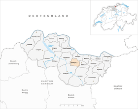
| Location of the municipality | |
  |
|
Baldingen (in local dialect : [ ˈb̥ɑldig̊ə ]) is a municipality in the Swiss canton of Aargau . It belongs to the Zurzach district and is just under two kilometers south of the border with Germany .
geography
The community consists of two districts: Oberbaldingen ( 558 m above sea level ) is located on the summit of the Spornegg, a semicircular hill in the Tabular Jura . Unterbaldingen ( 479 m above sea level ) is further down on the eastern slope of the hill. The development of both districts has only grown together for a few decades. The extensive, partly forested Güllenhau plateau extends south of the Spornegg. This drops steeply in the southwest into the valley of the Schlierenbach. The Chrüzlibach gorge, which is up to 80 meters deep and flows into the Upper Rhine near Rekingen, extends east of Unterbaldingen .
The area of the municipality is 282 hectares , of which 87 hectares are forested and 32 hectares are built over. The highest point is at 575 meters on the Güllenhau plateau, the lowest at 400 meters in the Chrüzlibach gorge. Neighboring communities are Rekingen in the north, Böbikon in the east, Lengnau in the southeast, Endingen in the south and Tegerfelden in the west.
history

Baldingen was first reliably mentioned in a document in 1317 ( Heini von Baldingen ); older evidence for the name probably all refer to other places. It is a derivation with the suffix -ing - (un), which was common in early medieval Alemanni settlements, and means 'among the people of Baldo'. Baldingen was the seat of a local ministerial family , but no traces of their small castle have been preserved. The Habsburgs exercised blood jurisdiction .
The Swiss conquered Aargau in 1415 and Baldingen now belonged to the Ehrendingen office in the county of Baden , a common rule . The rule of law was in the hands of several changing private fiefdoms. In March 1798 the French took Switzerland and proclaimed the Helvetic Republic . Baldingen was initially a municipality in the short-lived canton of Baden , since 1803 it has belonged to the canton of Aargau.
In the second half of the 19th century, Baldingen showed the greatest decline in population of all Aargau communities. Almost half of the residents left their homeland, and quite a few emigrated overseas. Baldingen was part of the Zurzach parish until 1883 and has since formed its own parish together with Böbikon . After a long period of stagnation and another marked decline in the 1970s, the population is rising again.
In 2000 Baldingen joined the administrative cooperation “Verwaltung2000”, which handles the administrative tasks of seven communities in the neighborhood. The municipality has been involved in the “Rheintal +” project since 2014, which envisages the merger of nine municipalities to form the municipality of Zurzach . After the municipal assembly approved the merger on May 23, 2019 with 56 to 17 votes, the decision was confirmed in a referendum on September 8, 2019 with 86 to 38 votes. This means that the merger will take place on January 1, 2022 (but without Mellikon , which narrowly refused).
Attractions

The Catholic parish church of St. Agatha, built in 1898, is located in Unterbaldingen. It is built in the neo-Gothic style and has some Art Nouveau elements. The church was built according to the plans of the architect Karl Moser , the builder of the Zürcher Kunsthaus and the Pauluskirche Basel .
coat of arms
The blazon of the municipal coat of arms reads: "In blue three yellow linden leaves with a yellow stem and branch." The coat of arms, which has been in use since 1953, goes back to the family coat of arms of Franz Zweyer von Evenbach . In Klingnau he had been the bailiff of the Bishop of Constance and had settled in Baldingen in 1667, where he had a small castle built.
population
The population developed as follows:
| year | 1799 | 1850 | 1900 | 1930 | 1950 | 1960 | 1970 | 1980 | 1990 | 2000 | 2010 |
| Residents | 236 | 336 | 183 | 193 | 182 | 185 | 175 | 144 | 212 | 249 | 291 |
On December 31, 2019, 267 people lived in Baldingen, the proportion of foreigners was 11.6%. In the 2015 census, 42.8% described themselves as Roman Catholic and 26.6% as Reformed ; 30.6% were non-denominational or of other faiths. 98.0% said German as their main language in the 2000 census .
Politics and law
The assembly of those entitled to vote, the municipal assembly , exercises legislative power. The executing authority is the five-member municipal council . He is elected by the people in the majority procedure, his term of office is four years. The parish council leads and represents the parish. To this end, it implements the resolutions of the municipal assembly and the tasks assigned to it by the canton. The Zurzach District Court is the first instance responsible for legal disputes . Baldingen belongs to the XVII (Zurzach) judges' circle.
economy
According to the company structure statistics (STATENT) collected in 2015, Baldingen has around 50 jobs, 51% of which are in agriculture, 9% in industry and 40% in the service sector. Most of the gainfully employed are commuters and work in Bad Zurzach and the surrounding area, some also in the Baden region .
traffic
The village is away from the through traffic on Kantonsstrasse 432/433, but Hauptstrasse 7 between Basel and Winterthur is only two kilometers away. A narrow side street leads to Lengnau in the Surbtal . A post bus line connects Bad Zurzach train station with Baldingen and Böbikon .
education
The community no longer has a school. The kindergarten and primary school can be attended in neighboring Rekingen , all upper levels ( Realschule , secondary school and district school ) in Bad Zurzach . The closest grammar schools are the Baden Cantonal School and the Wettingen Cantonal School .
Personalities
- Julius Binder (* 1925), National and Council of States
Web links
- Official website of the Baldingen community
- Administration2000 (administrative cooperation)
- Andreas Steigmeier : Baldingen. In: Historical Lexicon of Switzerland .
Individual evidence
- ↑ Cantonal population statistics 2019. Department of Finance and Resources, Statistics Aargau, March 30, 2020, accessed on April 2, 2019 .
- ↑ Cantonal population statistics 2019. Department of Finance and Resources, Statistics Aargau, March 30, 2020, accessed on April 2, 2019 .
- ↑ a b Beat Zehnder: The community names of the canton of Aargau . Historical sources and linguistic interpretations. In: Historical Society of the Canton of Aargau (Ed.): Argovia . Annual journal of the Historical Society of the Canton of Aargau. tape 100 / II . Verlag Sauerländer, Aarau 1991, ISBN 3-7941-3122-3 , p. 72 . The given phonetic transcription: báldigə .
- ↑ Standard area statistics - municipalities according to 4 main areas. Federal Statistical Office , November 26, 2018, accessed on June 17, 2019 .
- ↑ About us. Verwaltung2000, accessed June 17, 2019 .
- ^ Philipp Zimmermann, Andreas Fretz, David Rutschmann: Grossfusion im Zurzibiet: 9 municipalities say yes to «Zurzach» - Fisibach refuses to join. Aargauer Zeitung , May 24, 2019, accessed on June 17, 2019 .
- ↑ Pirmin Kramer, Daniel Weissenbrunnen: Zurzibieter large merger is perfect! Eight municipalities say yes, only Mellikon refuses. Aargauer Zeitung , September 8, 2019, accessed on September 10, 2019 .
- ^ Joseph Galliker, Marcel Giger: Municipal coat of arms of the Canton of Aargau . Lehrmittelverlag des Kantons Aargau, book 2004, ISBN 3-906738-07-8 , p. 110 .
- ↑ Population development in the municipalities of the Canton of Aargau since 1850. (Excel) In: Eidg. Volkszählung 2000. Statistics Aargau, 2001, archived from the original on October 8, 2018 ; accessed on June 17, 2019 .
- ↑ Resident population by religious affiliation, 2015. (Excel) In: Population and Households, Community Tables 2015. Statistics Aargau, accessed on June 17, 2019 .
- ↑ Swiss Federal Census 2000: Economic resident population by main language as well as by districts and municipalities. (Excel) Statistics Aargau, archived from the original on August 12, 2018 ; accessed on June 17, 2019 .
- ↑ circles of justice of the peace. Canton of Aargau, accessed on June 17, 2019 .
- ↑ Statistics of the corporate structure (STATENT). (Excel, 157 kB) Statistics Aargau, 2016, accessed on June 17, 2019 .
Bad Zurzach | Baldingen | Böbikon | Böttstein | Döttingen | Endingen | Fisibach | Full-Reuenthal | Kaiserstuhl | Klingnau | Koblenz | Leibstadt | Lengnau | Leuggern | Mellikon | Rekingen | Rietheim | Rümikon | Schneisingen | Siglistorf | Tegerfelden | Wislikofen
Former municipality: Mellstorf | Oberleibstadt | Unterendingen | Unterleibstadt
Canton of Aargau | Districts of the Canton of Aargau | Municipalities in the Canton of Aargau