Mülligen AG
| AG is the abbreviation for the canton of Aargau in Switzerland and is used to avoid confusion with other entries of the name Mülligen . |
| Garbage | |
|---|---|
| State : |
|
| Canton : |
|
| District : | Brugg |
| BFS no. : | 4107 |
| Postal code : | 5243 |
| Coordinates : | 660 382 / 256647 |
| Height : | 362 m above sea level M. |
| Height range : | 335–500 m above sea level M. |
| Area : | 3.16 km² |
| Residents: | 1083 (December 31, 2019) |
| Population density : | 343 inhabitants per km² |
|
Proportion of foreigners : (residents without citizenship ) |
17.6% (December 31, 2019) |
| Website: | www.muelligen.ch |
|
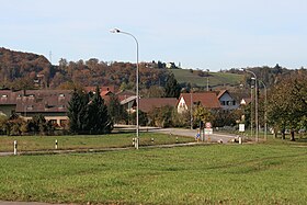
Southern entrance to Mülligen |
|
| Location of the municipality | |
Mülligen ( Swiss German : ˈmʏlɪgə ) is a municipality in the Swiss canton of Aargau . It belongs to the Brugg district and is located around three kilometers southeast of the district capital in the lower Reuss valley .
geography
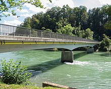
The village is located in the northeastern part of the flat and fertile Birrfeld on a gravel terrace, south of the Reuss . Immediately on the river bank, the terrain drops steeply, as the river has dug itself into a 40 meter deep gorge here over the millennia. The Reuss forms the municipality boundary in the north and east. In the southwest the Eiteberg rises ( 500 m above sea level ), on the south side of which lies the hamlet of Trotte ( 392 m above sea level ). A gravel pit characterizes the area south of the village.
The area of the municipality is 316 hectares , of which 103 hectares are forested and 100 hectares are built over. The highest point is the summit of the Eiteberg at 500 meters, the lowest is at 335 meters on the Reuss. Neighboring communities are Birmenstorf in the north and east, Birrhard in the south, Lupfig and Hausen in the west and Windisch in the north-west.
history
The oldest settlement witnesses are two groups of early medieval graves. The first written mention of Mulinon comes from the year 1273. The place name comes from the Old High German (ze) mulinon and means "at the mills". In the Middle Ages , the village belonged to Eigenamt , the oldest possession of the Habsburgs in Aargau, whose headquarters are only a few kilometers away on the Wülpelsberg. The Lords of Mülinen , a ministerial family , owned a small castle, the remains of which were completely removed by a quarry in the 19th century. In 1308 the land and judicial rule was transferred to the Königsfelden monastery in Windisch, which was founded in the same year .
After the conquest of Aargau by the Confederates in 1415, the city of Bern took over the rule and the self-office was now part of the subject areas in the Bernese Aargau . In 1528 the Bernese introduced the Reformation and dissolved the Königsfelden monastery. They converted their own office to the Landvogtei Königsfelden and now exercised all rulership rights in this area. In 1688 a third of the population died of the plague . In March 1798 the French took Switzerland, ousted the «Gracious Lords» of Bern and proclaimed the Helvetic Republic . Since then, Mülligen has belonged to the canton of Aargau.
In addition to agriculture and viticulture, working from home for the textile industry found its way into the lives of the villagers after 1730 . In 1849 the first industrial enterprise was established, a gypsum mill. In 1885, thirteen houses were destroyed by fire. The mining of gravel began in 1924. The population stagnated until around 1960, and after 1900 agriculture was increasingly displaced by small businesses and service providers. After the opening of the A3 motorway , Mülligen was easily accessible for commuters and the number of residents has almost tripled since 1970.
Attractions
The name of the village probably comes from the mill that was built in the 11th century on the banks of the Reuss. This was in operation until 1914 and is now a listed building . Until the 19th century, the only restaurant in the village was located here. The "Hof" is a small manorial estate that was built in the second quarter of the 18th century on behalf of the Brugger mayor Hans Heinrich Fröhlich. The reform pedagogue Johann Heinrich Pestalozzi lived there from 1769 to 1771 , before he settled on the Neuhof in nearby Birr .
coat of arms
The blazon of the municipal coat of arms reads: "In yellow over a green three-mountain black mill wheel." Apart from the Dreiberg , the coat of arms of the municipality corresponds to that of the ministerial family of the Lords of Mülinen and has been in use since 1872.
population
The population developed as follows:
| year | 1764 | 1803 | 1850 | 1900 | 1930 | 1950 | 1960 | 1970 | 1980 | 1990 | 2000 | 2010 |
| Residents | 151 | 320 | 397 | 374 | 357 | 377 | 377 | 433 | 482 | 674 | 780 | 956 |
On December 31, 2019, 1,083 people lived in Mülligen, the proportion of foreigners was 17.6%. In the 2015 census, 34.0% described themselves as Reformed and 28.2% as Roman Catholic ; 37.8% were non-denominational or of another faith. 94.9% said German as their main language in the 2000 census , 1.3% French and 1.0% Italian .
Politics and law
The assembly of those entitled to vote, the municipal assembly , exercises legislative power. The executing authority is the five-member municipal council . He is elected by the people in the majority procedure, his term of office is four years. The parish council leads and represents the parish. To this end, it implements the resolutions of the municipal assembly and the tasks assigned to it by the canton. The Brugg District Court is the first instance responsible for legal disputes . Mülligen belongs to the Friedensrichterkreis VIII (Brugg).
economy
According to the company structure statistics (STATENT) collected in 2015, Mülligen has around 260 jobs, 38% of them in agriculture, 16% in industry and 46% in the service sector. The most important employers are a LafargeHolcim gravel plant and Swissgenetics , a cattle insemination station . Most of the workers are commuters and work in Brugg , Baden or in the larger neighboring communities in Birrfeld.
traffic
The canton road 296 leads through the village from Brugg to Mellingen . From this branch road over to Birmenstorf and Lupfig . The Birrfeld motorway triangle is located in the municipality, where the A3 meets the A1 . The next motorway junction is just under two kilometers northwest between Lupfig and Hausen . The connection to the public transport network is via a post bus line between the Brugg train station and Mellingen. On weekends there is a night bus from Brugg via Windisch and Birr to Mülligen.
education
In Mülligen there is a kindergarten and a school house where the primary school is taught. All upper levels ( Realschule , Secondary School and District School ) can be attended in Windisch . The closest grammar schools are the Baden Cantonal School and the Wettingen Cantonal School .
Personalities
- Samuel Schwarz (1814–1868), Government, National and Council of States
literature
- Felix Müller: Mülligen. In: Historical Lexicon of Switzerland .
- Michael Stettler , Emil Maurer : The art monuments of the canton of Aargau . In: Society for Swiss Art History (Ed.): Art Monuments of Switzerland . Volume II: The districts of Lenzburg and Brugg. Birkhäuser Verlag, Basel 1953, DNB 750561750 .
Web links
Individual evidence
- ↑ Cantonal population statistics 2019. Department of Finance and Resources, Statistics Aargau, March 30, 2020, accessed on April 2, 2019 .
- ↑ Cantonal population statistics 2019. Department of Finance and Resources, Statistics Aargau, March 30, 2020, accessed on April 2, 2019 .
- ↑ a b Beat Zehnder: The community names of the canton of Aargau . In: Historical Society of the Canton of Aargau (Ed.): Argovia . tape 100 . Verlag Sauerländer, Aarau 1991, ISBN 3-7941-3122-3 , p. 286-287 .
- ^ National map of Switzerland, sheet 1070, Swisstopo.
- ↑ Standard area statistics - municipalities according to 4 main areas. Federal Statistical Office , November 26, 2018, accessed on June 11, 2019 .
- ^ Joseph Galliker, Marcel Giger: Municipal coat of arms of the Canton of Aargau . Lehrmittelverlag des Kantons Aargau, book 2004, ISBN 3-906738-07-8 , p. 221 .
- ↑ Population development in the municipalities of the Canton of Aargau since 1850. (Excel) In: Eidg. Volkszählung 2000. Statistics Aargau, 2001, archived from the original on October 8, 2018 ; accessed on June 11, 2019 .
- ↑ Resident population by religious affiliation, 2015. (Excel) In: Population and Households, Community Tables 2015. Statistics Aargau, accessed on June 11, 2019 .
- ↑ Swiss Federal Census 2000: Economic resident population by main language as well as by districts and municipalities. (Excel) Statistics Aargau, archived from the original on August 10, 2018 ; accessed on June 11, 2019 .
- ↑ circles of justice of the peace. Canton of Aargau, accessed on June 18, 2019 .
- ↑ Statistics of the corporate structure (STATENT). (Excel, 157 kB) Statistics Aargau, 2016, accessed on June 11, 2019 .
- ↑ Swissgenetics - insemination station for cattle


