
Birmenstorf
| Birmenstorf | |
|---|---|
 |
|
| State : |
|
| Canton : |
|
| District : | to bathe |
| BFS no. : | 4024 |
| Postal code : | 5413 |
| UN / LOCODE : | CH BMO |
| Coordinates : | 661 057 / 257 077 |
| Height : | 386 m above sea level M. |
| Height range : | 332-573 m above sea level M. |
| Area : | 7.80 km² |
| Residents: | 2986 (December 31, 2019) |
| Population density : | 383 inhabitants per km² |
|
Proportion of foreigners : (residents without citizenship ) |
19.9% (December 31, 2019) |
| Website: | www.b Firmenstorf.ch |
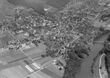
 View of the Catholic Church and the Widegass schoolhouse. |
|
| Location of the municipality | |
  |
|
Birmenstorf (in local dialect : Birmischtoorf, [ ˈb̥ɪ̞rmiʒ̊ˌtoːɾf ]) is a municipality in the Swiss canton of Aargau . It belongs to the Baden district and is located on the Reuss , around four kilometers west-southwest of Baden . It is not to be confused with the homophonic Birmensdorf in the canton of Zurich.
geography
The community lies on a gravel plain on the right side of the Reuss , a few kilometers from the confluence with the Aare . Through millennia of erosion, the Reuss has created a narrow gorge up to 30 meters deep. The Stettberg, the Bollrain and the Stutz protrude into the plain. These are smaller offshoots of the Gibstorfer Horn, which belongs to the Table Jura . The village center is located at the narrow narrow point between the Stutz and the Reuss.
The area of the municipality is 780 hectares , of which 285 hectares are forested and 128 hectares are built over. The highest point is on the Stutz at 573 meters, the lowest at 340 meters on the Reuss. Birmenstorf includes the hamlets of Müslen , Muntwil and Oberhard , as well as the farms in Ödhus and Hardwinkel and the Lindmühle . Neighboring communities are Gibstorf in the north, Baden in the east, Fislisbach and the Baden exclave Rütihof in the south-east, Mellingen and Wohlenschwil in the south, Birrhard in the south-west and Mülligen and Windisch in the west.
history

Traces of settlement can be traced back to the Neolithic Age . During Roman times, there were two manors here in the immediate vicinity of the Vindonissa legionary camp . The one in the Boll was inhabited in the 1st and 2nd centuries (mainly finds of brick stamps from the 11th and 21st Legion), the other in the Huggenbüel from the 2nd to the 4th century (mostly fragments of imported Terra Sigillata from Eastern Gaul).
The foundation stone for today's village was laid by Alemannic settlers in the 6th century. The village has been documented since the 12th century (1146 Birbovermesdorf ; around 1150 Pirpoumesdorf ; 12th / 13th century Birmomestorf ). The place name goes back to an Old High German composition piripoumes-thorf and means 'village near the pear tree'. In the 11th and 12th centuries, the sovereigns were the Counts of Lenzburg , from 1173 the Kyburgs and finally the Lords of Liebegg . On December 26, 1351, before the battle of Dättwil , the village was sacked by the people of Zurich. In 1363 Birmenstorf came into the possession of Queen Agnes of Hungary , who immediately awarded the new acquisition to the Königsfelden monastery in Windisch . In 1415 the Confederates conquered Aargau and Birmenstorf was now the capital of an office in the County of Baden , a common rule .
The introduction of the Reformation in 1528 had a major impact on the village. A third of the population had turned to the new denomination, which shaped village life well into the 20th century. The reformed city of Bern took over the rulership of the dissolved Königsfelden monastery and thus also the right of patronage for the Church of St. Leodegar , which often led to tensions with the Catholic majority of the population. Both denominations used the village church equally. In 1743 a fire destroyed 15 houses. In 1757, only a few years after the reconstruction, they burned down again. In March 1798 the French took Switzerland and proclaimed the Helvetic Republic . Birmenstorf was initially a municipality in the short-lived canton of Baden , since 1803 it has belonged to the canton of Aargau. There was another major fire, albeit in a different location, in 1843.
In the 18th century, Birmenstorf recorded a marked increase in population. Since there were no new employment opportunities, the villagers became impoverished. Many emigrated overseas and at the same time immigration was made more difficult. As a result, the population stagnated at around 900 throughout the 19th century. Only when the machine industry gained a foothold in the Baden region on the threshold of the 20th century did it begin to increase again slightly. In 1881 one of Switzerland's first long-distance telephone lines to Birmenstorf came about on a private initiative. In 1895, the brickworks was the first Birmenstorf company to be supplied with electricity from the spinning mill in Turgi via an overhead line . In 1911 the municipality's own electricity and water supply was established.
During the Second World War , troops were billeted repeatedly in Birmenstorf. Since the community was in the rear of the Limmat position , the army erected several defensive structures outside the settlement area. The community had to take in military internees twice . From March to July 1942, a Polish telegraph company with 86 soldiers and three officers was housed in the school building. For the around 50 Italian internees who were in Birmenstorf from December 1944 to July 1945, barracks were built on the forecourt of the former wallpaper factory. On the night of April 14th to 15th, 1943, a British Vickers-Wellington Mk X bomber , which had been involved in a bombing of Stuttgart , crashed on the road to Fislisbach . The five-man crew was able to parachute themselves in time and were interned. To commemorate the event, a memorial stone was erected at the crash site in 1993.
After the Second World War, the economic situation of the community improved, so that the first residential buildings were built outside of the traditional settlement structure. The first municipal building code dates from 1962, the municipality issued the first zoning plan in 1967 . In the same year, the regulation of goods for the agricultural perimeter and the building zone was decided after a partial regulation for the perimeter of the national road N1 had already been carried out in 1966 . After the opening of the autobahn in 1970, building activity began and the number of inhabitants rose by more than two thirds. Within a few years the community had to deal with numerous larger infrastructure projects, including several new buildings (multi-purpose building with kindergarten in 1972, sewage treatment plant in 1973, community center in 1981, multi-purpose hall in 1988, school in 1994).
The contrasts between the Catholic and the Reformed population remained visible well into the 20th century. The ratio of two thirds Catholics to one third Reformed was constant until the 1970s. Since then, the proportion of other faiths and the proportion of non-denominational people have increased. Although the members of both denominations lived side by side and used the same church until 1936, there were repeated tensions and, in some cases, targeted provocations. The denominational split also affected the club system: the first Birmenstorfer gymnastics club, founded in 1900, was anchored in the milieu of liberal freedom . In response to this, the Catholic village pastor set up a gymnastics section of the Catholic youth club in 1919. In the parish council and most other committees, the unwritten law applied that the first position was to be filled by a Catholic and the second position by a Reformed. The Catholics always formed the majority in the colleges. This rigid structure only dissolved in the last quarter of the 20th century.
Since the turn of the millennium there has been an increased tendency towards neighborly cooperation. In 2003, the association joined the community association “Kleinregionale Schiessanlage Mühlescheer”, which at the same time closed the shooting range at the Alte Trotte. In 2004 there was a merger across the district borders when the Birmenstorfer was merged with the Mülliger fire brigade. In 2011, Birmenstorf joined forces with several municipalities to form the Birretholz forestry operation, which also maintains the state forest in Mellingen and in Birretholz.
Attractions

Catholics and Protestants used the church of St. Leodegar equally until it was partially demolished in 1937. Only the choir remained, which was converted into today's cemetery chapel. It is also known as the "fresco chapel" because a high Gothic fresco cycle from 1440 came to light during the demolition work in the choir room . In 1935 the new Catholic church was built next to the old church , a year later the new reformed church followed on a vineyard on the western edge of the village .
The Catholics form an independent parish in the pastoral care association with the parish Gibstorf-Turgi, the Reformed (which formed their own parish until 1976) are now part of the Reformed parish Birmenstorf-Gibstorf-Turgi.
coat of arms
The blazon of the municipal coat of arms reads: "In green, yellow corn." The grain sheaf motif is derived from the coat of arms of the subordinate Daniel Zehnder, who used it on a seal from 1715, but accompanied by two five-pointed stars. His successor Johannes Zehnder left out the stars in 1756 and added a three-mountain instead . Until 1939 the shield color was not green but red. In 1953 the municipal council confirmed the method of representation used today.
population
The population developed as follows:
| year | 1620 | 1850 | 1900 | 1930 | 1950 | 1960 | 1970 | 1980 | 1990 | 2000 | 2010 |
| Residents | about 250 | 992 | 919 | 1069 | 1197 | 1330 | 1390 | 1446 | 1953 | 2313 | 2586 |
On December 31, 2019, 2986 people lived in Birmenstorf, the proportion of foreigners was 19.9%. In the 2015 census, 39.9% described themselves as Roman Catholic and 22.5% as Reformed ; 37.6% were non-denominational or of other faiths. In the 2000 census, 90.3% stated German as their main language, 2.0% Portuguese , 1.6% Albanian , 0.9% each Italian and English and 0.7% Serbo-Croatian .
Politics and law
The assembly of those entitled to vote, the municipal assembly , exercises legislative power. The executing authority is the five-member municipal council . He is elected by the people in the majority procedure, his term of office is four years. The parish council leads and represents the parish. To this end, it implements the resolutions of the municipal assembly and the tasks assigned to it by the canton. The Baden District Court is responsible for litigation in the first instance . Birmenstorf belongs to the judges' circle V (Mellingen).
economy

According to the company structure statistics (STATENT) collected in 2015, Birmenstorf has around 1,100 jobs, 11% of them in agriculture, 28% in industry and 71% in the service sector. In addition to a few industrial companies, there are numerous small and medium-sized commercial and service companies; the construction industry in particular is well represented. Many workers are commuters and work mainly in the agglomerations of Baden and Brugg .
Since the 20th century, large areas of gravel have been extracted in several pits. Today there are still a dozen farms in Birmenstorf. Vegetable growing has played an important role since the interwar period, so that today five companies grow vegetables on around 100 hectares, which are mainly sold through wholesalers. Viticulture has been practiced for more than 600 years . The 9.9 hectares of vineyards are now largely cared for by hobby winemakers who are part of the local wine cooperative, following the rules of organic farming . The main varieties are Blauburgunder (7.5 ha) and Riesling × Sylvaner (1.6 ha).
traffic
Birmenstorf is located on Kantonsstrasse 418, which leads from the Baden-West motorway junction near Dättwil to Brugg . In the center of the village, the canton road 420 branches off over the Reuss to Mülligen . The village is accessed by two bus routes. An RVBW line leads to Baden train station and on to Wettingen - Tägerhard . A Postbus line connects the Brugg station with Birmenstorf and the Mellingen Heitersberg station (connection to the Zurich S-Bahn ). On the weekends, a night bus runs from Baden via Gibstorf and Birmenstorf back to Baden.
education
The community has a kindergarten and two school houses in which primary school is taught. All upper levels ( Realschule , Secondary School and District School ) can be attended in Baden . The closest grammar schools are the Baden Cantonal School and the Wettingen Cantonal School .
Personalities
- Beda Humbel (1933–2019), politician
- Ruth Humbel Näf (* 1957), politician
- Reto Nause (* 1971), politician
- Johann Jakob Lips (1791–1833), engraver and draftsman
- David Zehnder (* 1952), sculptor and object artist
- Anna Iduna Zehnder (1877–1955), doctor, painter and anthroposophist
- Josef Zehnder (1810–1896), publisher, journalist, printer and politician
- Joseph Zimmermann (1923–1988), Roman Catholic Bishop of Morombe, Madagascar
literature
- Andreas Steigmeier : Birmenstorf (AG). In: Historical Lexicon of Switzerland .
- Max Rudolf: history of the community Birmenstorf . 2nd Edition. Sauerländer, Aarau 1991, OCLC 785528805 .
- Peter Hoegger: The art monuments of the canton of Aargau . Ed .: Society for Swiss Art History . Volume VII: District of Baden II. Birkhäuser Verlag, Basel 1995, ISBN 3-909164-44-7 , p. 12-26 .
- Patrick Zehnder, Stefan Michel, Patrick Schoeck-Ritschard, Corinne Rufli, Christine Seile : Birmenstorf in the 20th century: "Quite a der Rüüss, a me sunny Rai ..." here + now, Baden 2015, ISBN 978-3-85782- 805-8 .
Web links
Individual evidence
- ↑ Cantonal population statistics 2019. Department of Finance and Resources, Statistics Aargau, March 30, 2020, accessed on April 2, 2019 .
- ↑ Cantonal population statistics 2019. Department of Finance and Resources, Statistics Aargau, March 30, 2020, accessed on April 2, 2019 .
- ↑ a b Beat Zehnder: The community names of the canton of Aargau . Historical sources and linguistic interpretations. In: Historical Society of the Canton of Aargau (Ed.): Argovia . Annual journal of the Historical Society of the Canton of Aargau. tape 100 / II . Verlag Sauerländer, Aarau 1991, ISBN 3-7941-3122-3 , p. 88 ff . The phonetic transcription used : bí͈rmištọ̄́rf .
- ↑ a b Gabrielle Schmid: Birmenstorf AG (Baden) In: Dictionnaire toponymique des communes suisses - Lexicon of Swiss community names - Dizionario toponomastico dei comuni svizzeri (DTS | LSG). Center de dialectologie, Université de Neuchâtel, Verlag Huber, Frauenfeld / Stuttgart / Vienna 2005, ISBN 3-7193-1308-5 and Éditions Payot, Lausanne 2005, ISBN 2-601-03336-3 , p. 159. The phonetic transcription given: [ ˈBɪrmiˌʃtoːrf ].
- ^ National map of Switzerland, sheet 1070, Swisstopo.
- ↑ Standard area statistics - municipalities according to 4 main areas. Federal Statistical Office , November 26, 2018, accessed on June 3, 2019 .
- ^ Martin Hartmann, Hans Weber: The Romans in Aargau . Verlag Sauerländer, Aarau 1985, ISBN 3-7941-2539-8 , p. 165 .
- ↑ Max Rudolf: Memories of the Second World War 1939–1945 . In: Reports on local history . tape 2 . Birmenstorf 1993, p. 7-54 .
- ↑ Patrick Zehnder: Liquid manure against a censer. Physical and symbolic occupation of space in Birmenstorf (AG) 1900–1950 . In: Swiss journal for religious and cultural history . No. 109 , 2015, p. 329-344 .
- ^ Patrick Zehnder: At the denominational seam: a microanalysis of denominational gymnastics clubs in Birmenstorf . In: Swiss journal for religious and cultural history . No. 99 , 2005, pp. 335-347 .
- ↑ Patrick Zehnder: The three churches of Birmenstorf . In: Society for Swiss Art History (Ed.): Swiss Art Guides . tape 81 , no. 805 . Bern 2007, ISBN 978-3-85782-805-8 .
- ^ Joseph Galliker, Marcel Giger: Municipal coat of arms of the Canton of Aargau . Lehrmittelverlag des Kantons Aargau, book 2004, ISBN 3-906738-07-8 , p. 120 .
- ↑ Population development in the municipalities of the Canton of Aargau since 1850. (Excel) In: Eidg. Volkszählung 2000. Statistics Aargau, 2001, archived from the original on October 8, 2018 ; accessed on June 3, 2019 .
- ↑ Resident population by religious affiliation, 2015. (Excel) In: Population and Households, Community Tables 2015. Statistics Aargau, accessed on June 3, 2019 .
- ↑ Swiss Federal Census 2000: Economic resident population by main language as well as by districts and municipalities. (Excel) Statistics Aargau, archived from the original on August 10, 2018 ; accessed on June 3, 2019 .
- ↑ circles of justice of the peace. Canton of Aargau, accessed on June 18, 2019 .
- ↑ Statistics of the corporate structure (STATENT). (Excel, 157 kB) Statistics Aargau, 2016, accessed on June 3, 2019 .
- ↑ Birmenstorf wine cooperative
- ↑ Grape harvest control 2018 Canton Aargau. (PDF, 2.4 MB) Agricultural Center Liebegg, 2019, accessed on June 18, 2019 .
- ↑ David Zehnder on sikart.ch
Bathing | Bellikon | Bergdietikon | Birmenstorf | Things of honor | Ennetbaden | Fislisbach | Freienwil | Gibstorf | Killwangen | Künten | Mellingen | Mägenwil | Neuenhof | Niederrohrdorf | Oberrohrdorf | Obersiggenthal | Remetschwil | Spreitenbach | Stetten | Turgi | Untersiggenthal | Wettingen | Wohlenschwil | Würenlingen | Würenlos
Former municipalities: Büblikon | Dättwil | Kempfhof | Oberehrendingen | Oetlikon | Rohrdorf | Unterehrendingen
Canton of Aargau | Districts of the Canton of Aargau | Municipalities in the Canton of Aargau