
Niederrohrdorf
| Niederrohrdorf | |
|---|---|
 |
|
| State : |
|
| Canton : |
|
| District : | to bathe |
| BFS no. : | 4035 |
| Postal code : | 5443 |
| Coordinates : | 665 361 / 252879 |
| Height : | 435 m above sea level M. |
| Height range : | 375-529 m above sea level M. |
| Area : | 3.33 km² |
| Residents: | 4135 (December 31, 2019) |
| Population density : | 1242 inhabitants per km² |
|
Proportion of foreigners : (residents without citizenship ) |
18.6% (December 31, 2019) |
| Website: | www.niederrohrdorf.ch |
 View of Nieder- and Oberrohrdorf |
|
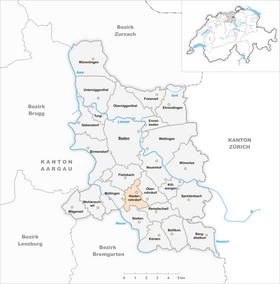
| Location of the municipality | |
  |
|
Niederrohrdorf (in local Swiss German : "Nederrohrdorf" , ˈnɪdərˌroːdləf ) is a municipality in the Swiss canton of Aargau . It belongs to the Baden district and is located on the edge of the Reuss Valley , between the district capital of Baden and Bremgarten .
geography
Niederrohrdorf is three kilometers from the Reuss at the foot of the south-west facing slope of the Rohrdorferberg. This 702-meter survey forms part of the Heitersberg -Hügelkette that the Reuss River Valley from further east Limmattal separates. The valley floor, on the edge of which the village center is located, consists of low terrace gravel that was deposited by the Reuss glacier during the Würm glacial period . Several lateral moraines with a height difference of up to 50 meters cross the plain. Of these, the Hiltiberg in the north is the most striking (the municipality boundary runs along its southern foot). In addition, there are smaller outcrops of several million years old Nagelfluh rock . The spaces between the moraines are partially filled with alluvial clay, which led to the formation of several wetlands .

The development of the village has completely merged with that of the higher-lying neighboring municipality of Oberrohrdorf . Separated by a flat, wooded moraine, is about one and a half kilometers southwest of the center of the hamlet of Holzrüti. The hamlet of Vogelrüti is about a kilometer south of the center, separated by a moraine protruding into the plain. In contrast to Niederrohrdorf, these two districts are still rural in character.
The area of the municipality is 333 hectares , of which 99 hectares are covered with forest and 93 hectares are built over. The highest point is at 530 meters in the Rotrisch area, two kilometers north of the village center, and the lowest at 375 meters at Holzrüti. Neighboring communities are Fislisbach in the north, Oberrohrdorf in the east, Remetschwil in the southeast, Stetten in the south and Mellingen in the west.
Between Niederrohrdorf, Stetten and Mellingen there is a forest area with various marshlands (peat moss, taumoos and Egelmoos) which are partially declared as nature reserves. The Taumoos is a raised bog of national importance. The Egelmoos is maintained by the Pro Natura organization .
history
Archaeological finds from prehistoric times are relatively rare on the Rohrdorferberg; the oldest date back to the late Neolithic . From various finds in neighboring communities, however, it can be concluded that the area could have been inhabited during the early Mesolithic around 11,500 years ago. In 1951, the remains of a grave from the Latène period were discovered at the foot of the Hiltiberg ; a burial field is suspected in this area. During the Roman era , a road possibly led from Dättwil over the southwest slope of the Rohrdorferberg to Lunnern near Obfelden . According to place names , Niederrohrdorf was probably settled by the Alamanni between the 6th and 8th centuries , while Holzrüti and Vogelrüti date back to clearing in the 11th and 12th centuries.
Rordorf is said to have been mentioned for the first time around 1040 in the Liber Heremi of the Einsiedeln monastery ; however, only a copy of this document from the 15th century has survived. The oldest surviving original document with the name of the place, an umbrella letter of the Muri monastery issued by Pope Hadrian IV , is dated March 11, 1159. The settlement of Nidern Rordorf is mentioned explicitly for the first time in 1275 . The place name comes from the Old High German Rorthorf and means "reed village".
In the 11th and early 12th centuries, the barons of Sellenbüren presumably ruled the Rohrdorferberg. The area later came under the control of the Habsburgs , who also had considerable property here and, after 1259, took over the patronage rights of the Rohrdorf Church from the Murbach Monastery . The Habsburgs secured sovereignty for themselves in 1273 after the rival family of the Counts of Kyburg had died out. Ministeriale took on administrative tasks on their behalf, initially the lords of Rüssegg, from 1344 the lords of Hünenberg. In the first half of the 14th century the office of Rohrdorf was formed, which largely coincided with the area of the parish. The monasteries of Muri , Wettingen and Gnadenthal were important landowners . In 1413 Duke Friedrich IV sold the Rohrdorf church set to the Agness Hospital in Baden .
In April and May 1415, the Swiss conquered Aargau with the office of Rohrdorf from the Habsburgs. Niederrohrdorf was now part of the county of Baden , a common rule . The federal provincial bailiff , who changes every two years and resides in Baden, exercised sovereignty and blood jurisdiction . In Holzrüti and Vogelrüti it was also in the possession of the lower jurisdiction , while in Oberrohrdorf the Gnadenthal Monastery held this task. The opening , which regulated the relationship between the court lord and the village population, dates back to 1462 and has been preserved in a copy from 1567. Under the leadership of Pastor Heinrich Buchmann, the brother of Theodor Bibliander , the Rohrdorf parish converted to the Reformation in 1529 . Two years later, after the Reformed towns were defeated in the Second Kappel War , the population had to reassume the Catholic denomination. Towards the end of the Peasant War of 1653, the Rohrdorferberg was the deployment area of the Zurich troops on the way to the decisive battle near Wohlenschwil . During the Second Villmerger War of 1712, the Catholic Central Swiss towns occupied the range of hills between the Reuss and Limmat valleys on May 12th. There were repeated raids; Among other things, residents of the Rohrdorferberg attacked the mill in Spreitenbach . Around 5,000 people from Zurich advanced over the Heitersberg towards Mellingen on May 21 , and Niederrohrdorf was heavily looted by the troops.
The old system of rule collapsed in 1798 with the French invasion and the proclamation of the Helvetic Republic . Several residents of the Rohrdorferberg offered resistance against the new revolutionary order, but the French troops defeated it in the battle near Hägglingen . In the new unified state, Niederrohrdorf was a municipality in the Baden district of the short-lived Canton of Baden . In addition to the hamlets of Holzrüti and Vogelrüti, the municipality also included the village of Staretschwil . With the mediation constitution of 1803, the new canton of Aargau came into being. Holzrüti demanded the formation of an independent municipality in 1804, which the cantonal government rejected. In 1805 Busslingen, Niederrohrdorf, Oberrohrdorf, Remetschwil and Staretschwil united to form the municipality of Rohrdorf , with the five parts of the municipality each having a representative on the municipal council. How this merger came about is unclear, as the sources do not describe the process in detail. The driving forces were District Administrator Johann Ludwig Baldinger and Justice of the Peace Johann Vogler, who presumably had made some decisions arrogantly and disregarded the democratic right of co-determination.

The Rohrdorf community was structurally weak. Life was almost exclusively geared towards agriculture, with the few businesses serving local needs. From 1807 peat was extracted in the peat moss near Vogeltrüti in order to protect the forest. The replacement of the feudal burden dragged on for decades. Due to poverty and famine, waves of emigration occurred after 1816 (“ year without a summer ”) and again in the 1840s. There were repeated efforts by the partly autonomous village communities to separate the large community again, because the cooperation in organizational and financial matters did not work smoothly. The cantonal government rejected such requests in 1813, 1816, 1832, 1842, 1850 and 1853. All of the requests came from Remetschwil, while Staretschwil and Busslingen mostly did not support them. Finally, the Grand Council asked the government to carry out the separation. In 1854 Rohrdorf was separated into the three communities Niederrohrdorf, Oberrohrdorf (with Staretschwil) and Remetschwil.
From the middle of the 19th century, the economy gradually diversified. Businesses began to settle there that produced beyond the purely local market. It all started in 1849 with the Castor Egloff metal workshop, one of the oldest metalworking companies in Aargau. Over the decades, the company has continuously transformed into a modern industrial company that has become the most important employer in the region, today's Egro AG. The mechanization of agriculture made it necessary to amalgamate the many small plots in order to be able to manage them more efficiently. The regulation of goods required for this was a long time coming, however, and initially only affected the hamlet of Holzrüti ( carried out together with Stetten ). The rest of the municipality followed in 1941, when the area under cultivation had to be increased anyway due to the Wahlen plan .
Niederrohrdorf had only a few fresh water sources, which is why the water supply was predominantly made with sod wells . From 1908 water pipes were laid, but even in later years the houses located higher often remained without water. This situation improved significantly in 1963 with a groundwater well in the Bodenmatt. In 1911 Niederrohrdorf was connected to the power grid, followed four years later by Holzrüti and Vogelrüti. At the beginning of the Second World War , the Swiss Army expanded the position of the Limmat , which also included a complex system of fortifications on the Heitersberg range of hills; An artillery position was created in the Eiermatt near Niederrohrdorf. With the Réduit strategy , the Limmat position lost its importance in the summer of 1940 and the troops billeted in the village were withdrawn. From June 1941 a unit of interned Polish soldiers was housed in two barracks in Niederrohrdorf .
In the mid-1950s, there was a lot of construction activity in the centers of Baden and Zurich due to the pressure of settlement . The population increase was particularly strong in the 1960s, when the population increased by almost 40%. Multi-family houses on the plain and extensive terraced settlements on the hillside replaced the rural, rural village structure in just a few years. In 1964 a zoning plan was passed in order not to let the unchecked building activity get out of hand. The built-up area grew together with that of Oberrohrdorf and Staretschwil. In 1964 the reformed church was opened, in 1972 the catholic church center Gut Hirt (as a supplement to the parish church of St. Martin in Oberrohrdorf). After a phase of stagnation from the mid-1970s, there has been a marked increase in population since the beginning of the 21st century. In 2005 there were considerations to aim for a merger with the neighboring municipality of Oberrohrdorf, which should have taken place in 2010. While the Niederrohrdorf community assembly approved a corresponding planning loan, this was rejected in Oberrohrdorf.
Attractions
coat of arms
The blazon of the municipal coat of arms reads: "In red on a green hill, a white lamb, in the right foreleg holding a white-red cross flag on a yellow pole." In 1856 the community had a seal made. It showed a fir tree on a hill, in front of it a lamb swept to the right (heraldic left). A similar coat of arms was already depicted on a boundary stone from 1694, but with a crosier instead of a fir tree. The shape used today was introduced in 1948. The lamb depicted is not an Agnus Dei , see also: «Agnus Dei» coat of arms gallery - the subtle difference .
population
The population developed as follows:
| year | 1780 | 1803 | 1900 | 1930 | 1950 | 1960 | 1970 | 1980 | 1990 | 2000 | 2010 |
| Residents | 255 | 396 | 631 | 895 | 1074 | 1469 | 2032 | 2424 | 2536 | 2443 | 3466 |
On December 31, 2019, 4,135 people lived in Niederrohrdorf, the proportion of foreigners was 18.6%. In the 2015 census, 41.2% described themselves as Roman Catholic and 22.3% as Reformed ; 36.5% were non-denominational or of other faiths. In the 2000 census, 89.1% stated German as their main language, 2.5% Italian , 1.2% each Albanian and Turkish and 1.1% each Portuguese and Serbo-Croatian .
Politics and law

The assembly of those entitled to vote, the municipal assembly , exercises legislative power. The executing authority is the five-member municipal council . He is elected by the people in the majority procedure, his term of office is four years. The parish council leads and represents the parish. To this end, it implements the resolutions of the municipal assembly and the tasks assigned to it by the canton. The Baden District Court is responsible for litigation in the first instance . Niederrohrdorf belongs to the judges' circle V (Mellingen).
economy
According to the company structure statistics (STATENT) collected in 2015, there are around 770 jobs in Niederrohrdorf, of which 2% are in agriculture, 24% in industry and 74% in the service sector. By far the largest employer is Egro AG, which emerged from a metal workshop founded in 1849 and is known today primarily for the manufacture of fully automatic coffee machines. Most of the employed are commuters and work in the Baden agglomeration .
traffic

Niederrohrdorf is located on Kantonsstrasse 281 between Baden and Bremgarten , about five kilometers south of the Baden-West junction of the A1 motorway near Dättwil . Two post bus lines run through Niederrohrdorf from Baden train station to Bremgarten and Berikon - Widen . From the Mellingen Heitersberg train station (connection to the Zurich S-Bahn ), two further lines run via Niederrohrdorf to Dättwil and Widen. On weekends there is a night bus from Baden to Bremgarten.
education
The community has two kindergartens and three schoolhouses, in which all levels of compulsory elementary school are taught ( primary school , secondary school , secondary school and district school ). The closest grammar schools are the Baden Cantonal School and the Wettingen Cantonal School .
The first school on Rohrdorferberg existed from the second half of the 17th century in neighboring Oberrohrdorf; it was a "winter school" that provided only the bare minimum of education. After the introduction of compulsory schooling in 1805, the offer was gradually expanded. In 1822 Niederrohrdorf received its own school building, which was replaced by the new village school building in 1896. The Hüslerberg school complex was completed in 1953, followed by the Rüsler school complex in 1973.
Personalities
- Kastor Notter (1903–1950), racing cyclist
- Josef Villiger (1910–1992), dialect writer
literature
- Patrick Zehnder: Niederrohrdorf. In: Historical Lexicon of Switzerland .
- Fabian Furter, Martin Handschin, Bruno Meier , René Roca, Miriam Rorato: Rohrdorferberg - history of Oberrohrdorf, Niederrohrdorf and Remetschwil . 2011.
Web links
Individual evidence
- ↑ Cantonal population statistics 2019. Department of Finance and Resources, Statistics Aargau, March 30, 2020, accessed on April 2, 2019 .
- ↑ Cantonal population statistics 2019. Department of Finance and Resources, Statistics Aargau, March 30, 2020, accessed on April 2, 2019 .
- ^ Furter et al .: Rohrdorferberg. Pp. 18-19.
- ^ National map of Switzerland, sheet 1090, Swisstopo.
- ↑ Standard area statistics - municipalities according to 4 main areas. Federal Statistical Office , November 26, 2018, accessed on June 1, 2019 .
- ↑ Nature conservation maintenance in wetlands ( Memento from February 26, 2016 in the Internet Archive ), Department of Construction, Transport and Environment
- ↑ Egelmoos , Pro Natura Aargau
- ^ Furter et al .: Rohrdorferberg. P. 20.
- ^ Furter et al .: Rohrdorferberg. P. 22.
- ^ Furter et al .: Rohrdorferberg. P. 26.
- ^ Beat Zehnder: The community names of the canton of Aargau . In: Historical Society of the Canton of Aargau (Ed.): Argovia . tape 100 . Verlag Sauerländer, Aarau 1991, ISBN 3-7941-3122-3 , p. 302-303 .
- ^ Furter et al .: Rohrdorferberg. Pp. 27-33.
- ^ Furter et al .: Rohrdorferberg. Pp. 36-37.
- ^ Furter et al .: Rohrdorferberg. P. 41.
- ^ Furter et al .: Rohrdorferberg. P. 49.
- ^ Furter et al .: Rohrdorferberg. Pp. 46-47.
- ^ Furter et al .: Rohrdorferberg. Pp. 90-92.
- ^ Furter et al .: Rohrdorferberg. Pp. 103-104.
- ^ Furter et al .: Rohrdorferberg. Pp. 109-110.
- ^ Furter et al .: Rohrdorferberg. P. 127.
- ^ Furter et al .: Rohrdorferberg. P. 129.
- ^ Furter et al .: Rohrdorferberg. Pp. 171-183.
- ^ Furter et al .: Rohrdorferberg. Pp. 159-160.
- ^ Furter et al .: Rohrdorferberg. Pp. 276-277.
- ^ Furter et al .: Rohrdorferberg. Pp. 192-198.
- ^ Furter et al .: Rohrdorferberg. Pp. 293-294.
- ^ Furter et al .: Rohrdorferberg. P. 227.
- ^ Joseph Galliker, Marcel Giger: Municipal coat of arms of the Canton of Aargau . Lehrmittelverlag des Kantons Aargau, book 2004, ISBN 3-906738-07-8 , p. 228 .
- ↑ Population development in the municipalities of the Canton of Aargau since 1850. (Excel) In: Eidg. Volkszählung 2000. Statistics Aargau, 2001, archived from the original on October 8, 2018 ; accessed on June 1, 2019 .
- ↑ Resident population by religious affiliation, 2015. (Excel) In: Population and Households, Community Tables 2015. Statistics Aargau, accessed on June 1, 2019 .
- ↑ Swiss Federal Census 2000: Economic resident population by main language as well as by districts and municipalities. (Excel) Statistics Aargau, archived from the original on August 10, 2018 ; accessed on June 1, 2019 .
- ↑ circles of justice of the peace. Canton of Aargau, accessed on June 19, 2019 .
- ↑ Statistics of the corporate structure (STATENT). (Excel, 157 kB) Statistics Aargau, 2016, accessed on June 1, 2019 .
- ^ Furter et al .: Rohrdorferberg. Pp. 136-140.
- ^ Furter et al .: Rohrdorferberg. Pp. 282-285.
Bathing | Bellikon | Bergdietikon | Birmenstorf | Things of honor | Ennetbaden | Fislisbach | Freienwil | Gibstorf | Killwangen | Künten | Mellingen | Mägenwil | Neuenhof | Niederrohrdorf | Oberrohrdorf | Obersiggenthal | Remetschwil | Spreitenbach | Stetten | Turgi | Untersiggenthal | Wettingen | Wohlenschwil | Würenlingen | Würenlos
Former municipalities: Büblikon | Dättwil | Kempfhof | Oberehrendingen | Oetlikon | Rohrdorf | Unterehrendingen
Canton of Aargau | Districts of the Canton of Aargau | Municipalities in the Canton of Aargau