
Kill cheeks
| Kill cheeks | |
|---|---|
 |
|
| State : |
|
| Canton : |
|
| District : | to bathe |
| BFS no. : | 4030 |
| Postal code : | 8956 |
| Coordinates : | 668 459 / 253 818 |
| Height : | 429 m above sea level M. |
| Height range : | 380–702 m above sea level M. |
| Area : | 2.43 km² |
| Residents: | 2058 (December 31, 2019) |
| Population density : | 847 inhabitants per km² |
|
Proportion of foreigners : (residents without citizenship ) |
26.6% (December 31, 2019) |
| Website: | www.killwangen.ch |
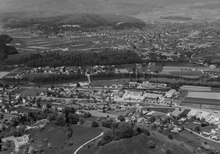
 Killwangen seen from Neuenhof |
|
| Location of the municipality | |
  |
|
Killwangen ( Swiss German : ˌχilːˈʋɑŋːə ) is a municipality in the Swiss canton of Aargau . It belongs to the Baden district and is located in the central Limmat Valley between Baden and Zurich .
geography
The village lies between the left bank of the Limmat and the wooded northeast slope of the Heitersberg , which is criss-crossed with numerous ravines . While the old village center is at the foot of the Heitersberg, the new quarters are on the narrow plain between the village center and the train station. The small hamlet of Sennenberg is located in a forest clearing at an altitude of around 660 meters.
The area of the municipality is 243 hectares , of which 119 hectares are forested and 61 hectares are built over. The highest point is at 702 meters above Sennenberg, the lowest at 385 meters on the banks of the Limmat. Neighboring communities are Würenlos in the north, Spreitenbach in the east, Oberrohrdorf in the south-west and Neuenhof in the north-west.
history
Chulliwanch was first mentioned in a document in 1227 in an interest register of the provost office of Zurich. The place name comes from the Old High German (ze) Chullinwangun and means "on the slopes of the Chullo". In 1234 a knight Ruom sold extensive goods and the lower jurisdiction to the Wettingen monastery . The Habsburgs were sovereigns and holders of blood jurisdiction . In 1259 the Habsburg Count Rudolf I sold further property to the monastery. For almost six centuries, the residents of Killwangen were dependent on the monastery.
In 1415 the confederates conquered Aargau. Killwangen was now part of the Wettingen office in the county of Baden , a common rule . Abbot Nikolaus Göldin had a rest home built on the Sennenberg around 1680 for the monks of the monastery. The Killwang farmers mostly sold their products on the market in Baden . At the beginning of the 18th century they tried three times in vain to be exempted from the Baden bridge toll. In March 1798 the French took Switzerland and proclaimed the Helvetic Republic . Killwangen was initially a municipality in the short-lived canton of Baden , since 1803 it has belonged to the canton of Aargau.


When the cantonal government abolished the Wettingen monastery in 1841, the convalescent home on the Sennenberg went into private ownership and is now owned by the Association of Aargau Simmental Breeding Cooperatives. The first railway line in Switzerland between Baden and Zurich , the Swiss Northern Railway , opened on August 7, 1847 , ran through the municipality of Killwangen, and on February 1, 1848 the village received its own train station. Until the 1920s, Killwangen remained strongly characterized by agriculture, from 1930 onwards, several industrial companies settled on the border with Spreitenbach. The opening of the Heitersberg tunnel to Mellingen took place on May 22, 1975. Since 1900 the population has increased by almost seven times.
Attractions
coat of arms
The blazon of the municipal coat of arms reads: "In red, white rafters, in the base of the shield a six-pointed white star." On the map of the canton of Zurich from 1667, the Killwanger coat of arms consisted of a red and yellow split shield, covered with a blue diamond and a blue star. This coat of arms, the origin of which is completely unknown, also appeared on the municipal seal in 1872. The coat of arms used today was created in 1926 and established itself over time. While the meaning of the rafter is not known, the star indicates that it once belonged to the Wettingen monastery .
population
The population developed as follows:
| year | 1778 | 1850 | 1900 | 1930 | 1950 | 1960 | 1970 | 1980 | 1990 | 2000 | 2010 |
| Residents | 90 | 182 | 306 | 439 | 597 | 802 | 842 | 1041 | 1328 | 1377 | 1820 |
On December 31, 2019, 2058 people lived in Killwangen, the proportion of foreigners was 26.6%. In the 2015 census, 35.1% described themselves as Roman Catholic and 15.9% as Reformed ; 49.0% were non-denominational or of other faiths. In the 2000 census, 88.2% stated German as their main language, 2.7% Italian and 1.9% Serbo-Croatian .
Politics and law
The assembly of those entitled to vote, the municipal assembly , exercises legislative power. The executing authority is the five-member municipal council . He is elected by the people in the majority procedure, his term of office is four years. The parish council leads and represents the parish. To this end, it implements the resolutions of the municipal assembly and the tasks assigned to it by the canton. The Baden District Court is responsible for litigation in the first instance . Killwangen belongs to the Friedensrichterkreis IV (Wettingen).
economy
According to the company structure statistics (STATENT) collected in 2015, there are around 700 jobs in Killwangen, of which 2% are in agriculture, 54% in industry and 44% in the service sector. Most of the employed people are commuters; they work either in the Baden agglomeration , in Spreitenbach and other Limmattal communities or in the city of Zurich .
traffic
Killwangen is located on the busy main road 3 between Baden and Zurich , about three kilometers southwest of the Wettingen junction of the A1 motorway . The Killwangen-Spreitenbach station is served by two lines of the Zurich S-Bahn , which run from Winterthur to Brugg and Aarau . Four RVBW bus lines connect the train station, as does one Limmatbus line . On weekends there is a night S-Bahn (Winterthur - Zurich HB - Baden - Brugg - Lenzburg - Aarau ) and a night bus from Baden to Dietikon . From 2022 the station will be the western terminus of the Limmattalbahn to Zurich Altstetten station .
education
Killwangen has two kindergartens and a school house in which the primary school is taught. All upper levels of the compulsory elementary school ( Realschule , Secondary School and District School ) can be attended in the neighboring municipality of Spreitenbach . The closest grammar schools are the Baden Cantonal School and the Wettingen Cantonal School .
Personalities
The sculptor Philipp Widmer was born in Killwangen in 1870. For the Bavarian city of Bad Windsheim , together with the Nuremberg architect Fritz Mayer, he created the design for the local war memorial for the fallen of the First World War .
literature
- Sarah Brian Scherer: Killwangen. In: Historical Lexicon of Switzerland .
- Peter Hoegger: The art monuments of the canton of Aargau . Ed .: Society for Swiss Art History . Volume VII: District of Baden II. Birkhäuser Verlag, Basel 1995, ISBN 3-909164-44-7 , p. 53-61 .
Web links
- Official website of the municipality of Killwangen
- The story of Killwangen on the CVP Killwangen website ( memento from October 30, 2009 in the Internet Archive )
Individual evidence
- ↑ Cantonal population statistics 2019. Department of Finance and Resources, Statistics Aargau, March 30, 2020, accessed on April 2, 2019 .
- ↑ Cantonal population statistics 2019. Department of Finance and Resources, Statistics Aargau, March 30, 2020, accessed on April 2, 2019 .
- ↑ a b Beat Zehnder: The community names of the canton of Aargau . In: Historical Society of the Canton of Aargau (Ed.): Argovia . tape 100 . Verlag Sauerländer, Aarau 1991, ISBN 3-7941-3122-3 , p. 171-172 .
- ^ National map of Switzerland, sheet 1090, Swisstopo.
- ↑ Standard area statistics - municipalities according to 4 main areas. Federal Statistical Office , November 26, 2018, accessed on June 4, 2019 .
- ^ Joseph Galliker, Marcel Giger: Municipal coat of arms of the Canton of Aargau . Lehrmittelverlag des Kantons Aargau, book 2004, ISBN 3-906738-07-8 , p. 190 .
- ↑ Population development in the municipalities of the Canton of Aargau since 1850. (Excel) In: Eidg. Volkszählung 2000. Statistics Aargau, 2001, archived from the original on October 8, 2018 ; accessed on June 4, 2019 .
- ↑ Resident population by religious affiliation, 2015. (Excel) In: Population and Households, Community Tables 2015. Statistics Aargau, accessed on June 4, 2019 .
- ↑ Swiss Federal Census 2000: Economic resident population by main language as well as by districts and municipalities. (Excel) Statistics Aargau, archived from the original on August 10, 2018 ; accessed on June 4, 2019 .
- ↑ circles of justice of the peace. Canton of Aargau, accessed on June 19, 2019 .
- ↑ Statistics of the corporate structure (STATENT). (Excel, 157 kB) Statistics Aargau, 2016, accessed on June 4, 2019 .
- ↑ Künstlerlexikon Thieme-Becker, vol. 35, p. 521: Philipp Widmer, sculptor in Nuremberg, * October 24, 1870 Killwangen (Switzerland)
Bathing | Bellikon | Bergdietikon | Birmenstorf | Things of honor | Ennetbaden | Fislisbach | Freienwil | Gibstorf | Killwangen | Künten | Mellingen | Mägenwil | Neuenhof | Niederrohrdorf | Oberrohrdorf | Obersiggenthal | Remetschwil | Spreitenbach | Stetten | Turgi | Untersiggenthal | Wettingen | Wohlenschwil | Würenlingen | Würenlos
Former municipalities: Büblikon | Dättwil | Kempfhof | Oberehrendingen | Oetlikon | Rohrdorf | Unterehrendingen
Canton of Aargau | Districts of the Canton of Aargau | Municipalities in the Canton of Aargau