
Würenlingen
| Würenlingen | |
|---|---|
 |
|
| State : |
|
| Canton : |
|
| District : | to bathe |
| BFS no. : | 4047 |
| Postal code : | 5303 |
| Coordinates : | 661 754 / 264 813 |
| Height : | 370 m above sea level M. |
| Height range : | 325–556 m above sea level M. |
| Area : | 9.37 km² |
| Residents: | 4765 (December 31, 2019) |
| Population density : | 509 inhabitants per km² |
|
Proportion of foreigners : (residents without citizenship ) |
24.9% (December 31, 2019) |
| Website: | www.wuerenlingen.ch |
 View of the village with the catholic church |
|
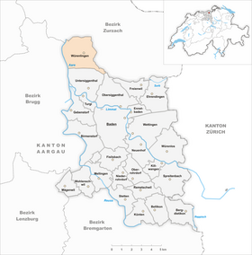
| Location of the municipality | |
  |
|
Würenlingen ( Swiss German Würelinge ˈʋʏrˌliŋːə , ˈʋʏrəˌliŋːə ) is a municipality in the Swiss canton of Aargau . It belongs to the Baden district and is located in the lower Aare valley north of Brugg , not far from Switzerland's moated castle .
geography
The village is located about two kilometers east of the Aare at the transition from the Aare to the Surbtal , on the northwest slope of the Siggenberg, which is part of the Table Jura . The upper village, the actual core zone, hugs a hilltop on which the church and the cemetery are located. The middle village and the lower village, which emerged in the 17th century, extend into the plain northwest of the upper village. On the level between the upper village and the Siggenthal-Würenlingen train station, two kilometers south-southwest, there are extensive modern residential areas, and a large industrial zone around the train station. To the northeast of the village, the terrain rises suddenly from the level of the Aare valley to the plateau of the Ruckfeld; the difference in altitude is more than 60 meters in places.
The area of the municipality is 937 hectares , of which 445 hectares are forested and 214 hectares are built over. The highest point is at 555 meters on the southeastern municipal boundary, the lowest at 325 meters on the Aare. Neighboring communities are Böttstein in the northwest, Döttingen in the north, Tegerfelden in the northeast, Endingen in the east, Obersiggenthal in the southeast, Untersiggenthal in the south and Villigen in the west.
history
Various grave finds in the “Misererebückli” point to settlement during the Hallstatt period around 2,600 years ago. The Roman road from Vindonissa ( Windisch ) to Tenedo ( Bad Zurzach ) led through what is now the municipality. Wirnaningum was first mentioned in a document in 828. The place name comes from the Old High German Wirantingun and means "among the people of Wirant". In the Middle Ages Würenlingen was under the rule of the Habsburgs , who exercised both lower and blood jurisdiction . In addition to the worldly owners, the most important feudal lords were the monasteries of Sankt Blasien , Säckingen and Klingnau as well as the cathedral monastery of Konstanz .

In 1415 the Swiss conquered Aargau and Würenlingen was now part of the Siggenamt in the county of Baden , a common rule . At the time of the Reformation , the population remained Catholic and therefore largely spared the sectarian conflicts in the county of Baden. The first school was built around 1680. From 1779 the village formed its own parish, previously it was under the parish of Klingnau. In 1790 a fire destroyed almost the entire upper village. In March 1798 the French took Switzerland and proclaimed the Helvetic Republic . Würenlingen was initially a municipality in the short-lived canton of Baden , since 1803 it has belonged to the canton of Aargau.
On August 18, 1859, with the opening of a train station on the border with Untersiggenthal , Würenlingen was connected to the Turgi – Koblenz – Waldshut railway line , which encouraged the settlement of industrial companies. Between 1900 and today the population increased four and a half times. In 1960 the Federal Institute for Reactor Research was opened, which in 1990 merged with the Swiss Institute for Nuclear Physics in Villigen to form the Paul Scherrer Institute . On February 21, 1970, a Convair CV-990 crashed on Swissair flight 330 in the forest west of the village, killing all 47 occupants.
Attractions

coat of arms
The blazon of the municipal coat of arms reads: "In white two-leaved green oak branch with fruit." The municipality seal from 1872 showed an unusual amalgamation of the canton and municipality coats of arms. In 1934 the oak branch appeared on its own in the coat of arms for the first time. The motif is reminiscent of the extensive oak forests that have been mentioned repeatedly in the history of Würenlingen.
population
The population developed as follows:
| year | 1487 | 1780 | 1850 | 1900 | 1930 | 1950 | 1960 | 1970 | 1980 | 1990 | 2000 | 2010 |
| Residents | 55 | 719 | 1130 | 1055 | 1242 | 1525 | 2005 | 2490 | 2831 | 3052 | 3647 | 4241 |
On December 31, 2019, 4,765 people lived in Würenlingen, the proportion of foreigners was 24.9%. In the 2015 census, 48.0% described themselves as Roman Catholic and 14.5% as Reformed ; 37.5% were non-denominational or of other faiths. In the 2000 census, 88.5% named German as their main language, 2.8% Albanian , 2.0% Italian , 1.1% Serbo-Croatian and 0.9% Portuguese .
Politics and law
The assembly of those entitled to vote, the municipal assembly , exercises legislative power. The executing authority is the five-member municipal council . He is elected by the people in the majority procedure, his term of office is four years. The parish council leads and represents the parish. To this end, it implements the resolutions of the municipal assembly and the tasks assigned to it by the canton. The Baden District Court is responsible for litigation in the first instance . Würenlingen belongs to the Friedensrichterkreis III (Baden).
economy


According to the corporate structure statistics (STATENT) collected in 2015, Würenlingen has around 3,500 jobs, of which 2% are in agriculture, 37% in industry and 61% in the service sector. Agriculture, which used to dominate, was almost completely displaced by industrial and service companies in the 19th century, and today there are only a dozen farms left. Numerous companies are located in the industrial zone around the train station. For example, LafargeHolcim , the largest cement company in the world, has a branch here. Würenlingen is the headquarters of Rotho , one of the largest European brand manufacturers of plastic consumer goods. There are also numerous service companies.
Würenlingen is known nationally as the location of the Paul Scherrer Institute (a research center) and the Zwilag , the interim storage facility for radioactive waste. Both institutions are located far outside the village center on the east bank of the Aare.
The viticulture in Würenlingen has a long tradition. On the southern slope of the Bollhölzli, a hill north of the village, and on the steep slope of the Ruckfeld, a total of 7.5 hectares was planted with vines in 2018. Over a dozen different varieties are grown, with Blauburgunder , Chardonnay , Kerner and Riesling × Sylvaner predominating. In addition, Würenlingen is the location of a renowned viticulture school.
traffic
The busy main road 5 between Brugg and Waldshut runs about half a kilometer west of Würenlingen, so that the village, with the exception of the station district, is largely spared from through traffic. From here the canton road 295 to Baden and the canton road 295.1 to Bad Zurzach branch off . SBB regional trains between Baden and Bad Zurzach or Waldshut stop at Siggenthal-Würenlingen station . In Würenlingen, the post bus lines cross from the Brugg train station to Bad Zurzach and fromhabenstorf to Villigen . A night bus runs from Baden to Würenlingen on weekends.
education
Würenlingen has three kindergartens and two schoolhouses in which the primary school , the secondary school and the secondary school are taught. The district school can be attended either in Endingen or in Turgi . The closest grammar schools are the Baden Cantonal School and the Wettingen Cantonal School .
Personalities
- Walter Birchmeier (* 1943), developmental biologist and cancer researcher
- Albert Meier (1896–1964), winemaker and canton politician
- Eugen Meier (* 1934), composer
- Pirmin Meier (* 1947), author
literature
- Patrick Zehnder: Würenlingen. In: Historical Lexicon of Switzerland .
- Peter Hoegger: The art monuments of the canton of Aargau . Ed .: Society for Swiss Art History . Volume VII: District of Baden II. Birkhäuser Verlag, Basel 1995, ISBN 3-909164-44-7 , p. 226-246 .
Web links
Individual evidence
- ↑ Cantonal population statistics 2019. Department of Finance and Resources, Statistics Aargau, March 30, 2020, accessed on April 2, 2019 .
- ↑ Cantonal population statistics 2019. Department of Finance and Resources, Statistics Aargau, March 30, 2020, accessed on April 2, 2019 .
- ↑ a b Beat Zehnder: The community names of the canton of Aargau . In: Historical Society of the Canton of Aargau (Ed.): Argovia . tape 100 . Verlag Sauerländer, Aarau 1991, ISBN 3-7941-3122-3 , p. 479-480 .
- ^ National map of Switzerland, sheet 1070, Swisstopo.
- ↑ Standard area statistics - municipalities according to 4 main areas. Federal Statistical Office , November 26, 2018, accessed on June 8, 2019 .
- ^ Joseph Galliker, Marcel Giger: Municipal coat of arms of the Canton of Aargau . Lehrmittelverlag des Kantons Aargau, book 2004, ISBN 3-906738-07-8 , p. 322 .
- ↑ Population development in the municipalities of the Canton of Aargau since 1850. (Excel) In: Eidg. Volkszählung 2000. Statistics Aargau, 2001, archived from the original on October 8, 2018 ; accessed on June 8, 2019 .
- ↑ Resident population by religious affiliation, 2015. (Excel) In: Population and Households, Community Tables 2015. Statistics Aargau, accessed on June 8, 2019 .
- ↑ Swiss Federal Census 2000: Economic resident population by main language as well as by districts and municipalities. (Excel) Statistics Aargau, archived from the original on August 10, 2018 ; accessed on June 8, 2019 .
- ↑ circles of justice of the peace. Canton of Aargau, accessed on June 19, 2019 .
- ↑ Statistics of the corporate structure (STATENT). (Excel, 157 kB) Statistics Aargau, 2016, accessed on June 8, 2019 .
- ↑ Grape harvest control 2018 Canton Aargau. (PDF, 2.4 MB) Agricultural Center Liebegg, 2019, accessed on June 19, 2019 .
Bathing | Bellikon | Bergdietikon | Birmenstorf | Things of honor | Ennetbaden | Fislisbach | Freienwil | Gibstorf | Killwangen | Künten | Mellingen | Mägenwil | Neuenhof | Niederrohrdorf | Oberrohrdorf | Obersiggenthal | Remetschwil | Spreitenbach | Stetten | Turgi | Untersiggenthal | Wettingen | Wohlenschwil | Würenlingen | Würenlos
Former municipalities: Büblikon | Dättwil | Kempfhof | Oberehrendingen | Oetlikon | Rohrdorf | Unterehrendingen
Canton of Aargau | Districts of the Canton of Aargau | Municipalities in the Canton of Aargau