
Küttigen
| Küttigen | |
|---|---|
 |
|
| State : |
|
| Canton : |
|
| District : | Aarau |
| BFS no. : | 4008 |
| Postal code : | 5024 |
| Coordinates : | 645968 / 251885 |
| Height : | 414 m above sea level M. |
| Height range : | 360–866 m above sea level M. |
| Area : | 11.90 km² |
| Residents: | 6276 (December 31, 2019) |
| Population density : | 527 inhabitants per km² |
|
Proportion of foreigners : (residents without citizenship ) |
16.0% (December 31, 2019) |
| Website: | www.kuettigen.ch |
 Kirchberg |
|
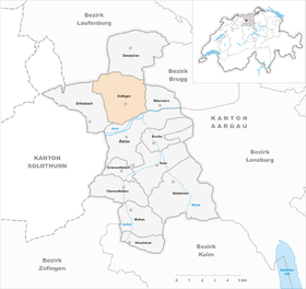
| Location of the municipality | |
  |
|
Küttigen ( Swiss German : ˈχʏtːiɡə ) is a municipality in the Swiss canton of Aargau . It belongs to the Aarau district and is located north of the canton capital Aarau in a side valley of the Aare .
geography
The northern border of the municipality extends along the main ridge of the Jura , between the Wasserflue ( 866 m above sea level , second highest point in the Aargau) in the north-west and the Küttiger Homberg ( 776 m above sea level ) in the north-east. The main outflow of the municipality is the Aabach , which rises below the 674 meter high Benkerjoch pass . After about one kilometer, it breaks through the Benkerklus, a gorge between the elevations Egg ( 776 m above sea level ) in the west and Acheberg ( 709 m above sea level ) in the east. After three more kilometers it joins the Aare opposite the Zurlindeninsel . Another pass crossing into the Fricktal is the 621 meter high Staffelegg . The Horenbach rises nearby, and after about one kilometer the Asperchlus breaks through between the Acheberg in the west and the Küttiger Homberg in the east and finally flows into the Aabach not far from the Aare.
The community consists of four districts. The main settlement of Küttigen is in the middle Aabach valley. This is followed by the Rombach settlement in the southwest, which lies between the Buechwald ( 498 m above sea level ) and the west bank of the Aabach. A little offset in the Horenbachtal are Horen and Kirchberg. All districts have grown together loosely, while Rombach merges seamlessly into the development of Aarau .
The area of the municipality is 1190 hectares , of which 590 hectares are covered with forest and 207 hectares are built over. The highest point is at 866 meters on the ridge of the Wasserflue, the deepest at 360 meters on the Aare. The municipality of Küttigens is part of the Aargau Jura Park , a “regional nature park of national importance” . Neighboring communities are Oberhof in the north-west, Densbüren in the north, Thalheim in the north-east, Biberstein in the east, Aarau in the south and Erlinsbach in the west.
history
Settlement history
Finds at a factory and settlement site in the Talmatt indicate settlement as early as the Neolithic Age . Finds in the Weidhölzli (earth fortifications, flint, sling stones, spindle whorls, etc.) and on the Homberg (stone setting, pit house, bronze brooch) date from the Bronze Age . During excavations on the southern slope of the Kirchberg in Bollacker in 1906, the remains of a Roman manor came to light. Various brick stamps and terra sigillata vessels as well as a coin from Emperor Claudius Gothicus indicate that the building was inhabited from the second half of the 1st to the end of the 3rd century. The Fischbachmulde was inhabited by Celtic and post-Roman times, as has been shown by finds and which Celtic field names such as Galmet (mountain pasture) and Leberten (mountain; a common name in the Jura region) are reminiscent of this. The Büren (Staffeleggseite of the pass named Wolf) is an Alemannic name for an existing settlement that probably existed at the same time.
Chutingen was first mentioned in a document in 1036 when Ulrich the Rich, the Count of Lenzburg , made generous donations to Beromünster Abbey . The place name is first attested in Old High German as Kuttingun and means "with the people of Kutto". In the Hüslimatt there was a medieval settlement called Aa on a rock head above the Aare, first mentioned in 1179 and 1422 as a court of law. In 1562 only masonry was left. The rock was removed when the Bibersteinerstrasse was built. In the 17th century there was a small settlement in Riepel , attested as Riedtwyl , in the area of the later gypsum quarry, which has now disappeared.
Changing rulers
In 1277 the Lords of Kienberg built Königstein Castle above the Benkerklus on the Egg ridge , of which only a few remains have survived. From there they managed their small bailiwick , which in addition to Küttigen also included the Aargau part of Erlinsbach . From 1335 to 1535 the village was owned by the Order of St. John as part of the Biberstein office until the friars were forced to sell by the city of Bern . Küttigen now belonged to the subject area known as the Bernese Aargau . The Bernese were able to implement the Reformation as early as 1528 .
In March 1798 the French took Switzerland ( French invasion ), ousted the «Gracious Lords» of Bern and proclaimed the Helvetic Republic . Since then, Küttigen has been part of the canton of Aargau. Until 1799 the neighboring Oberhof belonged to Upper Austria and in 1802 temporarily to the canton of Fricktal , until the village and other communities in the Fricktal also became part of the canton of Fricktal in 1803. There are still old boundary stones of the state border (Bern / Austria) in the forest on the Benkerjoch. In 1804 the new canton built the road over the Staffelegg , which Franz Xaver Bronner described in 1844 as "a true ornament of the village".
Industry, traffic and natural events

In the 16th and 17th centuries, plaster of paris and alabaster were mined on the mountain slopes , the latter again (at least) between 1806 and 1810 at the height of Staffelegg. The rose-red, flesh-red and snow-white alabaster, however, was too soft, salty and brittle, so that the works of art formed from it lacked durability. From 1780 onwards, Bohnerz was excavated on the Hungerberg and the Küttigen iron mine was built , which existed until 1826 and delivered ores primarily to the Albbruck ironworks .
The industry found its way in 1822 with the construction of a paper mill on the road over the Benkerjoch. During the Second World War , the army fortified the Benkerchlus with two bunkers, one by the bridge on Benkenstrasse and the other behind the "mudslide". In addition, several anti-tank barriers were erected, one of which was spilled by the "mudslide". The mobile anti-tank barriers (posts that could be inserted into covered recesses in the street) were cleared away when the street was renovated in the 1990s. In the second half of the 20th century, the economic focus on Aarau and Küttigen developed into a sought-after residential area. Since 1950 the population has increased by almost two and a half times.
On the night of February 23rd to 24th, 1999, an approximately one hundred meter long piece of the northern slope of the Brunneberg loosened and went down as a debris flow. The landscape was buried under mud over a length of around one kilometer and a width of up to 80 meters. The mud also covered parts of a historical path to the Wasserflue . Without further ado, the Fischbach, a tributary of the Aabach, had to be placed in a tube and its course shifted so that the approaching Opalinus Clay could not get into the stream and liquefy. The debris flow stopped right next to the tubes of the stream.
Attractions


- The Kirchberg church was first mentioned in 1036. It is located around one kilometer southeast of the village center on the Kirchberg, a hill spur near the banks of the Aare. The Romanesque church tower dates from the High Middle Ages, the nave and choir, on the other hand, were both built around 1500 in the late Gothic style. In 1851 a small vestibule was added and in 1868 the church tower was raised. Hermann Burger lived for some time in the rectory in Kirchberg; a few decades earlier Paul Haller had been pastor in Küttigen, from which time he had also obtained the material for his dialect epic "s'Juramareili".
- The "Türmlischuelhuus" in the center of the village from 1938 has five classrooms and a tower clock with a bell that rings at 11 am and 3 pm. This is due to the fact that the workers used to go home at 11 a.m. to have lunch and leave work at 3 p.m.
- The Horen ruin , referred to as "Rosenberg Ruin" on topographic maps, is located at the northwestern end of the Kirchberg at an altitude of 451 meters. It is not known what the correct name of the castle was, nor who it was built or the year it was built. Archaeological research, however, showed that the ruins were settled in the 12th century.
- Horenhof: courtyard to the castle of the same name.
- The Königstein ruins are the remains of a castle built by the Habsburgs. It is located at 610 meters in the northeast of the Brunnenberg.

- The " Schällebrugg " is a stone bridge built between 1804 and 1810 by convicts from the cantonal prison in Baden. The workers lived in the nearby "Schellenhaus" during construction. Schallenhaus or Schellenhaus is an old word for penal institution or penitentiary, as the convicts used to wear a device with one or more bells. From 1823 to 1923 a regular horse mail drove from Aarau via the Schällebrugg to Stein, then the post bus to Frick. 1919–1912 the course of the line was corrected (adaptation to car traffic: construction of the dam instead of the Schellenbrücke and the new Stockstrasse in Rombach). At the end of the 1990s, the bridge was paved as it served as an access to a construction site. It is located in the extension of the new Staffeleggstrasse at the Gibel, before it bypasses the Schellenbrücke over a dam and overcomes the steep incline that follows. Paul Haller mentions the bridge in his poem De Nussbaum a dr Schällebrugg .
- The old customs house, which was in operation on the Benkerjoch as a border crossing point for Switzerland at the time of the border crossing to Front Austria, is located at Benkenstrasse 4.
- The old mill (first mentioned in 1380) is a late Gothic building erected in 1609 behind the Linde restaurant. It has been restored by volunteers because its mill wheel was in very poor condition.
- The upper mill (near the Benkenstrasse-Brandackerstrasse junction) was built in the 17th century. It was later expanded with a leg mill, oil mill and hemp grater, later a carpentry shop. Today converted into an apartment building.

- The old schoolhouse, which is located at the junction of the main street into Benkenstrasse and Staffeleggstrasse, used to serve as a community meeting place and then as a schoolhouse.
- The wooden trot (first mentioned in 1512) is in an open shelter at the junction between Brandackerstrasse and Benkenstrasse. It used to be in the house at the confluence of Goldackerstrasse and Benkenstrasse, which is why it is also known as the "old Trotte".
- The "Papirmüli", built by H. R. Sauerländer in 1822/23, is the last house on Benkenstrasse in the direction of Oberhof and was built in the 19th century to make paper from rags. It was the first industrial company in the village. From the nearby Fischbach, a pressure tunnel was built from the bridge on Benkenstrasse, which then led over Benkenstrasse into the mill. This is still quite well preserved today. The waste water from the mill was then fed back into the stream via another tunnel. Large parts of this are still preserved, but barred as the exit is on the grounds of the Waldmann lamp company . The house now serves as a residential and studio building. From 1870 the building was used as a silk twisting mill by F. Frey, who expanded the water supply and installed a turbine. From 1905 silk weaving, later synthetic fibers until 1965.
- On the way over the Staffelegg there is the Stäglimatt stone staircase on the right-hand side .
coat of arms

The blazon of the municipal coat of arms reads: "Diagonally right divided by black with a white oblique left bar and by yellow." The coat of arms used from 1872 on showed a yellow quince (Swiss German: Chüttene ) with green leaves on a white background. In 1948 this speaking coat of arms was replaced by the historical coat of arms of the Lords of Kienberg, whose seat was the now ruined Königstein Castle . The Solothurn community of Kienberg has had exactly the same coat of arms since 1966.
The old coat of arms can still be seen in the Karl-Moser-Haus of the old canton school in Aarau on the third floor as a window picture.
population
The population developed as follows:
| year | 1764 | 1803 | 1850 | 1900 | 1930 | 1950 | 1960 | 1970 | 1980 | 1990 | 2000 | 2010 |
| Residents | 682 | 1078 | 1847 | 2018 | 2053 | 2508 | 3457 | 4181 | 4356 | 4781 | 5025 | 5618 |
On December 31, 2019, 6,276 people lived in Küttigen, the proportion of foreigners was 16%. In the 2015 census, 42.2% described themselves as Reformed and 21.3% as Roman Catholic ; 36.5% were non-denominational or of other faiths. In the 2000 census, 89.4% stated German as their main language, 2.6% Italian , 2.1% Albanian , 1.5% Serbo-Croatian , 0.8% French and 0.7% Turkish .
Politics and law
The assembly of those entitled to vote, the municipal assembly , exercises legislative power. The executing authority is the five-member municipal council . He is elected by the people in the majority procedure, his term of office is four years. The parish council leads and represents the parish. To this end, it implements the resolutions of the municipal assembly and the tasks assigned to it by the canton. The Aarau District Court is the first instance responsible for legal disputes . Küttigen belongs to the Friedensrichterkreis I (Aarau).
economy
According to the company structure statistics (STATENT) collected in 2015, there are around 1,350 jobs in Küttigen, 5% of them in agriculture, 26% in industry and 69% in the service sector. Economic activity is based entirely on Aarau , which is why most of the employed commute to the neighboring canton capital. Küttigen is thus a typical residential community on the edge of a medium-sized agglomeration .
Viticulture is of some importance . In 2018, an area of 4.8 hectares was planted with vines on the southern slope of the Acheberg. Seven different varieties are grown, with Blauburgunder , Riesling × Sylvaner and Sauvignon Blanc predominating.
traffic
To the east of Küttigen, Hauptstrasse 24 runs from Aarau via Staffelegg to Frick . The route includes a new Aare bridge and a tunnel in the Horenbachtal. After years of planning, characterized by numerous objections, construction work on this bypass road began in July 2004. Six years later, the street was opened in December 2010. As a result, the road through the village center was noticeably relieved, as it essentially only has to accommodate through traffic over the Benkerjoch . The community is served by three bus routes from Aarau train station , a city bus route operated by the Aarau bus company and two post bus routes via the Benkerjoch and Staffelegg to Frick. On weekends there is a night bus from Aarau to Küttigen.
education
Küttigen has four kindergartens and two schoolhouses in which the primary school , the secondary school and the secondary school are taught. The district school can be attended in Aarau. The nearest grammar schools, the old canton school and the new canton school are also located there . Küttigen has been the location of the cantonal language school since 1979 .
Specialties

The cultivation of the Küttiger carrots , a type of carrot , has always been cultivated by the farmers in Küttigen. The carrots have a white, conical root and an intense, bitter taste. The Küttiger Dachapfel is an endangered apple variety and is on the ProSpecieRara list.
Personalities
- Karl Blattner (1805–1883), Council of States and Government Council
- Adolf Frey (1855–1920), writer and literary historian
- Petra Henzi (* 1969), mountain biker
- Edmund Landolt (1846-1926), ophthalmologist
- Hans Peter Wehrli (* 1952), economist
literature
- Alfred Lüthi: Küttigen. In: Historical Lexicon of Switzerland .
- Traugott Fricker: Benkerjoch and Staffelegg: from the history of two Jura passes , Aarauer Neujahrsblätter, 1952, doi: 10.5169 / seals-571269 .
- Alfred Lüthi: Küttigen, history of a suburban community . Trüb-Sauerländer, Buchs 1991.
- Michael Stettler : The art monuments of the canton of Aargau . Ed .: Society for Swiss Art History . Volume I: The districts of Aarau, Kulm, Zofingen. Wiese Verlag, Basel 1948, DNB 366495623 .
Web links
Individual evidence
- ↑ Cantonal population statistics 2019. Department of Finance and Resources, Statistics Aargau, March 30, 2020, accessed on April 2, 2019 .
- ↑ Cantonal population statistics 2019. Department of Finance and Resources, Statistics Aargau, March 30, 2020, accessed on April 2, 2019 .
- ↑ a b Beat Zehnder: The community names of the canton of Aargau . In: Historical Society of the Canton of Aargau (Ed.): Argovia . tape 100 . Verlag Sauerländer, Aarau 1991, ISBN 3-7941-3122-3 , p. 238-239 .
- ↑ a b National map of Switzerland, sheet 1089, Swisstopo.
- ↑ Standard area statistics - municipalities according to 4 main areas. Federal Statistical Office , November 26, 2018, accessed on May 18, 2019 .
- ↑ a b c d e f g School supplies from the Küttigen village school from 1998, signed: KW 98 (Kurt Wullschläger?).
- ^ Martin Hartmann, Hans Weber: The Romans in Aargau . Verlag Sauerländer, Aarau 1985, ISBN 3-7941-2539-8 , p. 178 .
- ^ Franz Xaver Bronner : The canton Aargau historically, geographically, statistically portrayed . Huber, St. Gallen and Bern 1844, p. 473 ( Google Books ).
- ↑ Minaria-Helvetica (PDF)
- ↑ More knowledge about flood hazards. (PDF) Department for the Environment of the Canton of Aargau, August 2002, accessed on January 8, 2010 .
- ^ Stettler: The art monuments of the Canton of Aargau, Volume I: The districts of Aarau, Kulm, Zofingen. Pp. 162-165.
- ↑ Schweizerisches Idiotikon , Volume II, Col. 1728, Article Schallenhūs ( digitized version ) and Volume XVI, Col. 1250, Article Schallenwërch ( digitized version ).
- ^ Paul Haller : De Nussbaum a dr Schällebrugg . In: Erwin Haller (Ed.): Poems . HR Sauerländer & Co., Aarau 1922, pp. 100–101 ( Wikisource )
- ^ Joseph Galliker, Marcel Giger: Municipal coat of arms of the Canton of Aargau . Lehrmittelverlag des Kantons Aargau, book 2004, ISBN 3-906738-07-8 , p. 196 .
- ↑ Population development in the municipalities of the Canton of Aargau since 1850. (Excel) In: Eidg. Volkszählung 2000. Statistics Aargau, 2001, archived from the original on October 8, 2018 ; accessed on May 19, 2019 .
- ↑ Resident population by religious affiliation, 2015. (Excel) In: Population and Households, Community Tables 2015. Statistics Aargau, accessed on May 19, 2019 .
- ↑ Swiss Federal Census 2000: Economic resident population by main language as well as by districts and municipalities. (Excel) Statistics Aargau, archived from the original on August 10, 2018 ; accessed on May 19, 2019 .
- ↑ circles of justice of the peace. Canton of Aargau, accessed on June 21, 2019 .
- ↑ Statistics of the corporate structure (STATENT). (Excel, 157 kB) Statistics Aargau, 2016, accessed on May 19, 2019 .
- ↑ Grape harvest control 2018 Canton Aargau. (PDF, 2.4 MB) Agricultural Center Liebegg, 2019, accessed on June 21, 2019 .
- ↑ The new Staffeleggstrasse has opened. Aargauer Zeitung , December 7, 2010, accessed on January 16, 2012 .
Aarau | Biberstein | Box | Densbueren | Erlinsbach | Gränichen | Hirschthal | Küttigen | Mooing | Oberentfelden | Suhr | Unterentfelden
Former municipality: Rohr
Canton of Aargau | Districts of the Canton of Aargau | Municipalities in the Canton of Aargau