
Biberstein
| Biberstein | |
|---|---|
 |
|
| State : |
|
| Canton : |
|
| District : | Aarau |
| BFS no. : | 4002 |
| Postal code : | 5023 |
| UN / LOCODE : | CH BBN |
| Coordinates : | 648 689 / 251661 |
| Height : | 393 m above sea level M. |
| Height range : | 359–775 m above sea level M. |
| Area : | 4.10 km² |
| Residents: | 1592 (December 31, 2019) |
| Population density : | 388 inhabitants per km² |
|
Proportion of foreigners : (residents without citizenship ) |
9.4% (December 31, 2019) |
| Website: | www.biberstein.ch |
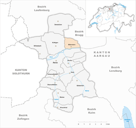
| Location of the municipality | |
  |
|
Biberstein (in local dialect : [ ˈb̥ʏb̥əɾˌʒ̊tæɪ̯ ]) is a municipality in the Swiss canton of Aargau . It belongs to the Aarau district and is located a little more than three kilometers northeast of the canton capital Aarau on the north bank of the Aare .
geography
Biberstein lies between the Aare and the Homberg, which is part of the southernmost chain of the Folded Jura . The populated area extends over a length of two and a half kilometers along the river, with the village center located on an elevated terrace. To the west lies the district of Wissen, to the east the district of Cholgrueben. The only flat area is the “Schachen”, a narrow former floodplain on the left side of the Aare that is used for agriculture. Most of the slope of the Homberg is forested. The forest is loosened up by several pastures at an altitude of around 650 meters.
The municipal area is 410 hectares ; 207 hectares of which are covered with forest and 58 hectares built over. The lowest point is at 360 m on the banks of the Aare, the highest at 768 m above sea level. M. on the Homberggrat. The municipality of Biberstein is part of the Aargau Jura Park, a "Regional Nature Park of National Importance". Neighboring communities are Thalheim in the north, Auenstein in the east, Aarau in the south and Küttigen in the west.
history
In the 13th century the counts of built Habsburg-Laufenburg the Castle Biberstein . The place was first mentioned in a document in 1280. The name is probably a combination of beaver and the basic word stone , which is common in castle names . The town of Rohr on the opposite bank, with which Biberstein was connected by a ferry , also belonged to the rule at that time. In addition, the village of Aa is documented in the years 1179 to 1400 in the area of today's municipal boundary to Küttigen . In the 14th century there was extensive clearing on Homberg. In 1335 the Habsburg-Laufenburgs sold blood and lower jurisdiction to the Order of St. John in Klingnau . Although Biberstein was designated as a town in 1319, the place had neither town nor market rights, but a curtain wall since 1399. In 1416, a conflagration largely destroyed the town, which subsequently sank into a village.

From 1344 onwards, the village together with Erlinsbach and Küttigen formed the Biberstein office administered by the respective Komtur . During the Swabian War of 1499, Biberstein was occupied by the Bernese , who then exerted an ever greater influence. 1527 Bern presented the rule of Biberstein, which also Erlinsbach belonged and Küttigen, arbitrarily a bailiff , who resided from now on at the castle. In 1528 the Reformation was introduced . Seven years later, the Bernese forced the Johanniter to sell their property. The office of Biberstein was now also formally in the subject area of the Bernese Aargau . In March 1798 the French took Switzerland, ousted the «Gracious Lords» of Bern and proclaimed the Helvetic Republic . Since then, Biberstein has been a municipality in the canton of Aargau.
Viticulture , first mentioned in 1363, was, alongside shipping on the Aare, the main line of business in the village for a long time. In 1857 the area under cultivation was around 20 hectares. Because of the phylloxera introduced, viticulture shrank to insignificance by the end of the 19th century. Many families became impoverished and had to emigrate overseas. Handicrafts and home work were little developed, which is why the nearby city of Aarau was an important place of work. In the early 20th century the population was stagnant or even declining slightly. In 1940 the army replaced the ferry with a military bridge, which later gave way to a permanent construction. After 1950, Biberstein developed into an attractive residential area. While the population almost doubled, economic activity was even more focused on Aarau than before.
Attractions

The Biberstein castle stands on a rock near by the river and is surrounded on the west side by a moat. It was created through the reconstruction of the medieval castle and is now used as a place to live, work and train for adults with mental or multiple disabilities. The arrangement of the houses in the village center still gives an idea of the former small-town settlement.
The Biberstein outdoor pool is the first public natural pool in Switzerland. It was opened in 2000 and is modeled on a swimming pond . The bathing water is treated chemical-free in the planted regeneration basin, filtered with gravel and ecologically cleaned on plant roots and microorganisms . The facility includes a swimming pool , a children's pool and a sunbathing lawn.
coat of arms
The blazon of the municipal coat of arms reads: "White beaver sitting in red on white rock, gnawing at yellow wood." This traditional coat of arms of the Biberstein rule is documented in a Basel chronicle from the 16th century. The version used today dates from 1977, when some details were changed in the drawing (thicker piece of wood with gnaw marks, visible beaver tail).
population

The population developed as follows:
| year | 1764 | 1803 | 1850 | 1900 | 1930 | 1950 | 1960 | 1970 | 1980 | 1990 | 2000 | 2010 |
| Residents | 307 | 464 | 761 | 651 | 549 | 652 | 785 | 823 | 889 | 1,104 | 1,101 | 1,417 |
On December 31, 2019, 1592 people lived in Biberstein, the proportion of foreigners was 9.4%. In the 2015 census, 46.7% described themselves as Reformed and 18.6% as Roman Catholic ; 34.7% were non-denominational or of other faiths. 94.7% said German as their main language in the 2000 census , 1.0% English , 0.8% Turkish and 0.7% Italian .
Politics and law
The assembly of those entitled to vote, the municipal assembly , exercises legislative power. The executing authority is the five-member municipal council . He is elected by the people in the majority procedure, his term of office is four years. The parish council leads and represents the parish. To this end, it implements the resolutions of the municipal assembly and the tasks assigned to it by the canton. The Aarau District Court is the first instance responsible for legal disputes . Biberstein belongs to the Friedensrichterkreis I (Aarau).
economy
According to the corporate structure statistics (STATENT) collected in 2015, there are around 330 jobs in Biberstein, of which 4% are in agriculture, 3% in industry and 93% in the service sector. Over three quarters of the working population works outside of the country, especially in Aarau . The largest employer is the Biberstein Castle Foundation, which operates the dormitory for mentally handicapped adults and the only village shop.
traffic
Biberstein is accessed via canton road 470 from Aarau via Auenstein to Wildegg . Just beyond the western boundary of the municipality, it crosses with Hauptstrasse 24 from Aarau via Staffelegg to Frick . A bridge leads over the Aare to Rohr . The connection to the public transport network by a line of bus operation Aarau to Aarau station . There is a night bus on weekends.
The Aare is followed on the left by a section of the national cycle route 8 “ Aare Route ” marked by SwitzerlandMobility . Hiking trails run from the Aare bridge to the Homberg and its ridge; At point 643, a light saddle on the ridge in the very north-east of the municipality, several hiking routes intersect.
education
The kindergarten and primary school are run in the Biberstein schoolhouse . The Realschule and the secondary school can be attended in Küttigen , the district school in Aarau . The closest grammar schools are the old canton school and the new canton school , both also in Aarau.
literature
- Alfred Lüthi: Biberstein (community). In: Historical Lexicon of Switzerland .
- Michael Stettler : The art monuments of the canton of Aargau . Ed .: Society for Swiss Art History . Volume I: The districts of Aarau, Kulm, Zofingen. Wiese Verlag, Basel 1948, DNB 366495623 .
Web links
Individual evidence
- ↑ Cantonal population statistics 2019. Department of Finance and Resources, Statistics Aargau, March 30, 2020, accessed on April 2, 2019 .
- ↑ Cantonal population statistics 2019. Department of Finance and Resources, Statistics Aargau, March 30, 2020, accessed on April 2, 2019 .
- ↑ a b Beat Zehnder: The community names of the canton of Aargau . Historical sources and linguistic interpretations. In: Historical Society of the Canton of Aargau (Ed.): Argovia . Annual journal of the Historical Society of the Canton of Aargau. tape 100 / II . Verlag Sauerländer, Aarau 1991, ISBN 3-7941-3122-3 , p. 87 f . The phonetic transcription used : bụ̈́bərštè͈i̯ .
- ↑ a b Gabrielle Schmid: Biberstein AG (Aarau) in: Dictionnaire toponymique des communes suisses - Lexicon of Swiss municipality names - Dizionario toponomastico dei comuni svizzeri (DTS | LSG). Center de dialectologie, Université de Neuchâtel, Verlag Huber, Frauenfeld / Stuttgart / Vienna 2005, ISBN 3-7193-1308-5 and Éditions Payot, Lausanne 2005, ISBN 2-601-03336-3 , p. 152. Quoted phonetic transcription : [ ˈbʏbərˌʃtæɪ ].
- ^ National map of Switzerland, sheet 1089, Swisstopo.
- ↑ Standard area statistics - municipalities according to 4 main areas. Federal Statistical Office , November 26, 2018, accessed on May 18, 2019 .
- ↑ Bio Badi Biberstein. In: badi-info. Retrieved May 18, 2012 .
- ↑ Biobadi. (No longer available online.) Biberstein parish, archived from the original on April 27, 2016 ; Retrieved May 18, 2012 . Info: The archive link was inserted automatically and has not yet been checked. Please check the original and archive link according to the instructions and then remove this notice.
- ^ Joseph Galliker, Marcel Giger: Municipal coat of arms of the Canton of Aargau . Lehrmittelverlag des Kantons Aargau, book 2004, ISBN 3-906738-07-8 , p. 119 .
- ↑ Population development in the municipalities of the Canton of Aargau since 1850. (Excel) In: Eidg. Volkszählung 2000. Statistics Aargau, 2001, archived from the original on October 8, 2018 ; accessed on May 18, 2019 .
- ↑ Resident population by religious affiliation, 2015. (Excel) In: Population and Households, Community Tables 2015. Statistics Aargau, accessed on May 18, 2019 .
- ↑ Swiss Federal Census 2000: Economic resident population by main language as well as by districts and municipalities. (Excel) Statistics Aargau, archived from the original on August 10, 2018 ; accessed on May 18, 2019 .
- ↑ circles of justice of the peace. Canton of Aargau, accessed on June 21, 2019 .
- ↑ Statistics of the corporate structure (STATENT). (Excel, 157 kB) Statistics Aargau, 2016, accessed on May 18, 2019 .
Aarau | Biberstein | Box | Densbueren | Erlinsbach | Gränichen | Hirschthal | Küttigen | Mooing | Oberentfelden | Suhr | Unterentfelden
Former municipality: Rohr
Canton of Aargau | Districts of the Canton of Aargau | Municipalities in the Canton of Aargau