
Low
| Low | |
|---|---|
 |
|
| State : |
|
| Canton : |
|
| District : | Aarau |
| BFS no. : | 4009 |
| Postal code : | 5037 |
| UN / LOCODE : | CH MUH |
| Coordinates : | 646 632 / 242579 |
| Height : | 433 m above sea level M. |
| Height range : | 418–639 m above sea level M. |
| Area : | 7.03 km² |
| Residents: | 3907 (December 31, 2019) |
| Population density : | 556 inhabitants per km² |
|
Proportion of foreigners : (residents without citizenship ) |
13.7% (December 31, 2019) |
| Website: | www.mühlen.ch |
 Low |
|
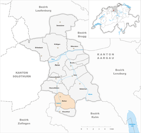
| Location of the municipality | |
  |
|
Muhen ( Swiss German : mu Einwohner ; inhabitant and adjective: Müheler, Swiss German ˈmyəl ) r ) is a municipality in the Swiss canton of Aargau . It belongs to the Aarau district and is located on the eastern edge of the lower Suhrental .
geography
Muhen is located about six kilometers south of the canton capital Aarau , on the northwest slope of the ridge between the Suhren - and the Wynental . The community consists (from north to south) of the three districts of Untermuhe, Mittelmuhe and Obermuhe, which were once separate, but have grown together in the last few decades. Each district lies on a cone of rubble at the exit of deeply cut valleys formed by the hill spurs Gibel, Veerstelli, Schafrain and Egg. The Suhre flows through the village from south to north, and the plain surrounding it is completely flat.
The area of the municipality is 703 hectares , of which 292 hectares are covered with forest and 131 hectares are built over. The lowest point is at 425 meters on the north-western boundary of the municipality, the highest at 639 meters on Wannenköpfli at the eastern end of the Egg. Neighboring communities are Oberentfelden in the north, Gränichen in the northeast, Unterkulm in the east, Hirschthal in the south, Holziken in the southwest and Kölliken in the west.
history
In 1962, Roman bricks came to light when the main line of the sewer system was being built , and a year later in Hardfeld those with brick stamps from the Legio XXI Rapax stationed in Vindonissa . Mucheim was first mentioned in a document in 1045 when King Heinrich III. , who was in Solothurn at the time , confirmed the holdings of Beromünster Abbey . Among them was a tavern in Muhen. The place name comes from the Old High German “Muochinheim” and means “Muocho's place of residence”, so it has nothing to do with mooing cows .

In the Middle Ages the village was under the rule of the Counts of Lenzburg , from 1173 on that of the Counts of Kyburg . After these became extinct, the Habsburgs took over rule in 1273. Around 1350, the Muhenamt was established, a separate judicial district that included Muhen, Attelwil , Bottenwil , Holziken , Kölliken , Staffelbach , Wiliberg and Wittwil . In 1415 the Swiss conquered Aargau; Muhen now belonged to the subject area of the city of Bern , the so-called Berner Aargau .
With the transfer of important rights to Bern, which previously belonged to the St. Gallen monastery , the old court of the Muhenamt moved from Muhen to Kölliken in the course of the 15th century. There was a dichotomy among the rural population. The wealthy farmers had rights to graze and use the common land, had draft animals and used most of the cultivated areas. The rest of the population was made up of Tauners and day laborers who sometimes served in foreign armies. Muhen did not have its own church until the 20th century; the residents attended the service partly in Suhr and partly in Schöftland . In 1528 the Bernese introduced the Reformation .
In March 1798 the French took Switzerland, ousted the «Gracious Lords» of Bern and proclaimed the Helvetic Republic . Since then, Muhen has belonged to the canton of Aargau. In the 19th century, Muhen was still heavily influenced by agriculture . On November 19, 1901, the Suhrental Railway, which connected Muhen with the big wide world, started operations. In the years that followed, it was connected to the power grid and the water supply. After 1950 the individual districts grew together and Muhen developed into a suburb of Aarau. Agriculture lost its former importance and gave way to industry and the service sector .
Attractions

One of the last farmhouses in western Aargau with a thatched roof is in Untermuhe . The exact year of construction of the thatched roof house in Lüscher has not been recorded, but it seems to have been built in the middle of the 17th century and was inhabited until 1954. In 1961 it was acquired by the Aargau Association for Homeland Security, but a large part of it burned down as a result of arson that same year. In 1962/63 it was rebuilt true to the original. In 1983 the community of Muhen bought it and set up the village museum there. The Reformed Muhen Church , built by the architect Hans Hauri, has existed since 1961. The Gasthof Bären is the birthplace of "Erzgauner" and escape king Bernhard Matter .
coat of arms
The blazon of the municipal coat of arms reads: "In blue over three white waves, three-arched, black-jointed white bridge, raised by two five-pointed yellow stars." The oldest depiction dates from 1683 on a church window in Schöftland , a single-arched bridge with five six-pointed stars. From 1827 to 1949, a three-arched bridge with a tree at each end of the bridge was depicted on the coat of arms.
population
The population developed as follows:
| year | 1764 | 1803 | 1850 | 1900 | 1930 | 1950 | 1960 | 1970 | 1980 | 1990 | 2000 | 2010 |
| Residents | 615 | 846 | 1,288 | 1'213 | 1,732 | 2,046 | 2,314 | 2,462 | 2,471 | 2,663 | 3,083 | 3,590 |
On December 31, 2019, 3,907 people lived in Muhen, the proportion of foreigners was 13.7%. In the 2015 census, 46.5% described themselves as Reformed and 19.8% as Roman Catholic ; 33.7% were non-denominational or of other faiths. In the 2000 census, 93.5% stated German as their main language, 3.1% Italian and 0.7% each Albanian and French .
Politics and law

The assembly of those entitled to vote, the municipal assembly , exercises legislative power. The executing authority is the five-member municipal council . He is elected by the people in the majority procedure, his term of office is four years. The parish council leads and represents the parish. To this end, it implements the resolutions of the municipal assembly and the tasks assigned to it by the canton. The Aarau District Court is the first instance responsible for legal disputes . Muhen belongs to the Friedensrichterkreis II (Oberentfelden).
economy
According to the company structure statistics (STATENT) collected in 2015, there are around 1,400 jobs in Muhen, 6% of them in agriculture, 17% in industry and 77% in the service sector. Most of the workers are commuters and work in Aarau and other communities in the agglomeration. The Wendpunkt Foundation has its headquarters in Muhen.
traffic


Kantonsstrasse 286 from Aarau to Schöftland runs through the three districts in a north-south direction . It is supplemented by the main road 24 from Aarau to Sursee , located further to the west , which also serves as a bypass and as a feeder to the Aarau-West connection to the A1 motorway . The connection to the public transport network is provided by the Suhrentalbahn from Aarau train station to Schöftland. There are four stops in the municipal area: Muhen Nord, Muhen, Mittelmuhe and Obermuhe. On weekends there is a night bus from Aarau via Muhen and Schöftland to Kölliken .
education
In Muhen, schoolchildren can attend kindergarten and primary school and, in some cases, secondary school and secondary school. The district school and some of the other upper levels can be attended in neighboring Kölliken . The closest grammar schools are the Alte Kantonsschule and the Neue Kantonsschule , both in Aarau .
Personalities
- Adolf Haller (1897–1970), writer
- Gottlieb Lüscher (1897–1984), food technologist and entrepreneur
- Bernhard Matter (1821–1854), the last executed criminal in the canton of Aargau
literature
- Markus Widmer-Dean: Muhen. In: Historical Lexicon of Switzerland .
- Michael Stettler : The art monuments of the canton of Aargau . Ed .: Society for Swiss Art History . Volume I: The districts of Aarau, Kulm, Zofingen. Wiese Verlag, Basel 1948, DNB 366495623 .
Web links
Individual evidence
- ↑ Cantonal population statistics 2019. Department of Finance and Resources, Statistics Aargau, March 30, 2020, accessed on April 2, 2019 .
- ↑ Cantonal population statistics 2019. Department of Finance and Resources, Statistics Aargau, March 30, 2020, accessed on April 2, 2019 .
- ↑ a b Beat Zehnder: The community names of the canton of Aargau . In: Historical Society of the Canton of Aargau (Ed.): Argovia . tape 100 . Verlag Sauerländer, Aarau 1991, ISBN 3-7941-3122-3 , p. 281-282 .
- ^ National map of Switzerland, sheet 1089, Swisstopo.
- ↑ Standard area statistics - municipalities according to 4 main areas. Federal Statistical Office , November 26, 2018, accessed on May 18, 2019 .
- ^ Joseph Galliker, Marcel Giger: Municipal coat of arms of the Canton of Aargau . Lehrmittelverlag des Kantons Aargau, book 2004, ISBN 3-906738-07-8 , p. 219 .
- ↑ Population development in the municipalities of the Canton of Aargau since 1850. (Excel) In: Eidg. Volkszählung 2000. Statistics Aargau, 2001, archived from the original on October 8, 2018 ; accessed on May 18, 2019 .
- ↑ Resident population by religious affiliation, 2015. (Excel) In: Population and Households, Community Tables 2015. Statistics Aargau, accessed on May 18, 2019 .
- ↑ Swiss Federal Census 2000: Economic resident population by main language as well as by districts and municipalities. (Excel) Statistics Aargau, archived from the original on August 10, 2018 ; accessed on May 18, 2019 .
- ↑ circles of justice of the peace. Canton of Aargau, accessed on June 21, 2019 .
- ↑ Statistics of the corporate structure (STATENT). (Excel, 157 kB) Statistics Aargau, 2016, accessed on May 18, 2019 .
Aarau | Biberstein | Box | Densbueren | Erlinsbach | Gränichen | Hirschthal | Küttigen | Mooing | Oberentfelden | Suhr | Unterentfelden
Former municipality: Rohr
Canton of Aargau | Districts of the Canton of Aargau | Municipalities in the Canton of Aargau