
Bottenwil
| Bottenwil | |
|---|---|
 |
|
| State : |
|
| Canton : |
|
| District : | Zofingen |
| BFS no. : | 4273 |
| Postal code : | 4814 |
| Coordinates : | 642845 / 237247 |
| Height : | 490 m above sea level M. |
| Height range : | 468–664 m above sea level M. |
| Area : | 5.10 km² |
| Residents: | 807 (December 31, 2019) |
| Population density : | 158 inhabitants per km² |
|
Proportion of foreigners : (residents without citizenship ) |
10.5% (December 31, 2019) |
| Website: | www.bottenwil.ch |
 View of Bottenwil from the Bottenstein |
|
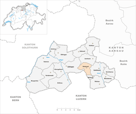
| Location of the municipality | |
  |
|
Bottenwil ( Swiss German ˌbɔtːəˈʋiːu ) is a municipality in the Swiss canton of Aargau . It belongs to the district of Zofingen , is located in the upper Uerkental and borders the canton of Lucerne .
geography
The village is located in a narrow valley on the upper reaches of the Uerke , with the valley floor nowhere wider than 250 meters. Bottenwil consists (from north to south) of the three districts Winkel, Eggen and Vorstatt, which have now grown together. At Eggen, the roughly one kilometer long Grabental branches off to the west, which is surrounded by the hills Eichstock ( 631 m above sea level ), Rottannhubel ( 657 m above sea level ) and Bottenstein ( 603 m above sea level ). At Winkel, the Sulbach valley branches off towards the southeast. The Buechwald hill ( 665 m above sea level ) rises between the Uerke and Sulbach valleys on the border with the canton of Lucerne .
The area of the municipality is 510 hectares , 212 hectares of which are forested and 51 hectares are built over. The highest point is at 665 meters in the Buechwald, the deepest is 470 meters on the Uerke. Neighboring communities are Zofingen in the west, Uerkheim in the north, Staffelbach in the east, Wiliberg in the southeast and the Lucerne community of Wikon in the southwest.
history
The Alamanni settled in the upper Uerkental in the 7th or 8th century. In 1189, Pope Clement III confirmed . the convent Muri possession in Botanwile ; this is the first written mention of the village. The place name is derived from the Old High German Botinwilari , which means "Hofsiedlung des Boto". Other landowners during the Middle Ages were the Einsiedeln monastery and the barons of Aarburg .

The village was under the rule of the Counts of Lenzburg , from 1173 on that of the Counts of Kyburg . After these died out, the Habsburgs took over sovereignty and blood jurisdiction in 1273 . The Muhenamt , a separate judicial district to which Bottenwil also belonged, was established around 1350 . The ruins of Burg Bottenstein (today located in the area of Zofingen ) rise above the village on a hill . This was built in the 13th century on behalf of the ministerial family of the same name . The castle was abandoned as early as the middle of the 15th century and fell into ruins, only the foundation walls of which have been preserved.
In 1415 the confederates conquered Aargau. Bottenwil now belonged to the subject area of the city of Bern , the so-called Berner Aargau . Until 1496, the lower jurisdiction lay with the city of Zofingen and then also came to Bern, whereupon Bottenwil was assigned to the judicial district of Kölliken in the Lenzburg district. In 1528 the Bernese introduced the Reformation .
In March 1798 the French took Switzerland, ousted the «Gracious Lords» of Bern and proclaimed the Helvetic Republic . Since then, Bottenwil has belonged to the canton of Aargau. The first school building was built there. Around the middle of the 19th century, the population reached its all-time high, but then fell continuously as many residents moved to the neighboring industrial centers or even emigrated overseas. By 1980 the population had decreased by almost a third. Since then, there has been a slight upward trend again.
Attractions
coat of arms
The blazon of the municipal coat of arms reads: "White crenellated wall with red and black grooves with a green fir tree." The coat of arms is shown for the first time on the municipal seal from 1811, in white on a green shield. In 1872 it appeared green on a blue shield over a green three-mountain. In 1965 the local council introduced the current version. The battlements from the coat of arms of the Lords of Bottenwil were taken as an additional symbol.
population
The population developed as follows:
| year | 1798 | 1850 | 1900 | 1930 | 1950 | 1960 | 1970 | 1980 | 1990 | 2000 | 2010 |
| Residents | 556 | 960 | 762 | 754 | 706 | 671 | 679 | 660 | 762 | 799 | 792 |
On December 31, 2019, 807 people lived in Bottenwil, the proportion of foreigners was 10.5%. In the 2015 census, 49.9% described themselves as Reformed and 13.5% as Roman Catholic ; 36.6% were non-denominational or of other faiths. In the 2000 census, 98.2% stated German as their main language.
Politics and law
The assembly of those entitled to vote, the municipal assembly , exercises legislative power. The executing authority is the five-member municipal council . He is elected by the people in the majority procedure, his term of office is four years. The parish council leads and represents the parish. To this end, it implements the resolutions of the municipal assembly and the tasks assigned to it by the canton. The District Court of Zofingen is primarily responsible for legal disputes . Bottenwil belongs to the XVI (Zofingen) judges' circle.
economy
According to the company structure statistics (STATENT) collected in 2015, there are around 200 jobs in Bottenwil, 30% of them in agriculture, 39% in industry and 31% in the service sector. Most of the employed are commuters and work in Zofingen or in the Aarau region .
traffic
Bottenwil is located off the main traffic axes at the end of canton road 317 to Kölliken . Other roads lead into Suhrental and Wiggertal . A bus line operated by the Limmat Bus company runs from Zofingen train station via Bottenwil to Schöftland .
education
The community has a school building with a kindergarten and primary school . All upper levels of the compulsory elementary school ( Realschule , Secondary School and District School ) can be attended in Zofingen . The closest grammar school is the Zofingen Cantonal School .
Personalities
- Hans Müller (1916–2013), entrepreneur
literature
- Andreas Steigmeier : Bottenwil. In: Historical Lexicon of Switzerland .
- Michael Stettler : The art monuments of the canton of Aargau . Ed .: Society for Swiss Art History . Volume I: The districts of Aarau, Kulm, Zofingen. Wiese Verlag, Basel 1948, DNB 366495623 .
Web links
Individual evidence
- ↑ Cantonal population statistics 2019. Department of Finance and Resources, Statistics Aargau, March 30, 2020, accessed on April 2, 2019 .
- ↑ Cantonal population statistics 2019. Department of Finance and Resources, Statistics Aargau, March 30, 2020, accessed on April 2, 2019 .
- ↑ a b Beat Zehnder: The community names of the canton of Aargau . In: Historical Society of the Canton of Aargau (Ed.): Argovia . tape 100 . Verlag Sauerländer, Aarau 1991, ISBN 3-7941-3122-3 , p. 101-102 .
- ^ National map of Switzerland, sheet 1109, Swisstopo.
- ↑ Standard area statistics - municipalities according to 4 main areas. Federal Statistical Office , November 26, 2018, accessed on May 28, 2019 .
- ^ Joseph Galliker, Marcel Giger: Municipal coat of arms of the Canton of Aargau . Lehrmittelverlag des Kantons Aargau, book 2004, ISBN 3-906738-07-8 , p. 127 .
- ↑ Population development in the municipalities of the Canton of Aargau since 1850. (Excel) In: Eidg. Volkszählung 2000. Statistics Aargau, 2001, archived from the original on October 8, 2018 ; accessed on May 28, 2019 .
- ↑ Resident population by religious affiliation, 2015. (Excel) In: Population and Households, Community Tables 2015. Statistics Aargau, accessed on May 28, 2019 .
- ↑ Swiss Federal Census 2000: Economic resident population by main language as well as by districts and municipalities. (Excel) Statistics Aargau, archived from the original on August 10, 2018 ; accessed on May 28, 2019 .
- ↑ circles of justice of the peace. Canton of Aargau, accessed on June 21, 2019 .
- ↑ Statistics of the corporate structure (STATENT). (Excel, 157 kB) Statistics Aargau, 2016, accessed on May 28, 2019 .
Aarburg | Bottenwil | Brittnau | Kirchleerau | Kölliken | Moosleerau | Murgenthal | Oftringen | Reitnau | Rothrist | Safenwil | Staffelbach | Strengelbach | Uerkheim | Vordemwald | Wiliberg | Zofingen
Former municipality: Attelwil | Balzenwil | Mühlethal | Riken | Wittwil
Canton of Aargau | Districts of the Canton of Aargau | Municipalities in the Canton of Aargau