
Oftringen
| Oftringen | |
|---|---|
 |
|
| State : |
|
| Canton : |
|
| District : | Zofingen |
| BFS no. : | 4280 |
| Postal code : | 4665 |
| UN / LOCODE : | CH OFT |
| Coordinates : | 636 535 / 240724 |
| Height : | 422 m above sea level M. |
| Height range : | 403–692 m above sea level M. |
| Area : | 12.85 km² |
| Residents: | 14,096 (December 31, 2019) |
| Population density : | 1097 inhabitants per km² |
|
Proportion of foreigners : (residents without citizenship ) |
36.9% (December 31, 2019) |
| Website: | www.oftringen.ch |
 Oftringen |
|
| Location of the municipality | |
  |
|
Oftringen ( Swiss German : ˈɔftrɪɡə ) is a municipality in the Swiss canton of Aargau . It belongs to the district of Zofingen , is located in the Wiggertal and borders the canton of Solothurn . With over 13,000 inhabitants, Oftringen is the fifth most populous municipality in the canton.
geography
The community extends over the eastern part of the Wigger plain. It has no actual center, but is a scattered settlement . The districts north of the motorway have merged with Aarburg . The Kreuzstrasse district was created at the intersection of the most important main roads in Switzerland (Zurich – Bern and Basel – Lucerne). To the north of this is the district of Schwarzhoor at the foot of the steep Engelberg ( 691 m above sea level ), which forms the natural border with the Aare valley between Olten and Aarau .
To the south of the motorway, a second settlement focus has arisen with the village of Küngoldingen (districts Bühnenberg, Ruhbank) and the district Wirtshüsli . Their buildings have grown together with those of Zofingen . The south-eastern part of the municipality consists of an elevated plain, which is surrounded in a semicircle by gently rising to moderately steep hills. The highest point of this chain of hills is the Hochwacht ( 654 m above sea level ). The Wigger forms the southwestern municipal boundary. At the same time, about three hundred meters further east, the Aarburger Mühletych flows through Kreuzstrasse . This is an artificial branch that was created at the beginning of the 16th century. It was used to drive mill wheels and a few centuries later as a hydropower supplier for industry.
The area of the municipality is 1285 hectares , of which 432 hectares are forested and 429 hectares are built over. The highest point is at 664 meters on the Säli, part of the Engelberg chain, the lowest at 405 meters on the Wigger. Neighboring communities are Safenwil in the east, Zofingen and Strengelbach in the south, Rothrist in the southwest, Aarburg in the northwest and the Solothurn communities Starrkirch-Wil , Dulliken and Walterswil in the north.
history
The area of Oftringen was settled around 10,000 years ago during the Mesolithic . The remains of a spacious estate date from Roman times . In the 7th century Alemannic immigrants founded a scattered settlement. Ofteringa is mentioned in a document for the first time in 893 in an application from the Fraumünster in Zurich . The place name comes from the Old High German Oftharingun , which means "among the people of Ofthar". The village of Küngoldingen was first mentioned in 1346 (as Kuinnolfingen ). In the Middle Ages, Oftringen was owned by the Counts of Frohburg , and later by the Habsburgs .
Küngoldingen belonged to the domain of the Counts of Lenzburg , from 1173 to that of the Counts of Kyburg . After these died out, the Habsburgs took over sovereignty and blood jurisdiction in 1273 . At that time there was the small Scherenberg Castle on the Sodhubel (district of Oftringen, bordering on Safenwil) , of which only the foundations have been preserved. From 1361 the village area of Küngoldingen also belonged to the Lords of Ifenthal .

The Lords of Ifenthal built the Alt-Wartburg on the Säli . It was destroyed in 1415 when the Swiss conquered Aargau. Oftringen was now in the subject area of the city of Bern , the so-called Berner Aargau . Administratively, the community belonged to the Aarburg Office , in spiritual matters it was subordinate to the Canon Monastery in Zofingen . In 1528 the Bernese introduced the Reformation . Oftringen built a first schoolhouse in 1663, and a second one in Küngoldingen around 1740. The French took Switzerland in March 1798, ended the rule of the «Gracious Lords» of Bern and proclaimed the Helvetic Republic . Since then, Oftringen has belonged to the canton of Aargau.
For centuries, Oftringen was shaped by agriculture and the small businesses closely related to it. However , this changed with industrialization in the 19th century. Especially after the opening of the Aarau - Olten - Emmenbrücke railway line on June 9, 1856 and the line to Herzogenbuchsee on March 16, 1857, numerous industrial companies settled in and benefited from the favorable traffic situation. Oftringen has had its own parish only since 1920, the first church was built in 1933. The construction of the motorways further boosted growth. Especially in the boom between 1950 and 1970 the village grew very strongly. During the economic crisis of the 1970s stagnation prevailed, since 1980 the population has increased again slightly. The 10,000 mark was exceeded in December 1995. From 1974, Oftringen owned a local parliament, which was abolished in a referendum in 1989.
Attractions


On the Säli, a side peak of Engelberg, is the Alt-Wartburg , a castle that was destroyed in 1415 and only ruins remain. The Kreuzstrasse district is characterized by town houses that were built at the end of the 18th century in a classical style. Oftringen did not get its own church until 1933/34; the most striking feature of this building is the distinctive stiletto-shaped steeple.
From the ruins of Scherenberg near Küngoldingen only a few remains of the wall and a now almost collapsed well (including underground passages that have long been buried) are left, but the animal and other wall reliefs in the immediate vicinity are worth seeing, which were a "dropout" at the beginning of the 20th century chiseled into the sandstone walls. The Oftringen local museum is well worth seeing. It consists of two buildings, the "Old Lion" and the "Hochstudhaus". The high-rise shows rural life and work (equipment and tools). In the Old Lion, the second oldest stone house in the village, you can see temporary exhibitions on village life and history. New special exhibitions take place every year.

Local museum

Village school house in the old village center

Realschule building

Secondary school house
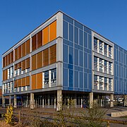
District schoolhouse


coat of arms
The blazon of the municipal coat of arms reads: "In blue three (2.1) rising white crescent moons." The three crescent moons were depicted on the community seal as early as 1811, but with their faces and above a green mountain of three . The coat of arms was derived from that of the Lords of Ofteringen from the Wutach Valley , and it was associated with Oftringen as early as 1621. In 1953 the faces and the three mountain were left out.
population
The population developed as follows:
| year | 1764 | 1850 | 1900 | 1930 | 1950 | 1960 | 1970 | 1980 | 1990 | 2000 | 2010 | 2016 |
| Residents | 884 | 2,584 | 3,247 | 4,212 | 5,350 | 7,731 | 9,189 | 9,006 | 9,883 | 10,243 | 12,326 | 13,483 |
On December 31, 2019, 14,096 people lived in Oftringen, the proportion of foreigners was 36.9%. In the 2015 census, 25.6% described themselves as Reformed and 24.7% as Roman Catholic ; 49.7% were non-denominational or of other faiths. In the 2000 census, 81.4% had German as their main language, 5.4% Italian , 3.7% Serbo-Croatian , 2.5% Albanian , 1.8% Turkish , 1.1% Portuguese , 1.0% Spanish and 0.7% French .
Politics and law
The assembly of those entitled to vote, the municipal assembly , exercises legislative power. The executing authority is the five-member municipal council . He is elected by the people in the majority procedure, his term of office is four years. The parish council leads and represents the parish. To this end, it implements the resolutions of the municipal assembly and the tasks assigned to it by the canton.
The five municipal councils for the 2018–2021 term are:
- Hanspeter Schläfli ( FDP ), mayor
- Markus Steiner ( SP ), Vice-Minister
- Werner Amsler (Pro Oftringen)
- Werner Rudin (FDP)
- Ruth Stauch (independent)
The District Court of Zofingen is primarily responsible for legal disputes . Oftringen belongs to the Peace Judge Circle XV (Rothrist).
In the Swiss parliamentary elections 2019, the proportion of voters in Oftigen was: SVP 33.5%, SP 19.3%, FDP 12.2%, Greens 7.7%, glp 7.4%, EPP 6.8%, CVP 6, 3%, BDP 3.1%, EDU 1.4%, Team 65+ 1.2%.
Oftringen introduced the residents' council in 1974 , but abolished it in 1989 and returned to the "proper community organization" with community assembly. An attempt to reintroduce it failed in 2015.
economy
According to the company structure statistics (STATENT) collected in 2015, Oftringen has around 5,250 jobs, of which 2% are in agriculture, 26% in industry and 72% in the service sector. Due to the ideal location next to the motorway, numerous service companies have settled. The best-known industrial company is Omya (fillers and pigments), whose headquarters are in Oftringen. Senn AG is active in steel and metal construction. There are three shopping centers, the eo-Tychboden shopping center, the Perry-Center (in Aarburg municipality) and the Center a1 . Many employees are commuters and work in Zofingen or Olten .
traffic

Oftringen is extremely conveniently located next to the Wiggertal motorway triangle, where the A2 meets the A1 . In the Kreuzstrasse district, the two most important main roads in Switzerland cross, Hauptstrasse 1 from Zurich to Bern and Hauptstrasse 2 from Basel to Lucerne .
The SBB train station in Aarburg-Oftringen is on the municipal boundary; regional trains run to Olten , Langenthal and Lucerne . The district of Küngoldingen has its own train station on the Zofingen − Lenzburg railway line . Three bus routes operated by the Limmat Bus company provide access to the municipality; between Zofingen and Aarburg, from Trimbach via the Olten and Aarburg to the Center a1 and from Zofingen via Rothrist to Murgenthal . On weekends there is a night bus from Olten via Oftringen and Zofingen to Vordemwald .
education
The community has five kindergartens and six schoolhouses in which all levels of compulsory elementary school can be attended ( primary school , secondary school , secondary school and district school ). The closest grammar school is the Zofingen Cantonal School .
Personalities
- Natascha Badmann (* 1966), triathlete
- Barbara Balzan (* 1969), jazz singer
- Walter Glur (* 1943), politician
- Paul Haupt (1889–1978), publisher
- Markus Hottiger (* 1958), teacher, composer, founder and director of Adonia
- Arnold Lang (1855-1914), zoologist
- Erich Ritter (* 1958), biologist
- Max Widmer (1933–2010), wrestler and wrestler
- Jacob Wothly (1823–1873), photography pioneer
- Jakob Zimmerli (1863–1940), politician

literature
- Christian Lüthi: Oftringen. In: Historical Lexicon of Switzerland .
- Michael Stettler : The art monuments of the canton of Aargau . Ed .: Society for Swiss Art History . Volume I: The districts of Aarau, Kulm, Zofingen. Wiese Verlag, Basel 1948, DNB 366495623 .
- Martin Eich: Oftringen then and now . Small chronicle of the community. Oftringen municipality, Oftringen 1957.
- Annelies Hüssy: Oftringen . The story of a village for the anniversary in 1993 [on behalf of the Oftringen municipal council]. Ed .: Municipality of Oftringen. Residential community, Oftringen 1993.
- Franz Oswald, Peter Baccini , Mark Michaeli: Netzstadt . Introduction to urban design. Birkhäuser, Basel 2003, ISBN 3-7643-6962-0 (urban development theory, explanation of the Netzstadt using the example of the "Stadt an der Wigger", consisting of Aarburg, Oftringen, Rothrist, Strengelbach and Zofingen).
- Stefan Suter: Chronicle of the water and electricity supply Oftringen . The water 1905–1989; The stream 1914–1989; Commemorative publication for the 75th anniversary of the Oftringen municipal enterprise. Municipal enterprises, Oftringen 1989.
Web links
Individual evidence
- ↑ Cantonal population statistics 2019. Department of Finance and Resources, Statistics Aargau, March 30, 2020, accessed on April 2, 2019 .
- ↑ Cantonal population statistics 2019. Department of Finance and Resources, Statistics Aargau, March 30, 2020, accessed on April 2, 2019 .
- ↑ a b Beat Zehnder: The community names of the canton of Aargau . In: Historical Society of the Canton of Aargau (Ed.): Argovia . tape 100 . Verlag Sauerländer, Aarau 1991, ISBN 3-7941-3122-3 , p. 336-337 .
- ↑ a b National map of Switzerland, sheets 1108 and 1109, Swisstopo.
- ↑ Standard area statistics - municipalities according to 4 main areas. Federal Statistical Office , November 26, 2018, accessed on May 29, 2019 .
- ^ Joseph Galliker, Marcel Giger: Municipal coat of arms of the Canton of Aargau . Lehrmittelverlag des Kantons Aargau, book 2004, ISBN 3-906738-07-8 , p. 244 .
- ↑ Population development in the municipalities of the Canton of Aargau since 1850. (Excel) In: Eidg. Volkszählung 2000. Statistics Aargau, 2001, archived from the original on October 8, 2018 ; accessed on May 29, 2019 .
- ↑ Resident population by religious affiliation, 2015. (Excel) In: Population and Households, Community Tables 2015. Statistics Aargau, accessed on May 29, 2019 .
- ↑ Swiss Federal Census 2000: Economic resident population by main language as well as by districts and municipalities. (Excel) Statistics Aargau, archived from the original on August 10, 2018 ; accessed on May 29, 2019 .
- ↑ circles of justice of the peace. Canton of Aargau, accessed on June 21, 2019 .
- ^ Federal Statistical Office : NR - Results parties (municipalities) (INT1). In: Federal Elections 2019 | opendata.swiss. August 8, 2019, accessed August 1, 2020 .
- ↑ Results of the National Council elections 2019 - Canton Aargau. Retrieved August 2, 2020 .
- ↑ Urs Hofmann : The residents' council: loss of democracy or gain in democracy? (PDF, 62 kB) Department of Economics and Home Affairs, March 14, 2016, accessed on June 27, 2019 .
- ↑ Statistics of the corporate structure (STATENT). (Excel, 157 kB) Statistics Aargau, 2016, accessed on May 29, 2019 .
Aarburg | Bottenwil | Brittnau | Kirchleerau | Kölliken | Moosleerau | Murgenthal | Oftringen | Reitnau | Rothrist | Safenwil | Staffelbach | Strengelbach | Uerkheim | Vordemwald | Wiliberg | Zofingen
Former municipality: Attelwil | Balzenwil | Mühlethal | Riken | Wittwil
Canton of Aargau | Districts of the Canton of Aargau | Municipalities in the Canton of Aargau