
Wiliberg
| Wiliberg | |
|---|---|
 |
|
| State : |
|
| Canton : |
|
| District : | Zofingen |
| BFS no. : | 4288 |
| Postal code : | 5058 |
| Coordinates : | 644 104 / 235474 |
| Height : | 652 m above sea level M. |
| Height range : | 514–684 m above sea level M. |
| Area : | 1.17 km² |
| Residents: | 163 (December 31, 2019) |
| Population density : | 139 inhabitants per km² |
|
Proportion of foreigners : (residents without citizenship ) |
3.1% (December 31, 2019) |
| Website: | www.wiliberg.ch |
 View from Reidermoos to Wiliberg |
|
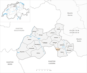
| Location of the municipality | |
  |
|
Wiliberg ( Swiss German : ˈʋiːlibærɡ ) is a municipality in the Swiss canton of Aargau . It belongs to the district of Zofingen , is located in the upper Uerkental and borders the canton of Lucerne . Wiliberg is the fourth smallest municipality in terms of area and the smallest municipality in terms of population.
geography
The community is located on a short side valley east of the Uerke . This stream, flowing in a north-westerly direction, also forms the border with the canton of Lucerne. The steeply rising side valley merges into a small plateau in the east. There are two main settlements, the village of Wiliberg on the edge of the plateau and the Buechacker district on the southern slope of the Buechwald. The Hinterwiliberg and Sacher farms are located in another side valley on the southern border of the municipality.
The area of the municipality is 117 hectares , of which 21 hectares are forested and 14 hectares are built over. The highest point is at 685 meters on the plateau, the lowest at 520 meters on the Uerke. Neighboring communities are Bottenwil in the north, Staffelbach in the northeast, Reitnau in the southeast and the Lucerne communities Reiden in the southwest and Wikon in the west.
history

Wileberch was first mentioned in a document in 1160 in the Acta Murensia of the Muri monastery . The place name can be derived from the Old High German Wilinberg and means «mountain (settlement) des Wilo». In the Middle Ages the village was under the rule of the Counts of Kyburg . After these had died out in 1273, the Habsburgs took over sovereignty and blood jurisdiction . In 1251, citizens of the city of Zofingen sold the lower jurisdiction to Engelberg Abbey . Around 1350 the Muhenamt , a separate judicial district to which Wiliberg also belonged, was established. In 1415 the confederates conquered Aargau. Wiliberg now belonged to the subject area of the city of Bern , the so-called Bernese Aargau . In 1528 the Bernese introduced the Reformation .
For centuries, Wiliberg was an autonomous Steckhof . When the Bernese dissolved all the Steckhöfe in the Landvogtei Lenzburg area in 1751, Wiliberg was forgotten for unknown reasons. This put the residents in a difficult position, as they no longer belonged anywhere. The recognition as an independent community only took place on January 16, 1781 after several petitions. In March 1798 the French took Switzerland, ousted the «Gracious Lords» of Bern and proclaimed the Helvetic Republic . Since then, the community has belonged to the canton of Aargau. Because of its remoteness, Wiliberg has hardly grown since then, so that agriculture still plays a dominant role today.
coat of arms
The blazon of the municipal coat of arms reads: "Divided by white with a blue grape on a green vine with two leaves and by blue with half a yellow mill wheel." The coat of arms first appeared on the municipal seal in 1811 and is intended to symbolize the two main families of the village, the millers and the Lässer (grape harvesters). Until 1966 the grapevine was drawn smaller and stood on a green three-hill.
population
The population developed as follows:
| year | 1850 | 1900 | 1930 | 1950 | 1960 | 1970 | 1980 | 1990 | 2000 | 2010 |
| Residents | 197 | 133 | 127 | 155 | 137 | 114 | 127 | 148 | 151 | 155 |
On December 31, 2019, 163 people lived in Wiliberg, the proportion of foreigners was 3.1%. In the 2015 census, 65.3% described themselves as Reformed and 15.0% as Roman Catholic ; 19.7% were non-denominational or of another faith. In the 2000 census, all residents named German as their main language.
Politics and law
The assembly of those entitled to vote, the municipal assembly , exercises legislative power. The executing authority is the five-member municipal council . He is elected by the people in the majority procedure, his term of office is four years. The parish council leads and represents the parish. To this end, it implements the resolutions of the municipal assembly and the tasks assigned to it by the canton. The District Court of Zofingen is primarily responsible for legal disputes . Wiliberg belongs to the Peace Judges' Circle XVI (Zofingen).
economy
According to the corporate structure statistics (STATENT) collected in 2015, there are around 30 jobs in Wiliberg, 50% of them in agriculture and in the service sector. Most of the employed are commuters and work in the Zofingen or Aarau regions .
traffic
Wiliberg is far away from the traffic axes and can be reached via side roads from the Suhrental and Wiggertal . There is no connection to the public transport network, a bus line to Zofingen was discontinued in 2008.
education
The community has a primary school , the kindergarten is in Reitnau . Due to the lower number of pupils, the village school should actually have been closed, but in 2011 the Wannenhof private school took over the building and the local children attend classes together with private students from abroad. The secondary school and the Realschule can be attended in Reitnau or Staffelbach , the district school in Schöftland . The closest grammar school is the Zofingen Cantonal School .
literature
- Christian Lüthi: Wiliberg. In: Historical Lexicon of Switzerland .
- Michael Stettler : The art monuments of the canton of Aargau . Ed .: Society for Swiss Art History . Volume I: The districts of Aarau, Kulm, Zofingen. Wiese Verlag, Basel 1948, DNB 366495623 .
Web links
Individual evidence
- ↑ Cantonal population statistics 2019. Department of Finance and Resources, Statistics Aargau, March 30, 2020, accessed on April 2, 2019 .
- ↑ Cantonal population statistics 2019. Department of Finance and Resources, Statistics Aargau, March 30, 2020, accessed on April 2, 2019 .
- ↑ a b Beat Zehnder: The community names of the canton of Aargau . In: Historical Society of the Canton of Aargau (Ed.): Argovia . tape 100 . Verlag Sauerländer, Aarau 1991, ISBN 3-7941-3122-3 , p. 466-467 .
- ^ National map of Switzerland, sheet 1109, Swisstopo.
- ↑ Standard area statistics - municipalities according to 4 main areas. Federal Statistical Office , November 26, 2018, accessed on May 28, 2019 .
- ^ Joseph Galliker, Marcel Giger: Municipal coat of arms of the Canton of Aargau . Lehrmittelverlag des Kantons Aargau, book 2004, ISBN 3-906738-07-8 , p. 315 .
- ↑ Population development in the municipalities of the Canton of Aargau since 1850. (Excel) In: Eidg. Volkszählung 2000. Statistics Aargau, 2001, archived from the original on October 8, 2018 ; accessed on May 28, 2019 .
- ↑ Resident population by religious affiliation, 2015. (Excel) In: Population and Households, Community Tables 2015. Statistics Aargau, accessed on May 28, 2019 .
- ↑ Swiss Federal Census 2000: Economic resident population by main language as well as by districts and municipalities. (Excel) Statistics Aargau, archived from the original on August 10, 2018 ; accessed on May 28, 2019 .
- ↑ circles of justice of the peace. Canton of Aargau, accessed on June 21, 2019 .
- ↑ Statistics of the corporate structure (STATENT). (Excel, 157 kB) Statistics Aargau, 2016, accessed on May 28, 2019 .
- ↑ Location portrait. Wiliberg community, accessed on May 28, 2019 .
Aarburg | Bottenwil | Brittnau | Kirchleerau | Kölliken | Moosleerau | Murgenthal | Oftringen | Reitnau | Rothrist | Safenwil | Staffelbach | Strengelbach | Uerkheim | Vordemwald | Wiliberg | Zofingen
Former municipality: Attelwil | Balzenwil | Mühlethal | Riken | Wittwil
Canton of Aargau | Districts of the Canton of Aargau | Municipalities in the Canton of Aargau