
Walterswil SO
| SO is the abbreviation for the canton of Solothurn in Switzerland and is used to avoid confusion with other entries of the name Walterswil . |
| Walterswil | |
|---|---|
 |
|
| State : |
|
| Canton : |
|
| District : | Olten |
| BFS no. : | 2585 |
| Postal code : | 5746 |
| Coordinates : | 639 496 / 241856 |
| Height : | 465 m above sea level M. |
| Height range : | 432–663 m above sea level M. |
| Area : | 4.48 km² |
| Residents: | 724 (December 31, 2018) |
| Population density : | 162 inhabitants per km² |
| Website: | www.walterswil.ch |
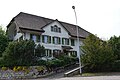
 Walterswil, view from the south |
|
| Location of the municipality | |
  |
|
Walterswil is a municipality in the Olten district in the canton of Solothurn in Switzerland .
geography
Walterswil lies at 465 m above sea level. M. , 5 km southeast of the district capital Olten (air line). The village is located in a basin at the southern foot of the angel mountain and at the outlet of Mattetals in the valley floor of Safenwil in the Swiss Plateau .
The area of the 4.5 km² municipal area covers a section of the eastern Solothurn Mittelland. The southern border runs along the motorway and the stream flowing parallel to it, which drains the area to the west to the Aare . From the Safenwil valley basin, the municipality extends northward over the relatively gently sloping slopes of Walterswil and Rothacker to the Engelberg range. At 660 m above sea level M. , the highest point in Walterswil is reached on the edge of the Engelberg plateau. The eastern continuation of the Engelberg, simply called the mountain ( 610 m above sea level ), also belongs to the municipality. The eastern municipality is located in the catchment area of the short side stream that flows into the Aare near Gretzenbach. In 1997, 9% of the municipal area was accounted for by settlements, 37% for forests and woodlands and 54% for agriculture.
The municipality of Walterswil consists of three parts of the settlement:
- Walterswil ( 465 m above sea level ) at the southern foot of the Engelberg
- Rothacker ( 542 m above sea level ) in a location with great views on a south-east facing slope above the Safenwil hollow; largest settlement in the municipality
- Hennebühl ( 500 m above sea level ), a hamlet on the eastern slope of the mountain
Furthermore, some individual farms also belong to the community. The neighboring communities of Walterswil are Dulliken , Däniken and Gretzenbach in the canton of Solothurn and Safenwil and Oftringen in the canton of Aargau .
population
With 724 inhabitants (as of December 31, 2018), Walterswil is one of the smaller communities in the canton of Solothurn. 98.3% of the residents are German-speaking, 0.3% French-speaking and 0.3% speak English (as of 2000). The population of Walterswil was 448 in 1850 and 430 in 1900. In the course of the 20th century the population always fluctuated between 500 and 600 inhabitants. Only since 1980 (547 inhabitants) has a significant increase in population been recorded.
economy
Until well into the 20th century, Walterswil was predominantly an agricultural community. Even today, agriculture , fruit growing , cattle breeding and forestry have an important place in the income structure of the population. Further jobs are available in local small businesses and in the service sector, including in an electrical engineering company and in a painting business. In the last few decades Walterswil has developed into a residential community. Many employed people are therefore commuters who mainly work in the regions of Zofingen , Olten and Aarau .
traffic
The community is quite well developed in terms of transport, although it is located off the main thoroughfares on a connecting road from Oftringen to Däniken . The nearest connection to the A1 motorway (Bern-Zurich) is around 4 km from the town center. On September 6, 1877, the railway line from Suhr to Zofingen with the Walterswil-Striegel station just outside the municipality south of the motorway was put into operation.
history
The place was first mentioned in a document in 1257 under the name Walderswile . The place name means the homestead of Walthari . Walterswil has been under the rule of Gösgen since the Middle Ages . Thomas von Falkenstein had to sell the rulership, which had been under Habsburg suzerainty, to Solothurn in 1458. Walterswil was assigned to the Bailiwick of Gösgen and in 1623 came to the newly founded Schultheissenamt Olten. After the collapse of the Ancien Régime (1798), Walterswil belonged to the Solothurn administrative district during the Helvetic Republic and to the Olten district from 1803.
Attractions


Walterswil had a chapel since 1275; today's St. Jakob chapel was built in 1733. The parish village after the Reformation after Gretzenbach became an independent parish in 1840. The parish church of Sankt Joseph is located in Rothacker, was inaugurated in 1839 and has remarkable stucco work and rich furnishings .
coat of arms
- Divided by red and white, covered by a diagonal bar in alternating colors; below right a green, brown-branched juniper branch with three black fruits
Personalities
- Max Widmer (1933–2010), wrestler and wrestler
Web links
- Website of the municipality of Walterswil
- Aerial view of the village
- Hans Brunner: Walterswil (SO). In: Historical Lexicon of Switzerland .
Individual evidence
- ↑ Permanent and non-permanent resident population by year, canton, district, municipality, population type and gender (permanent resident population). In: bfs. admin.ch . Federal Statistical Office (FSO), August 31, 2019, accessed on December 22, 2019 .
photos
Restaurant sun

village street


Boningen |
Däniken |
Dulliken |
Eppenberg-Wöschnau |
Fulenbach |
Gretzenbach |
Gunzgen |
Hägendorf |
Kappel |
Olten |
Rickenbach |
Schönenwerd |
Starrkirch-Wil |
Walterswil |
Wangen near Olten
Former parishes: Grod
Canton of Solothurn | Districts of the Canton of Solothurn | Municipalities of the Canton of Solothurn