Olten district
| Olten district | |
|---|---|
| Basic data | |
| Country: |
|
| Canton : |
|
| Main town : | Olten |
| FSO number : | 1108 |
| Area : | 80.57 km² |
| Height range : | 363–1122 m above sea level M. |
| Residents: | 55,372 (December 31, 2018) |
| Population density : | 687 inhabitants per km² |
| map | |
The Olten district in the canton of Solothurn extends to the city and surroundings of Olten . He belongs to the Olten-Gösgen office .
coat of arms
-
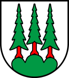
In silver, green three mountain with three green, red-stemmed fir trees
- The city and district of Olten use the same coat of arms.
Municipalities
| coat of arms | Name of the parish | Population (December 31, 2018) |
Area in km² |
Inhabitants per km² |
|---|---|---|---|---|
|
|
Boningen | 772 | 2.76 | 280 |
|
|
Daniken | 2851 | 5.43 | 525 |
|
|
Dulliken | 5048 | 6.04 | 836 |
|
|
Eppenberg-Wöschnau | 330 | 1.81 | 182 |
|
|
Fulenbach | 1777 | 4.48 | 397 |
|
|
Gretzenbach | 2784 | 5.83 | 478 |
|
|
Gunzgen | 1652 | 3.93 | 420 |
|
|
Hägendorf | 5138 | 13.94 | 369 |
|
|
Kappel (SO) | 3239 | 5.10 | 635 |
|
|
Olten | 18,363 | 11.49 | 1598 |
|
|
Rickenbach (SO) | 1012 | 2.76 | 367 |
|
|
Schönwerd | 4911 | 3.71 | 1324 |
|
|
Starrkirch-Wil | 1714 | 1.85 | 926 |
|
|
Walterswil (SO) | 724 | 4.48 | 162 |
|
|
Wangen near Olten | 5057 | 6.96 | 727 |
| Total (15) | 55,372 | 80.57 | 687 | |
Changes in the community
- 1973: Merger of Gretzenbach and Grod → Gretzenbach
Web links
Commons : Olten - collection of images, videos and audio files
Individual evidence
- ↑ Permanent and non-permanent resident population by year, canton, district, municipality, population type and gender (permanent resident population). In: bfs. admin.ch . Federal Statistical Office (FSO), August 31, 2019, accessed on December 22, 2019 .
- ↑ Federal Statistical Office Generalized Limits 2020.


