
Graenichen
| Graenichen | |
|---|---|
 |
|
| State : |
|
| Canton : |
|
| District : | Aarau |
| BFS no. : | 4006 |
| Postal code : | 5722 |
| UN / LOCODE : | CH GNI |
| Coordinates : | 649 876 / 245641 |
| Height : | 410 m above sea level M. |
| Height range : | 399–631 m above sea level M. |
| Area : | 17.23 km² |
| Residents: | 7987 (December 31, 2019) |
| Population density : | 464 inhabitants per km² |
|
Proportion of foreigners : (residents without citizenship ) |
22.0% (December 31, 2019) |
| Website: | www.graenichen.ch |
 View over the village |
|
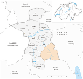
| Location of the municipality | |
  |
|
Gränichen ( Swiss German : older ˈɡrɛːniχə , younger ˈɡræːnəχə ) is a municipality in the Swiss canton of Aargau . It belongs to the Aarau district and is located in the Wynental . With over 17 square kilometers, it is the sixth largest municipality in the canton in terms of area.
geography
The Wyna flows first in a northerly direction, then in a north-westerly direction, with the valley floor being an average of five hundred meters wide. On both sides there are strongly structured ranges of hills with steep slopes and small plateaus, the protruding hills are separated from each other by short side valleys. The shape of the landscape is strongly reminiscent of the Tabular Jura , even if the area is geographically and geologically part of the Central Plateau.
The hills on the left side of the valley are (from north to south) the Manzenberg ( 524 m above sea level ), the Wällenen (559 m), the Moosberg (550 m), the Heidberg ( 566 m above sea level ) and the Pfendel ( 615 m above sea level ). These five hills are foothills of the Schornig ( 596 m above sea level ), which forms the transition to the Suhrental . The hills on the right side of the valley are called Fuden ( 570 m above sea level ), Räckholderen ( 566 m above sea level ), Breitenberg ( 551 m above sea level ) and Surberg ( 607 m above sea level ). In front of the Breitenberg is the almost elliptical Schulthess ( 513 m above sea level ). In front of the Surberg are the Dossen ( 532 m above sea level ) and the Liebegg plateau. There are three small hamlets near the southern border of the municipality: Rütihof ( 585 m above sea level ) on the plateau at the western end of the Moorberg, Bleien ( 430 m above sea level ) in the valley floor and Refental (490 m) in a side valley between Breitenberg , Dossen and Surberg.
The area of the municipality is 1723 hectares , of which 992 hectares are forested and 260 hectares are built over. The highest point is at 615 meters on the Pfendel, the lowest at 402 meters on the Wyna. Neighboring communities are Suhr in the northwest, Hunzenschwil in the north, Schafisheim in the northeast, Seon in the east, Teufenthal in the southeast, Unterkulm in the south, Muhen in the southwest and Oberentfelden in the west. The southeastern border point is the Siebenzwingstein .
history
The area around today's village was already populated during the Neolithic Age. Structures of a Bronze Age village were uncovered in 2017. On the Burghalde, a small protruding hill directly at the village center, there was a Helvetian refuge . Roman settlements can be found in various places . There was an estate in the Muracher / Kirchenfeld area that was excavated in 1854 (one of the earliest archaeological investigations ordered by the cantonal government). The complex, which had a hypocaust , was inhabited from the early 1st to the late 3rd century.
The first written mention of Cranechon was in 1184. The place name comes from the Latin granica and means "granary". From this the Old High German grenichon developed . In the Middle Ages the village belonged to Engelberg Monastery , as a fief of the Counts of Lenzburg , and later the Counts of Kyburg . The Counts of Habsburg-Laufenburg (a side line of the Habsburgs ) left the fiefdom to the Lords of Liebegg in 1270, after whom Liebegg Castle is named. From 1306, the main line of the Habsburgs had lower and blood jurisdiction .

In 1415 the Swiss conquered the Aargau and Gränichen was henceforth part of the subject area of the city of Bern , the so-called Bernese Aargau . The village was part of the Lenzburg district and was the seat of a subordinate and its own court. The Bernese introduced the Reformation in 1528 . There was a school since the second half of the 16th century. In 1596, the local community acquired most of the forest from the Liebegger lords of the castle, and today it is the third largest forest owner in the canton. In March 1798 the French took Switzerland, ousted the «Gracious Lords» of Bern and proclaimed the Helvetic Republic . Since then, Gränichen has belonged to the canton of Aargau.
The Gränich farms were below average and the village was a typical Tauner settlement . For this reason, the pre-industrial trade found its way early. Among other things, there were mills, blacksmiths, a grater, oil trotting and tobacco pounding. In the middle of the 19th century, Gränichen was the second most populous municipality in the canton of Aargau after Aarau and Zofingen . However, the rapid population growth has resulted in widespread poverty, so that many residents are forced to emigrate overseas. The Wynentalbahn began operations on March 5, 1904, which made it possible for industrial companies to settle in there . Over time, Gränichen transformed into an agglomeration municipality of Aarau, since 1900 the number of inhabitants has increased by more than two and a half times.
Attractions

Liebegg Castle stands on a hilltop three kilometers south-southeast of the village center, just under two hundred meters from the edge of the village of Teufenthal . The castle, which dates back to the 11th century and was first mentioned in 1241, is owned by the canton and today serves as a conference and cultural center. Since 2018 it has been the location of the Witch Museum Switzerland .
In the center of the village is the choir building , built in 1695 , which looks like a small castle with the attached turret. It served as a granary until 1798 and then stood empty for half a century. Later it served as a school building and for more than a hundred years as the seat of the local government. Since 1995 it has been the location of the village museum.
The reformed church , which was built from 1661 to 1663 instead of the collapsed previous building, replaced a dilapidated previous building elsewhere from 1473; The site manager was foreman Abraham Dünz . The rectangular building, built in the late Gothic style, is considered the main work of Protestant church building in Aargau. The former ossuary , a two-storey wall structure, was built around 1470. Also worth seeing is the listed Untervogthaus .
coat of arms
The blazon of the municipal coat of arms reads: "Three times obliquely divided by yellow and blue." The coat of arms first depicted on the municipal seal in 1811 is modeled on that of the barons of Grenchen , although historically there is no connection.
population

The population developed as follows:
| year | 1560 | 1764 | 1803 | 1850 | 1900 | 1930 | 1950 | 1960 | 1970 | 1980 | 1990 | 2000 | 2010 |
| Residents | about 250 | 1,226 | 1,897 | 3,038 | 2,771 | 3,459 | 3,727 | 4,411 | 5,298 | 5'246 | 5,772 | 6'115 | 6,711 |
On December 31, 2019, 7,987 people lived in Gränichen, the proportion of foreigners was 22%. In the 2015 census, 40.9% described themselves as Reformed and 20.4% as Roman Catholic ; 38.7% were non-denominational or of other faiths. In the 2000 census, 90.2% stated German as their main language, 4.1% Italian , 1.5% Albanian , 1.1% Serbo-Croatian and 0.7% Turkish .
Politics and law
The assembly of those entitled to vote, the municipal assembly , exercises legislative power. The executing authority is the five-member municipal council . He is elected by the people in the majority procedure, his term of office is four years. The parish council leads and represents the parish. To this end, it implements the resolutions of the municipal assembly and the tasks assigned to it by the canton. The Aarau District Court is the first instance responsible for legal disputes . Gränichen belongs to the Friedensrichterkreis II (Oberentfelden).
economy
According to the company structure statistics (STATENT) collected in 2015, Gränichen has around 2500 jobs, 3% of them in agriculture, 47% in industry and 50% in the service sector. Here is the Jowa , an operation of Migros , one of the largest metropolitan Bakeries Switzerland. There is also a leading radiator manufacturer ( Zehnder ), a transport company (Dreier), a gravel works and several medium-sized and small companies. Most of the employed are commuters and work in and around Aarau .
traffic
Gränichen is located on Hauptstrasse 23 , which runs from Aarau via Beromünster to Sursee . A side road leads to Seon in the Seetal , another via the Rütihof to Muhen in the Suhrental . The connection to the public transport network is provided by the Wynentalbahn between Aarau and Menziken . In addition to the Gränichen train station, there are three stops: Töndler, Oberdorf and Bleien. Until 1985, the railway line ran right next to the main road, but was then relocated by about a hundred meters and now runs along the banks of the Wyna . On weekends there is a night bus from Aarau through the Wynental to Menziken.
Education and Research
The community has four kindergartens and four schoolhouses in which the primary school , the junior high school and the secondary school are taught. The district school can be attended in Suhr . The cantonal agricultural vocational school, which opened in 1958, is located next to Liebegg Castle. The closest grammar schools are the Alte Kantonsschule and the Neue Kantonsschule , both in Aarau .
The Lead Observatory of the ETH Zurich is located in the Bleien district . It was put into operation in 1979 and is used to receive cosmic radio waves.
Open Air Gränichen

The Open Air Gränichen is a two-day open-air festival that has been held annually since 1995 in August. It was able to secure a permanent place in the hardcore, punk and metalcore scene. Every year around 4,000 visitors are counted. The Open Air Gränichen is a non-profit organization, i. H. all 450 employees and the entire organizational team work on a voluntary basis.
Personalities
- Werner Arber (* 1929), Nobel Prize Winner Medicine 1978
- Urs Bitterli (* 1935), historian
- Adolf Läuppi (1906–1974), racing cyclist
- Bernhard Lehner (* 1953), film editor, cameraman and university professor
- Freddy Nock (* 1964), high wire artist
- Adolf Richner (1908–1982), politician
- Hans Schaffner (1908–2004), Federal Council 1961 to 1969
- Hans Schmid (1917–1976), chemist
- Franz Suter (1890–1914), racing cyclist
- Heiri Suter (1899–1978), racing cyclist
- Hugo Suter (1943–2013), artist
- Paul Suter (1892–1966), racing cyclist
- Max Suter (1895–1936), racing cyclist
- Max Widmer (1910–1991), painter, draftsman and illustrator
literature
- Franz Kretz: Graenichen. In: Historical Lexicon of Switzerland .
- Michael Stettler : The art monuments of the canton of Aargau . Ed .: Society for Swiss Art History . Volume I: The districts of Aarau, Kulm, Zofingen. Wiese Verlag, Basel 1948, DNB 366495623 .
- Markus Widmer-Dean: Gränicher village history. 2003.
- Franz Kretz: Give us our daily bread tomorrow too - the checkered life story of the Gränicher Kornhaus. 1995.
- Max Byland: Old Graenichen. Pictures from the village history. With a contribution by Eugen Widmer. Drawings by Arthur and Hans Byland. Selbst-Verlag, Buchs, 1942; 2nd expanded edition, Heimatvereinigung Gränichen, 1965.
Web links
Individual evidence
- ↑ Cantonal population statistics 2019. Department of Finance and Resources, Statistics Aargau, March 30, 2020, accessed on April 2, 2019 .
- ↑ Cantonal population statistics 2019. Department of Finance and Resources, Statistics Aargau, March 30, 2020, accessed on April 2, 2019 .
- ↑ a b Beat Zehnder: The community names of the canton of Aargau . In: Historical Society of the Canton of Aargau (Ed.): Argovia . tape 100 . Verlag Sauerländer, Aarau 1991, ISBN 3-7941-3122-3 , p. 180-181 .
- ↑ a b National map of Switzerland, sheet 1089, Swisstopo.
- ↑ Standard area statistics - municipalities according to 4 main areas. Federal Statistical Office , November 26, 2018, accessed on May 18, 2019 .
- ↑ Spectacular find: a village from the Bronze Age discovered in Aargau. Neue Zürcher Zeitung , November 15, 2017, accessed on November 16, 2017 .
- ^ Martin Hartmann, Hans Weber: The Romans in Aargau . Verlag Sauerländer, Aarau 1985, ISBN 3-7941-2539-8 , p. 171 .
- ↑ Liebegg Castle
- ^ Stettler: The art monuments of the Canton of Aargau, Volume I: The districts of Aarau, Kulm, Zofingen. Pp. 146-153.
- ^ Joseph Galliker, Marcel Giger: Municipal coat of arms of the Canton of Aargau . Lehrmittelverlag des Kantons Aargau, book 2004, ISBN 3-906738-07-8 , p. 167 .
- ↑ Population development in the municipalities of the Canton of Aargau since 1850. (Excel) In: Eidg. Volkszählung 2000. Statistics Aargau, 2001, archived from the original on October 8, 2018 ; accessed on May 18, 2019 .
- ↑ Resident population by religious affiliation, 2015. (Excel) In: Population and Households, Community Tables 2015. Statistics Aargau, accessed on May 18, 2019 .
- ↑ Swiss Federal Census 2000: Economic resident population by main language as well as by districts and municipalities. (Excel) Statistics Aargau, archived from the original on August 10, 2018 ; accessed on May 18, 2019 .
- ↑ circles of justice of the peace. Canton of Aargau, accessed on June 21, 2019 .
- ↑ Statistics of the corporate structure (STATENT). (Excel, 157 kB) Statistics Aargau, 2016, accessed on May 18, 2019 .
- ^ Agricultural vocational school
- ^ Website of the Open Air Gränichen
Aarau | Biberstein | Box | Densbueren | Erlinsbach | Gränichen | Hirschthal | Küttigen | Mooing | Oberentfelden | Suhr | Unterentfelden
Former municipality: Rohr
Canton of Aargau | Districts of the Canton of Aargau | Municipalities in the Canton of Aargau