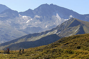
Kölnbreinspitze
| Kölnbreinspitze | ||
|---|---|---|
|
Kölnbreinspitze from the north (Riedingscharte) |
||
| height | 2934 m above sea level A. | |
| location | Carinthia and Salzburg , Austria | |
| Mountains | Ankogel Group | |
| Dominance | 3.7 km → Großer Hafner | |
| Notch height | 213 m ↓ Wastlkarscharte | |
| Coordinates | 47 ° 5 '33 " N , 13 ° 22' 49" E | |
|
|
||
| rock | Migmatite | |
| Age of the rock | Old Paleozoic | |
| First ascent | August 7, 1893 by Frido Kordon and Maurilius Mayr (tourist) | |
| Normal way | Northwest Ridge ( I ) | |
The Kölnbreinspitze is 2934 m above sea level. A. high mountain in the Ankogel group of the Hohe Tauern . It is located on the border between the Austrian federal states of Carinthia and Salzburg, east of the Kölnbreinsperre .
On August 8, 1893, Frido Kordon and Maurilius Mayr were the first tourists to reach Kölnbreinspitze via the northwest ridge. Today it can be reached from the Kölnbreinsperre toll parking lot ( 1928 m ). From there it goes over alpine pastures to the Katowice hut at 2360 m and from the hut in another three hours over the northwest ridge ( normal route ) to the summit.
Individual evidence
- ^ Journal of the German and Austrian Alpine Club , Volume XXVI, Graz 1895, pp. 211-223

