Cologne Rand Canal

The Cologne Rand Canal is an almost 20 kilometer long drainage canal that was built between 1954 and 1959. It runs along the southern and western Cologne city limits and flows into the Rhine near Cologne- Worringen . The canal is operated by a special purpose association in which industry and the neighboring municipalities are involved.
Intended use
The main purpose of the canal is to keep the Rhenish lignite mine near Frechen dewater. In addition, it supports the drainage of the Rhein-Erft district and takes in the treated wastewater from the sewage treatment plants in Pulheim , Frechen , Hürth and the Cologne districts of Esch , Auweiler, Pesch and Widdersdorf . The city of Dormagen and Ineos Cologne in Cologne-Worringen have direct discharge rights. The Southern edge channel takes today allersüdlichsten part of the old sewage treatment plant in Hermülheim only rain water in heavy rain on.
Clarified wastewater from the parts of Cologne further east and the Rhein-Erft district are discharged through the southern receiving water to the Rhine near Rodenkirchen . With the receiving water south, the sewage ring around the Cologne city area on the left bank of the Rhine is closed.
In addition to the discharge of treated wastewater from the municipalities in the Cologne Bay , the edge canal has been used again for flood protection on the Erft since it was renovated in 2010–2015 . A weir near the Kerpen district of Horrem-Götzenkirchen allows the Erftflut Canal to be partially dammed and the corresponding amounts of water to be diverted into the supply canals to the Götzenkirchen pumping station and through the Ville tunnel into the edge canal and thus into the Rhine.
Parts of the plant
The actual peripheral canal begins at the outlet of the Ville tunnel in Frechen-Königsdorf. It has a length of 19.68 km to its confluence with the Rhine near Cologne-Worringen (Rhine km 710.5), of which 2.24 km is an underground channel, the Worringen tunnel .
In 1956 and 1959, the southern edge channel that was south canal , from Lövenich to Hermülheim built in Cologne area partly underground. Today it is mostly dry in the southernmost part from the old to the new Hürth sewage treatment plant. A special purpose association exists for the maintenance of this part of the canal.
Design
The above-ground routes are made of concrete with a steep slope. Although these stretches are protected by a thick hedge on both sides, it happened again and again in strong currents that people or animals could not find their way out in an accident. There are therefore rescue ladders with swimmers under the bridges to be crossed.
Function as a recreational destination
Although the edge canal mostly runs above ground, its system with its steep, mostly straight concrete bed prevents ecological integration into the landscape. As part of the RegioGrün project of the Regionale 2010 , measures were carried out that were intended to help integrate the canal more closely into local recreation. For this purpose, the greening was upgraded, opportunities to stay were created and path connections were expanded.
Since 2012 there has been a signposted, continuous cycle path connection along the canal from Frechen-Königsdorf to Cologne-Worringen, which is provided with information boards at prominent places. At the mouth of the old harbor Worringer was mouth Park created, the u. a. is equipped with a "living room", a furniture made of bricks in the form of a sofa seating group. In addition, a steel “dining room” was built in 2013 at the entrance to the Worring tunnel as a resting place for cyclists. In the same year, the theme trail “Energy & Water” was created with 22 narrative stations and 3 anchor points, which also extends over the entire length of the edge canal.
Hydroelectric power plant

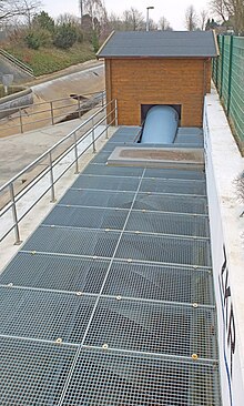
In May 2011 , a hydropower plant was put into operation at the canal crossing with Hugo-Junkers-Strasse in the Pulheim industrial park ( coordinates ), which uses a long hydropower screw according to the reverse Archimedean principle to generate 200,000 kWh of electricity per year from water dammed there in a retention basin , which is fed into the Rheinenergie network. The system should have amortized itself after 20 years. This is the only hydropower plant in the range of the districts and municipalities involved.
See also
Web links
- Zweckverband Kölner Randkanal
- Map of the Cologne canals on the website of the Cologne city drainage company (PDF file)
Individual evidence
- ↑ a b The development of the Cologne Rand Canal. Zweckverband Kölner Randkanal, accessed on July 14, 2018 .
- ↑ Werbekurier Wesseling: Pump station in Götzenkirchen renovated - Kerpen - Werbekurier Wesseling. Retrieved September 11, 2016 .
- ^ Regionale 2010. Zweckverband Kölner Randkanal, accessed on July 14, 2018 .
- ↑ Cologne Rand Canal cycle route. Zweckverband Kölner Randkanal, accessed on July 14, 2018 .
- ^ Maria Machnik: Randkanal: adventure trail takes shape. In: Kölner Stadt-Anzeiger. August 13, 2012, accessed July 14, 2018 .
- ↑ Old Port Estuary Park . Zweckverband Kölner Randkanal, accessed on July 14, 2018 .
- ↑ Sarah Sallen: New resting place for cyclists on the Rand Canal. In: NGZ online. October 9, 2013, accessed July 14, 2018 .
- ↑ Thematic Path Energy & Water. LEB Umweltberatung Zeese + Partner, accessed on July 14, 2018 .
- ↑ Dieter Wolf: Hydroelectric power station as an attraction , online in Kölnische Rundschau from May 20, 2011 (accessed April 27, 2017)
Coordinates: 50 ° 59 ′ N , 6 ° 49 ′ E


