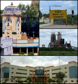
Kadapa
| Kadapa | ||
|---|---|---|
|
|
||
| State : |
|
|
| State : | Andhra Pradesh | |
| District : | YSR | |
| Location : | 14 ° 28 ′ N , 78 ° 49 ′ E | |
| Height : | 137 m | |
| Area : | 164.08 km² | |
| Residents : | 343,054 (2011) | |
| Population density : | 2091 inhabitants / km² | |
| Website : | www.kadapamunicipalcorporation.org | |
Kadapa (formerly Anglicizing Cuddapah ) is a city in the Indian state of Andhra Pradesh .
Kadapa is the capital of the YSR District (formerly Kadapa ). Founded in 1868, the municipality is one of the oldest in the Rayalaseema region . At that time it extended over an area of 6.84 km². On November 17, 2004, the city received the status of a Municipal Corporation and increased its area to 91.05 km². In the following year the city grew to 164.08 km² as a result of incorporations. In 2001 the city had 287,093 inhabitants. At the 2011 census, the population of Kadapa was 343,054.
Kadapa is located 210 km northwest of Chennai on the edge of the Palakonda Hills. 5 km north of the city, the Penna River flows eastwards.
The national highway NH 18 ( Kurnool - Chittoor ) runs through Kadapa.


