Kannaland
| Kannaland Kannaland Local Municipality |
|
|---|---|
 |
|
| Basic data | |
| Country | South Africa |
| province | Western cape |
| District | Garden Route |
| Seat | Ladismith |
| surface | 4758 km² |
| Residents | 24,767 (October 2011) |
| density | 5.2 inhabitants per km² |
| key | WC041 |
| ISO 3166-2 | ZA toilet |
| Website | www.kannaland.gov.za (English) |
| politics | |
| mayor | Magdaleen Barry |
Coordinates: 33 ° 29 ′ S , 28 ° 15 ′ E
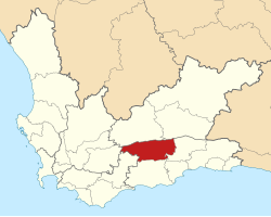
Kannaland is a municipality in the Garden Route District, Western Cape Province in South Africa . In 2011 the population was 24,767 on a total area of 4,758 km². The seat of the municipal administration is Ladismith .
The community is named after the Khoikhoi name for a plant that grows there, the gwana .
Cities / towns
- Anysberg
- Badshoogte
- Bergsig
- Calitzdorp
- Droevlei
- Kraaldorings
- Ladismith
- Oosgam
- Plathuis
- Vanwyksdorp
- Vleirivier
- Zoar
population
In 2011 the community had 24,767 inhabitants. 84.6% of these were colored , 9.9% white and 4.7% black.
The spoken language was 93.1% Afrikaans and 2.5% English.
history
Kannaland is the only South African community in which the Independent Civic Organization of South Africa got the most seats with three out of seven in the local elections in 2016 . However, the remaining parties formed a coalition.
Attractions
- Anysberg Nature Reserve
- Gamkaberg Nature Reserve
- Red Mountain Nature Reserve
- Swartberg Nature Reserve
- Towerkop Nature Reserve
Web links
- Portrait at localgovernment.co.za (English)
Individual evidence
- ^ Municipal boundaries South Africa
- ↑ Meaning of the name municipalities ( Memento from August 29, 2019 in the Internet Archive ) (English)
- ↑ http://www.statssa.gov.za/?page_id=993&id=kannaland-municipality