
Kaponigbach
| Kaponigbach | ||
 Kaponigbach (2017) |
||
| Data | ||
| location | Carinthia | |
| River system | Danube | |
| Drain over | Möll → Drau → Danube → Black Sea | |
| source | at Tristenspitz 46 ° 58 ′ 1 ″ N , 13 ° 17 ′ 34 ″ E |
|
| Source height | 2187 m | |
| muzzle | near Obervellach in the Möll coordinates: 46 ° 55 '49 " N , 13 ° 11' 55" E 46 ° 55 '49 " N , 13 ° 11' 55" E |
|
| Mouth height | 670 m | |
| Height difference | 1517 m | |
| Bottom slope | 15% | |
| length | 10 km | |
The Kaponigbach is about ten kilometers long, year-round water-bearing flowing water in the Hohe Tauern National Park in Carinthia , Austria .
course
The stream rises in a barren scree field on the western slope of the Tristenspitz (2930 m) at an altitude of 2187 m above sea level. A. just above the tree line . After about 800 m to the west, the stream occurs at 1950 m above sea level. A. enters the Krummholz zone, which is characterized by pines , and takes in the water of numerous mountain streams of the Reisseck group on its further flow path . Some of these are only temporarily pouring and some arise at heights of over 2500 m.
At an altitude of about 1500 m above sea level. A. the accompanying vegetation gradually changes into fir stands and the mountain mixed forest begins below the Stranighütte .
After a further two kilometers of the flow path and further tributaries, the Kaponigbach, which has already swelled into a small river there, turns to a southwestern flow course at 1300 m and meanders down to the at about 1000 m above sea level. A. lying, name-giving scattered settlement Kaponig .
Below Kaponig, the water runs in a steep, southern straight line to Dürnvellach , where its water power used to drive a mill. In Obervellach , the Kaponigbach flows into the Möll from the left as a receiving water after it has overcome an altitude of 1500 meters .
gallery
View in the upper reaches

in the moss soil

Scree field in the middle reaches

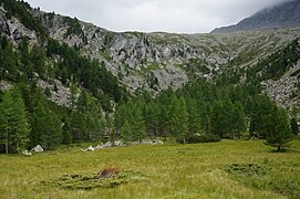
View into the Kaponigtal (2017)
_mit_Blick_auf_die_Pfaffenberger_Nocken.jpg)


)/init.aspx?hotspot=kaernten_atlas%7Catlas_basiskarten%7C1:100000.0%7C439796%7C199012%7Chotspot0.gif%7C&redliningid=vehiul5ruxp54stfla15rivz)