Kasym
|
Kasym Казы́м, Казым |
||
|
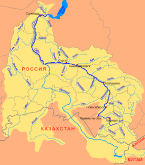
Course of the Kasym (Казым) in the north of the Ob river basin |
||
| Data | ||
| Water code | RU : 15020100112115300020203 | |
| location | Khanty and Mansi Autonomous Okrug / Ugra ( Russia ) | |
| River system | If | |
| Drain over | Whether → Arctic Ocean | |
| origin | Kasym-Tai-Lor Lake 63 ° 10 ′ 14 ″ N , 71 ° 27 ′ 14 ″ E |
|
| Source height | 136 m | |
| muzzle |
Whether coordinates: 64 ° 6 ′ 0 ″ N , 66 ° 2 ′ 3 ″ E 64 ° 6 ′ 0 ″ N , 66 ° 2 ′ 3 ″ E |
|
| Mouth height | 7 m | |
| Height difference | 129 m | |
| Bottom slope | 0.2 ‰ | |
| length | 659 km | |
| Catchment area | 35,600 km² | |
| Discharge at the Juilsk A Eo gauge : 7540 km² Location: 417 km above the mouth |
MQ 1967/1999 Mq 1967/1999 |
76.7 m³ / s 10.2 l / (s km²) |
| Left tributaries | Amnja , Lychn | |
| Right tributaries | This way | |
| Medium-sized cities | Belojarsky | |
| Navigable | 180 km (from Verkhnekasymsky ) | |
The Kasym ( Russian Казы́м ) is a 659 kilometers long right tributary of the Ob in the West Siberian lowlands in Russia .
course
The Kasym flows at 136 m height from a swamp area around the lake Kasym-Tai-Lor on the northern flank of the Siberian Ridge (Sibirskije Uwaly) in the north-western central part of the West Siberian lowlands. It flows through the swampy and lake-rich lowlands in a westerly direction for the first few kilometers in a northerly direction , then along its entire length, always on the territory of the autonomous district of the Khanty and Mansi / Ugra . It finally flows into the right arm of the Ob, the Great Ob (Bolshaya Ob) at a height of 7 m , after it had already united with the Ob arm Sudochodnaja ("Navigable Ob") about 40 km before that, below the settlement of Polnowat , and parallel to the Ob had flowed north.
The most important tributaries of the Kasym are Amnja and Lychn from the left and Sorum from the right.
Hydrography
The catchment area of the Kasym covers 35,600 km². Near the mouth, below the junction with the Sudokhodnaja Ob, the river reaches a width of almost 500 m and a depth of 5 m; the flow velocity here is 0.5 m / s.
The Kasym freezes from the beginning of November until the second half of May. The water flow at Juilsk on the upper middle reaches, 417 km above the mouth, is an annual average of 76.7 m³ / s with a minimum of 21.7 m³ / s in March and a maximum of 191 m³ / s in June, in the vicinity of the mouth the annual average 267 m³ / s.
Infrastructure and economy
The river is navigable for 180 km from the Verkhnekasymsky settlement .
The catchment area of the Kasym is the main settlement area of the northern group of the Chanten . The economic development of part of the area through which the Kasym flows began with the discovery of West Siberian oil and natural gas deposits in the 1970s. The town of Belojarsky was built on the lower middle reaches of the river ; several pipelines cross the river.
Individual evidence
- ↑ a b Kasym in the State Water Register of the Russian Federation (Russian)
- ↑ a b Article Kasym in the Great Soviet Encyclopedia (BSE) , 3rd edition 1969–1978 (Russian)
- ↑ a b Kasym at the Juilsk gauge - hydrographic data from R-ArcticNET
- ^ List of Inland Waterways of the Russian Federation (confirmed by Order No. 1800 of the Government of the Russian Federation of December 19, 2002); on-line
