
Kathreinkogel
| Kathreinkogel | ||
|---|---|---|
 The Kathreinkogel in front of the Karawanken . |
||
| height | 772 m above sea level A. | |
| location | Carinthia , Austria | |
| Mountains | Gurktal Alps | |
| Dominance | 1.9 km → Turiawald | |
| Notch height | 200 m ↓ Kreuzwirt | |
| Coordinates | 46 ° 35 '10 " N , 14 ° 4' 29" E | |
|
||
| Type | Zeugenberg | |
| rock | dolomite | |
| Age of the rock | Anisium - Ladinium | |

The Kathreinkogel is a mountain at the western end of the Sattnitz in southern Carinthia .
geology
The Kathreinkogel is a witness mountain or a tectonic mini cliff from mitteltriassischem , weak metamorphic überprägtem, coralline algae leading dolomite ( "Diploporendolomit") formed on a mylonitic mica of the pre- perm is pushed over bedrock. The shear zone (mylonitization) extends up to 1.5 m into the carbonate rock. The determination of the age of the dolomite is based exclusively on the calcareous algae, as other fossils from this rock unit are not yet known. It is probable that these units belong to the Oberostalpin , but this is not certain. The dolomite is quarried on the southwest flank of the mountain in a large quarry. The mica schist of the basement is mostly covered by Quaternary sediments in the vicinity of the mountain .
history
Traces of Mesolithic hunters from the 7th millennium BC can be found on the mountain . Farm settlements are tangible from the Neolithic Age (3rd millennium BC). The following Bronze Age culture is seen in connection with the Frög cemetery . The first people known by name to settle here were the Celts . Artifacts from Roman times indicate the presence of the Mithras cult . During the Great Migration , the lofty mountain was used as a place of refuge. A first church from the 5th / 6th centuries Century could be archaeologically secured.
Attractions
The existing Gothic branch church Kathreinkogel was first mentioned in 1385. To the northeast of the church there is a statue of Christophorus attributed to Lobisser .
Exposed remains of the wall of a fortification from the Migration Period run around the west side of the summit.

The Gothic church on the Kathreinkogel

Christophorus statue by Lobisser
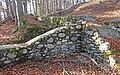
Wall remains of a fortification


literature
- Günter Lehofer: Kathreinkogel, 772m . In: Carinthia . Bergverlag Rother, pp. 84–85
- Press release on the book presentation: Searching for traces on the Kathreinkogel. News on research and settlement history. ( MS Word ) Verlag Johannes Heyn, accessed in 2014 .
- Gerfried Horand people: Contributions to the flora of Keutschach in Carinthia . In: Carinthia II . tape 176_96 . Klagenfurt 1986, p. 87-107 ( PDF on ZOBODAT [accessed March 28, 2014]).
- Herbert Paschinger: A hilltop landscape in southern Carinthia . In: Carinthia II . tape 160_80 . Klagenfurt 1970, p. 55–64 ( PDF on ZOBODAT [accessed on March 28, 2014]).
Web links
- Natural history study trip: Southern Alps and Hochkarst. (PDF) Retrieved March 28, 2014 .
- Schiefling community: Kathreinkogel. Retrieved November 12, 2019 .
Individual evidence
- ^ Karl Krainer: The Trias in Carinthia. In: Carinthia II . Volume 186 (year 106), Klagenfurt 1996, pp. 76, 84 ( PDF (17.2 MB) on ZOBODAT ).
- ↑ Thomas Claassen, Werner van Gosen, Hanns Sylvester, Friedhelm Thiedig: The Permotrias and their basement between Faaker See and Turiawald southeast of Villach (Carinthia / Austria). In: Yearbook of the Federal Geological Institute. Volume 130, No. 4, 1987, p. 393 ff. ( PDF (1.9 MB) on ZOBODAT ).