
Geba (river)
|
Rio Geba Kayanga |
||
 Map of Guinea and Guinea-Bissau with the Bissagos Archipelago and the Geba catchment area (light green) |
||
| Data | ||
| location | West Africa Guinea Senegal Guinea-Bissau |
|
| River system | Geba | |
| source |
Boké region , Guinea 12 ° 37 ′ 23 " N , 13 ° 39 ′ 6" W |
|
| Source height | approx. 75 m | |
| muzzle |
Gulf of Guinea , Guinea-Bissau , Atlantic Ocean Coordinates: 11 ° 43 ′ 20 " N , 15 ° 38 ′ 40" W, 11 ° 43 ′ 20 " N , 15 ° 38 ′ 40" W |
|
| Mouth height | 0 m | |
| Height difference | approx. 75 m | |
| Bottom slope | approx. 0.14 ‰ | |
| length | 545 km | |
| Left tributaries | Bidigor, Colufe (Campossa), Undauma, Corubal | |
| Right tributaries | Anambé | |
| Navigable | 145 km for ships up to 2000 GRT | |
 The Geba with a view of Bissau |
||
The Rio Geba is the largest river in Guinea-Bissau . In the upper reaches it is known as the Kayanga .
geography
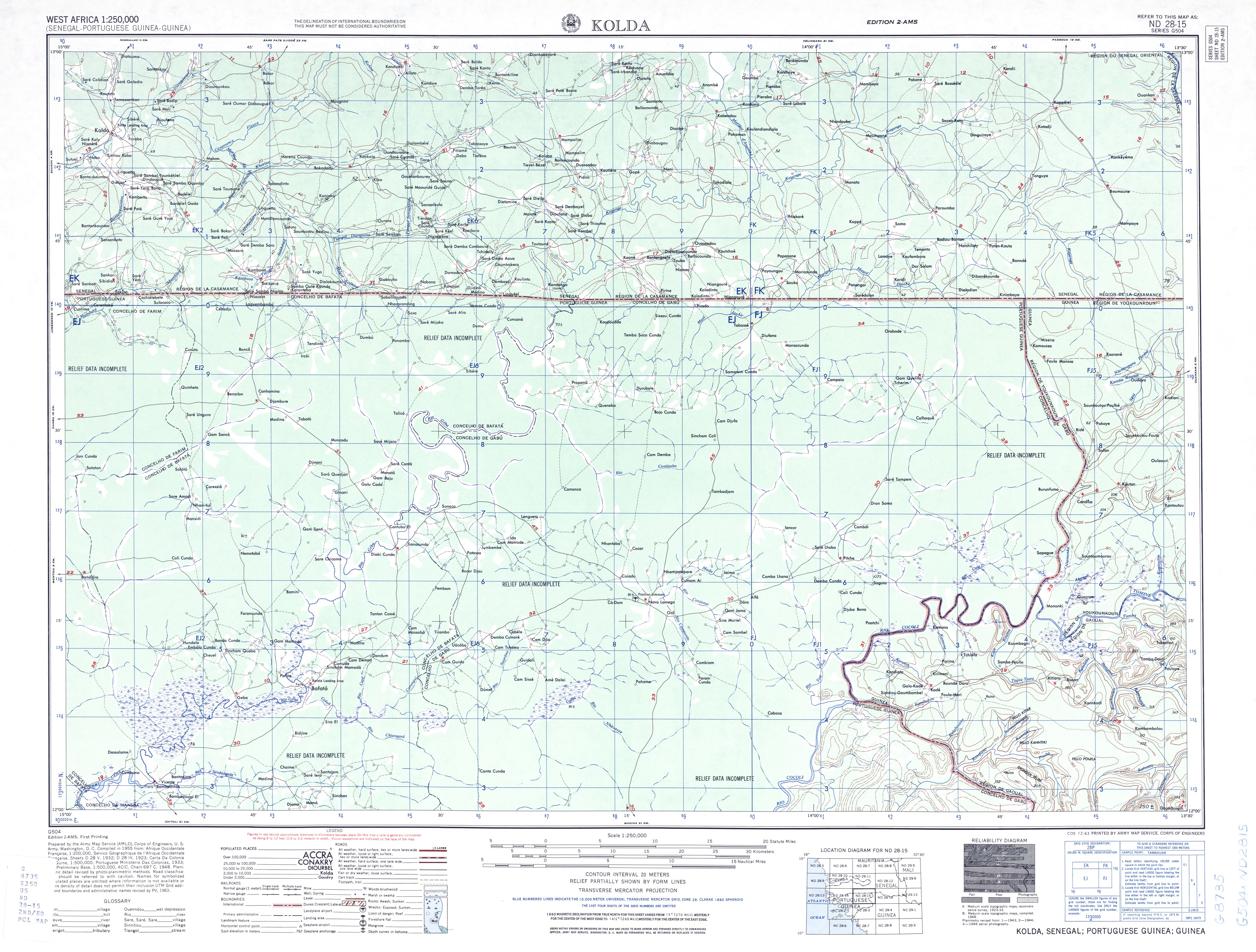
The source of the Kayanga is in the Boké region in Guinea . First, it crosses the border with the Kolda region six kilometers northwest of the source in the east of the Casamance . At a distance of about 24 kilometers from the southern border of Senegal , the Kayanga turns to the west and initially flows through a 16-kilometer-long reservoir, which is dammed behind the 1000-meter-long Barrage de Niandouba , which was built in 1997 . A little further west, at the confluence of the Anambé , a right northern tributary that drains the Vélingara crater , a 225-meter-long dam, known as the Barrage du Confluent , was built in 1984 . Both serve primarily to promote rice cultivation. The Kayanga Guinea-Bissau reaches 34 kilometers southwest of this dam.
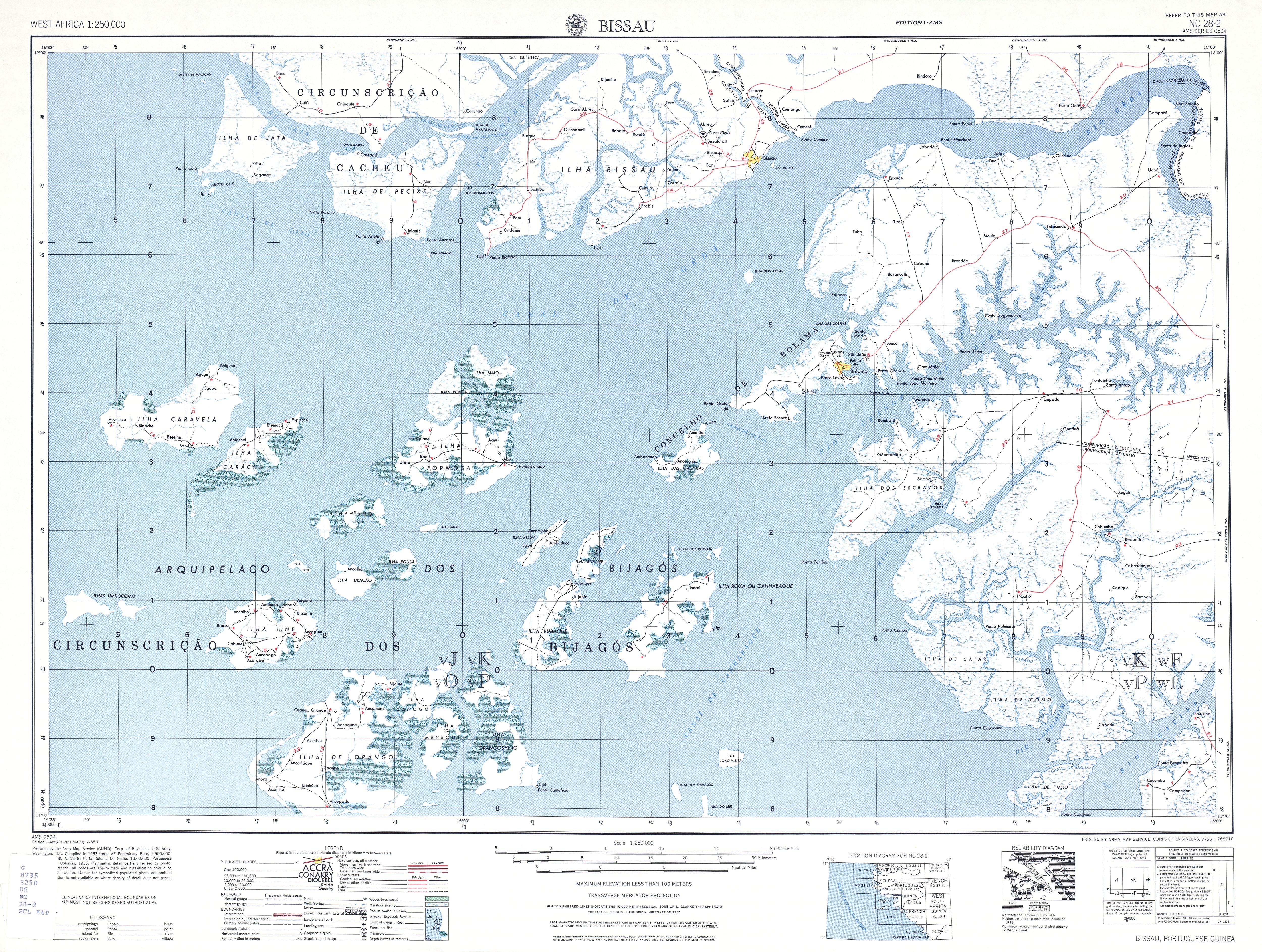
After a total length of a good 540 kilometers, the Rio Geba flows into the Atlantic Ocean in a 76-kilometer-long and up to 10-kilometer-wide funnel near Guinea-Bissau's state capital, Bissau . The mouth of the funnel extends considerably into the lower reaches of the Rio Corubal, which flows 60 kilometers above Bissau from the left and south .
Economy and Transport
The Rio Geba is navigable upstream to Bafatá , where the Colufe River empties. Among other things, rice is grown in its bank or flood zones - the rainy season from April to October .
In Guinea-Bissau, the Rio Geba is spanned by three road bridges. 82 kilometers east of the capital Bissau there is a bridge for the national road 1 , at Bafata a bridge for the regional road 1 , which leads to Bissorã , and 24 kilometers northeast of Bafata a junction from the N1 crosses the river on the way over the border to Kolda in the Casamance .
history
In Guinea-Bissau the tradition is maintained that the Rio Geba was already sailed by Nuno Tristão in 1446 . A statue in the city of Bissau commemorates him and silver coins from 1991 honor his name as the discoverer of the country.
During the Portuguese Colonial War until 1974, the river was the site of various military operations.
Web links
- Rio Geba at Geonames
- Kayanga at Geonames
- Comissão de Cartografia: "Rio Geba"
- City of Bafatá with pictures of the river
Maps of the course of the river
- TK250 sheet ND28-15 KOLDA - Upper course with the headwaters in the rainforest of Senegal and Guinea
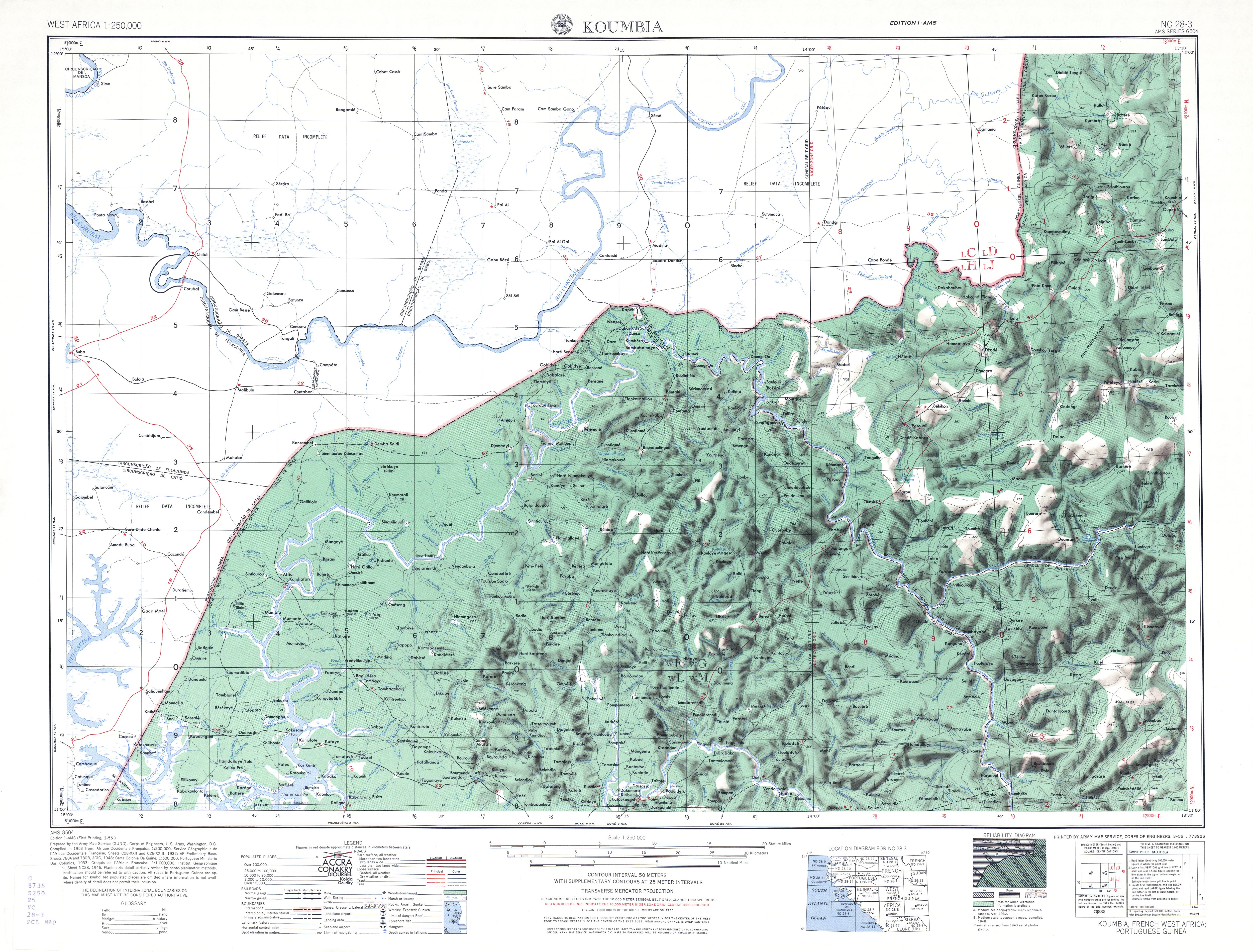
- TK250 sheet NC28-3 KOUMBIA - middle barrel
- TK250 sheet NC28-3 BISSAU - underflow as a cone funnel
Individual evidence
- ↑ Evaluation économique ex-post des barrages de Niandouba et Confluent au Sénégal. Dr. Ibrahima Hathie, 2015 PDF file 1.19 MB
- ↑ Measure distances with google maps
- ↑ bridge at Bafata
- ↑ carreiradaindia.net: rio Geba and Nuno Tristão ( Memento from November 22, 2008 in the Internet Archive )
- ↑ Bissau (Guiné) - Estátua de Nuno Tristão ( Memento from March 19, 2017 in the Internet Archive )
- ^ Commemorative coin Nuno Tristão