
Kelebia
| Kelebia | |||||
|
|||||
| Basic data | |||||
|---|---|---|---|---|---|
| State : | Hungary | ||||
| Region : | Southern Great Plain | ||||
| County : | Bács-Kiskun | ||||
| Small area until December 31, 2012 : | Kiskunhalas | ||||
| District since 1.1.2013 : | Kiskunhalas | ||||
| Coordinates : | 46 ° 12 ′ N , 19 ° 36 ′ E | ||||
| Area : | 66.70 km² | ||||
| Residents : | 2,646 (Jan. 1, 2011) | ||||
| Population density : | 40 inhabitants per km² | ||||
| Telephone code : | (+36) 77 | ||||
| Postal code : | 6423 | ||||
| KSH kódja: | 27571 | ||||
| Structure and administration (as of 2020) | |||||
| Community type : | local community | ||||
| Mayor : | József Maczkó (independent) | ||||
| Postal address : | Ady Endre et al. 114 6423 Kelebia |
||||
| Website : | |||||
| (Source: A Magyar Köztársaság helységnévkönyve 2011. január 1st at Központi statisztikai hivatal ) | |||||


Kelebia ( Croatian Kelebija , Serbian Келебија ) is a Hungarian municipality in the Kiskunhalas district in Bács-Kiskun County . It is located a good 20 kilometers south of Kiskunhalas and two kilometers north of the border with Serbia .
Parish partnership
Attractions
- Railway memorial house ( Vasutas Emlékház ) in the former railway guard house , built in 1882 (museum since 2001)
- Kárpát Fesztivál
- Roman Catholic Church Körösaljai Árpád-házi Szent Margit
- Roman Catholic Church Krisztus Király , built in 1928
- Sculpture Integető lány ( The waving girl ), created in 1963 by István Szabó jun.
- Szent István király statue, created by Jenő Kovács
photos

View of the Roman Catholic Church Krisztus Király
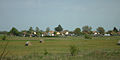
Landscape near Kelebia


traffic
Road No. 5501 runs through Kelebia. The municipality is connected to the Budapest – Belgrade railway line .
Web links
- Official website ( Hungarian )
- Kelebia near Kulturális út (Hungarian)