
Keltersbaumbach
| Keltersbaumbach | ||
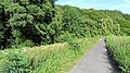
 The trench of the Keltersbaumbach on the L158 |
||
| Data | ||
| Water code | DE : 2719694 | |
| location | Bonn , North Rhine-Westphalia , Germany | |
| River system | Rhine | |
| Drain over | Godesberger Bach → Rhine → North Sea | |
| source | in Marienforst, southwest of Schweinheim (Bonn) 50 ° 40 ′ 37 ″ N , 7 ° 7 ′ 43 ″ E |
|
| Source height | approx. 153 m above sea level NHN | |
| muzzle | At Gut Marienforst in the Godesberger Bach Coordinates: 50 ° 40 ′ 22 " N , 7 ° 8 ′ 22" E 50 ° 40 ′ 22 " N , 7 ° 8 ′ 22" E |
|
| Mouth height | approx. 80 m above sea level NHN | |
| Height difference | approx. 73 m | |
| Bottom slope | approx. 67 ‰ | |
| length | 1.1 km | |
| Catchment area | 1.1 km² | |
| Drain |
MQ MHQ |
4 m³ / s 900 m³ / s |
| Big cities | Bonn | |
The Keltersbaumbach is a left tributary of the Godesberger Bach in Bonn and runs in the Schweinheim district in the Bad Godesberg district . Its total length is 1090 meters, its catchment area is 1.1 square kilometers.
Naming
The name Keltersbaum goes back to historical viticulture on the north-east exposed valley slope.
course
The Keltersbaumbach rises about 500 m east of the Hermann Löns monument on the southern slope of the Kottenforst plateau between Venner Straße and Marienforster Kirchweg. The stream does not have a point source, but is formed in its headwaters from several small watercourses, which are fed by layer springs that emerge from the main terrace as an aquifer.
Initially, the stream runs in a wooded area in an easterly direction, until it bends to the southeast after approx. 450 m below the agricultural area of the Marienforst estate . Here he takes on some side runs. In its further course, the stream flows until it crosses under the Im Hohn road within a notched valley with sometimes high erosion rates and a pronounced SW-NE valley asymmetry. From the road underpass, it is then piped for 60 m and then crosses some private gardens, although here there is little proximity to nature. After the Keltersbaumbach has reached the state road 158, it runs parallel to it for about 180 m in a south-westerly direction in a ditch until it passes under it at Gut Marienforst and after a further 70 m in a north-east direction it flows into a still water. The overflow of this pond, which has already been partially silted up by sediment loads, then drains into the Godesberger Bach .
The stream flows through the forest area, settlement area and agricultural land. The water quality in the non-piped areas is II.
particularities
The special geological situation on the edge of the Kottenforst Plateau causes the extensive discharge of groundwater in the source area.
The beginning of the formation of sources can be dated to around 10,000 years ago ( Quaternary , Holocene ).
The water ecology in the forestry upper reaches is almost undisturbed.
gallery
Dense, natural flora on the upper reaches of the Keltersbaumbach

The "natural" source of a tributary
Short piping in the upper reaches at the beginning of the Marienforster Kirchweg

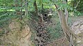
The Keltersbaumbach below the Marienforster Kirchweg
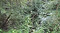
The Keltersbaumbachtal in the middle reaches


Web links
Individual evidence
- ↑ a b Topographical Information Management, Cologne District Government, Department GEObasis NRW ( Notes )
- ↑ a b German basic map 1: 5000
- ↑ a b c d e Bach Development Plan 2008 , City of Bonn (PDF; 1.65 MB)
- ↑ Water quality map of the city of Bonn, 3rd edition