Kienberg (Ascha)
|
Kienberg
Ascha municipality (Lower Bavaria)
Coordinates: 48 ° 59 ′ 29 ″ N , 12 ° 37 ′ 18 ″ E
|
|
|---|---|
| Height : | 390–405 m above sea level NN |
| Residents : | 16 (May 25 1987) |
| Postal code : | 94347 |
| Area code : | 09961 |
|
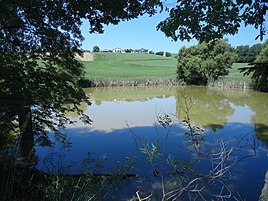
Kienberg from the southeast
|
|
The hamlet of Kienberg is a district in the Bärnzell district of the municipality of Ascha in the Lower Bavarian district of Straubing-Bogen . The small settlement with three farmsteads is a good one kilometer southwest of the center of Ascha in an open corridor on the leading edge of a plateau that runs to the southeast and merges into a steeper slope in the local area. Along the southwestern foot of the river, the Kienbach runs in mostly wooded Kerbtal to the Kinsach , which runs southward in a significantly wider hollow on the other side of the small ridge. The federal highway 20 moves slightly before the foot of the slope on the Kinsachseite the river parallel. An access road from the SR 68 district road, which runs closer to the Kinsach, climbs the slope to Kienberg and then continues over the rear plateau to the SR 28 from Ascha to Falkenfels .
history
For the years 1950 and 1961, the census records document Kienberg and not Bärnzell as the main town of Bärnzell.
Population development
| year | 1861 | 1871 | 1875 | 1885 | 1900 | 1925 | 1950 | 1961 | 1970 | 1987 |
|---|---|---|---|---|---|---|---|---|---|---|
| Resident town Kienberg | 22nd | 19th | 20th | 45 | 25th | 23 | 29 | 18th | 15th | 16 |
| Population share of the community population | 8.87% | 7.42% | 8.03% | 18.15% | 10.12% | 10.70% | 12.95% | 10.71% | ||
| Resident of the Bärnzell community | 248 | 256 | 249 | 248 | 247 | 215 | 224 | 168 |
The year 1885 is striking in terms of population development, with an increase in the population of 125% within ten years and a subsequent decrease of 44% within five years.
Web links
- Kienberg in the location database of the Bayerische Landesbibliothek Online . Bavarian State Library
Individual evidence
- ↑ a b Bavarian State Office for Statistics and Data Processing (Ed.): Official local directory for Bavaria, territorial status: May 25, 1987 . Issue 450 of the articles on Bavaria's statistics. Munich November 1991, DNB 94240937X , p. 233 ( digitized version - (in tabular form) Kienberg, W .; population at the location of the main building: 16; buildings with living space: 3; apartments: 4;)
- ↑ a b Bavarian State Statistical Office (ed.): Official place directory for Bavaria - edited on the basis of the census of September 13, 1950 . Issue 169 of the articles on Bavaria's statistics. Munich 1952, DNB 453660975 , Section II, Sp. 364 ( digitized version ).
- ↑ a b Bavarian State Statistical Office (ed.): Official city directory for Bavaria, territorial status on October 1, 1964 with statistical information from the 1961 census . Issue 260 of the articles on Bavaria's statistics. Munich 1964, DNB 453660959 , Section II, Sp. 271 ( digitized version ).
- ^ Joseph Heyberger, Chr. Schmitt, v. Wachter: Topographical-statistical manual of the Kingdom of Bavaria with an alphabetical local dictionary . In: K. Bayer. Statistical Bureau (Ed.): Bavaria. Regional and folklore of the Kingdom of Bavaria . tape 5 . Literary and artistic establishment of the JG Cotta'schen Buchhandlung, Munich 1867, Sp. 364 , urn : nbn: de: bvb: 12-bsb10374496-4 ( digitized version ).
- ↑ Kgl. Statistical Bureau (ed.): Complete list of localities of the Kingdom of Bavaria. According to districts, administrative districts, court districts and municipalities, including parish, school and post office affiliation ... with an alphabetical general register containing the population according to the results of the census of December 1, 1875 . Adolf Ackermann, Munich 1877, 2nd section (population figures from 1871, cattle figures from 1873), Sp. 394 , urn : nbn: de: bvb: 12-bsb00052489-4 ( digital copy ).
- ↑ Kgl. Statistical Bureau (ed.): Complete list of localities of the Kingdom of Bavaria. According to districts, administrative districts, court districts and municipalities, including parish, school and post office affiliation ... with an alphabetical general register containing the population according to the results of the census of December 1, 1875 . Adolf Ackermann, Munich 1877, section 3, p. 77 , urn : nbn: de: bvb: 12-bsb00052489-4 ( digitized version ).
- ↑ K. Bayer. Statistical Bureau (Ed.): Localities directory of the Kingdom of Bavaria. According to government districts, administrative districts, ... then with an alphabetical register of locations, including the property and the responsible administrative district for each location. LIV. Issue of the contributions to the statistics of the Kingdom of Bavaria. Munich 1888, Section III, Sp. 374 ( digitized version ).
- ↑ K. Bayer. Statistical Bureau (Ed.): Directory of localities of the Kingdom of Bavaria, with alphabetical register of places . LXV. Issue of the contributions to the statistics of the Kingdom of Bavaria. Munich 1904, Section II, Sp. 381 ( digitized version ).
- ↑ Bavarian State Statistical Office (ed.): Localities directory for the Free State of Bavaria according to the census of June 16, 1925 and the territorial status of January 1, 1928 . Issue 109 of the articles on Bavaria's statistics. Munich 1928, Section II, Sp. 393 ( digitized version ).
- ^ Bavarian State Statistical Office (ed.): Official place directory for Bavaria . Issue 335 of the articles on Bavaria's statistics. Munich 1973, DNB 740801384 , p. 112 ( digitized version ).

