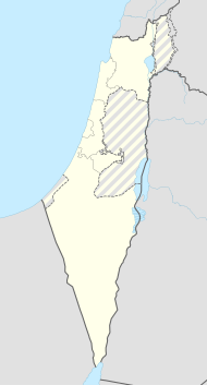
Kirjat Tiw'on
| Kirjat Tiw'on | ||
|---|---|---|
| Basic data | ||
| hebrew : | קִרְיַת טִבְעוֹן | |
| State : |
|
|
| District : | Haifa | |
| Coordinates : | 32 ° 43 ' N , 35 ° 8' E | |
| Area : | 8.419 km² | |
| Residents : | 18,121 (as of 2018) | |
| Population density : | 2,152 inhabitants per km² | |
| Community code : | 2300 | |
| Time zone : | UTC + 2 | |
|
|
||
Kirjat Tiw'on ( Hebrew קִרְיַת טִבְעוֹן Qirjat Ṭivʿōn ; Due to the translation from Hebrew, different spellings occur, e.g. B. Qiryat Tiv'on) is a local association in Galilee in northern Israel with 18,121 inhabitants (as of 2018).
General information
The place is located on a ridge east of the Carmel Mountains on the Haifa - Nazaret road .
The coat of arms of Kirjat Tiw'on shows a cyclamen , which is supposed to symbolize growth in barren surroundings and at the same time the connection to the natural environment. After the establishment of the State of Israel, Kirjat Tiw'on had the status of a development city . Today the average level of education is relatively high. There is no industry in Kirjat Tiw'on, but there are two swimming pools, a picnic area, a youth hostel , a guest house and a home care facility.
There are several social and educational institutions in the Kirjat Tiw'on area. The youth village Ramat Hadassah Szold is located in a natural oak forest in the urban area for 220 disadvantaged children and young people between 12 and 16 years of age. In the southwest of the city is the disabled village Kfar Tikva, founded in 1964 with German support . West of Kirjat Tiw'on is the "Oranim" (pine or pine) training center, founded in 1951, with a botanical garden and a small zoo that trains educators and teachers in cooperation with the University of Haifa .
history
Kirjat Tiw'on was combined in 1958 from three places, two of which were created during the time of the "fifth Aliyah " (wave of immigration) from 1933 to 1939, mainly from Germany:
- Tiw'on, founded in 1947, named after a settlement which, at the time of the Roman occupation, was presumably on the site of today's neighboring kibbutz Allonim;
- Kirjat Amal, founded in 1937 and
- Elroi, founded in 1936 by immigrants from Kurdistan and named after David El Ro'i , who led a messianic movement there in the 12th century .
Kirjat Haroschet, which was founded in 1934 and thus also at the time of the fifth Aliyah, was incorporated in 1979 as the fourth town.
Near Kirjat Tiw'on
The most important sight is the national park Bet She'arim , southeast of Kirjat Tiw'on, the seat of the highest Jewish court around 2000 years ago with the most important Jewish burial place from the time of the Mishnah and Talmud . The catacombs were excavated and surrounded by parks.
An open archaeological park is to be created near the northeastern settlement of Aloni Aba / Allone Abba . During construction work in September 2006, an oil mill and oil press that was more than 2000 years old was discovered, which archaeologists believe had been in use from the Hellenistic period (4th century BC) to the early Roman epoch (1st century) .
Town twinning
Kirjat Tiw'on maintains city partnerships with Braunschweig and Compiègne . Contacts with Braunschweig have existed since 1968; In 1981 a friendship agreement was signed and in 1985/86 it was converted into a town twinning. In October 1991 a newly designed friendship garden "Kiryat Tivon - Braunschweig" was opened.
Web links
- City partnership on the website of the city of Braunschweig
- The discovery of the olive press on the website of the Israeli Antiquities Authority (English)
Individual evidence
- ↑ אוכלוסייה ביישובים 2018 (population of the settlements 2018). (XLSX; 0.13 MB) Israel Central Bureau of Statistics , August 25, 2019, accessed May 11, 2020 .
- ↑ אוכלוסייה ביישובים 2018 (population of the settlements 2018). (XLSX; 0.13 MB) Israel Central Bureau of Statistics , August 25, 2019, accessed May 11, 2020 .

