Kleine Ohe (Danube)
|
Little Ohe Schöllnach |
||
|
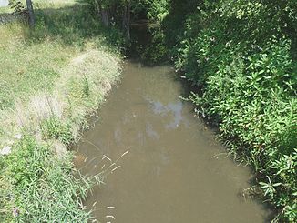
The Kleine Ohe in Schöllnach |
||
| Data | ||
| Water code | EN : 1734 | |
| location |
District of Passau , District of Deggendorf |
|
| River system | Danube | |
| Drain over | Danube → Black Sea | |
| source | west of the Brotjacklriegel , east of Liebmannsberg 48 ° 49 ′ 4 ″ N , 13 ° 12 ′ 2 ″ E |
|
| Source height | 790 m | |
| muzzle | from the north into the Danube (river km 2254) near Unterschöllnach coordinates: 48 ° 39 '49 " N , 13 ° 7' 49" E 48 ° 39 '49 " N , 13 ° 7' 49" E |
|
| Mouth height | approx. 300 m | |
| Height difference | approx. 490 m | |
| Bottom slope | approx. 16 ‰ | |
| length | 31.6 km | |
| Catchment area | 85.47 km² | |
| Left tributaries | Stadelberger Bach, Kohlstettbach, Brunnbach, Retzbach, Taidinger Graben, Wiesenbachl, Thannbach | |
| Right tributaries | Egglbach, Kellergraben, Renzlinger Mühlbach | |
| Communities | Hofkirchen (Danube) , Ausernzell , Schöllnach , Grattersdorf | |
The Kleine Ohe (also: Schöllnach ) is a left tributary of the Danube in the area of the Upper Bavarian Forest and the Lallinger Winkel .
The river, which rises as Schöllnach near the Brotjacklriegel, drains the low mountain range to the south. It crosses several places with a similar name, such as Markt Schöllnach , Schöllnstein and the districts of Hofkirchen (Danube) Ober- and Unterschöllnach .
In the Deggendorf – Passau section, the federal motorway 3 crosses the Kleine Ohe with the Schöllnachtalbrücke (422 m).
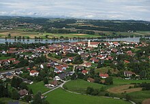
The Kleine Ohe flows into the Danube at Unterschöllnach, across from Pleinting .


