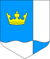
Kohtla
| Kohtla | |||
|
|||
| State : |
|
||
| Circle : |
|
||
| Coordinates : | 59 ° 20 ′ N , 27 ° 11 ′ E | ||
| Area : | 101.56 km² | ||
| Residents : | 1,640 (2012) | ||
| Population density : | 16 inhabitants per km² | ||
| Time zone : | EET (UTC + 2) | ||
| Community type: | Rural community | ||
| Mayor : | Etti Kagarov
( SDE ) |
||
| Postal address : | Järve küla 2-10 30331 Kohtla |
||
| Website : | |||

|
|||
The rural municipality of Kohtla ( Kohtla vald ) is located in Ida-Viru County in northeast Estonia .
description
The rural community has an area of 101.56 km². 1640 people live in it (as of 2012). The population density is 16 people per square kilometer.
structure
In addition to the main town Kohtla , the rural community includes the villages of Amula , Järve , Kaasikaia , Kaasikvälja , Kabelimetsa , Kukruse , Mõisamaa , Ontika , Paate , Peeri , Roodu , Saka , Servaääre , Täkumetsa , Valaste and Vitsiku .
Attractions
The Baltic German manor houses of Ontika , Kukruse , Järve , Kohtla and Kohtla are particularly worth seeing .
There is a German military cemetery in Kukruse . It is maintained by the Volksbund Deutsche Kriegsgräberfürsorge eV .
Personalities
- Reginald Uba (1911–1972), middle distance runner
Web links
Commons : Landgemeinde Kohtla - Collection of pictures, videos and audio files
- Official website (Estonian)
- Full description (Estonian)
Individual evidence
- ↑ Archived copy ( memento of the original from March 12, 2016 in the Internet Archive ) Info: The archive link was inserted automatically and has not yet been checked. Please check the original and archive link according to the instructions and then remove this notice.


