
Löwygrube

The Löwygrube park is a Viennese park in the 10th district, Favoriten .
description

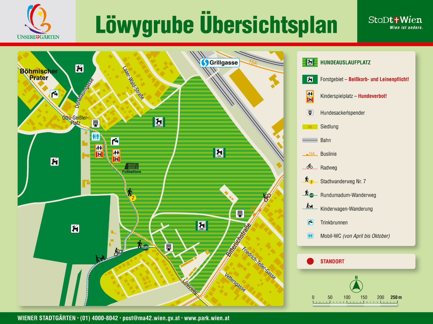
The Löwygrube park is an approx. 164,000 m² natural park in the Oberlaa district . The park is located between Bitterlichstrasse, An der Ostbahn, Donabaumgasse and Löwyweg. It is extensively cared for and is almost entirely dedicated as a dog zone . In addition to extensive lawns and an old tree population, it has a children's playground , soccer field , public toilet , seating and a drinking fountain . The Löwygrube and the Kurpark Oberlaa , the Volkspark Laaerberg and the Laaerwald are part of the Laaerberg recreational area .
history
The Löwygrube owes its name to the private Löwy brickworks by Jacob Löwy (1859–1942) , which was formerly established at this location and which mined clay and burned bricks in the Laaer Wald forest . The pipe pond and the butter pond are remnants of these brick pits. After the Second World War , from the early 1950s to around 1965, the Löwygrube was used as a landfill . Then it was converted to a local recreation area. The contaminated sites of the landfill have been secured since 2011. Today the entire area is protected as a landscape protection area.
Attractions

- In the park there is the natural monument 704 , the former dismantling wall of the Rudolf brick kilns.
- When the weather is clear, the park offers a beautiful view over the Vienna Prater and Marchfeld to the Lower Carpathian Mountains in Slovakia .
.jpg)
Web links
Individual evidence
- ↑ a b c m42sso: Löwygrube - park in Vienna. Retrieved February 10, 2019 .
- ↑ Overview plan of the Löwygrube park. In: wien.gv.at. City of Vienna, accessed on February 9, 2019 .
- ↑ Löwygrube park on sunny.at. Retrieved February 10, 2019 .
- ↑ Laaer Wald - Vienna History Wiki. Retrieved February 10, 2019 .
- ↑ m48pob: History of the Viennese garbage disposal. Retrieved February 10, 2019 .
- ^ Secured contaminated site W5: Löwy Grube-Bitterlichstrasse, contaminated site portal. Retrieved February 10, 2019 .
- ^ Vienna Environment Good. Retrieved February 10, 2019 .
- ↑ m22stb: Natural monuments in the 10th district. Retrieved February 10, 2019 .
Coordinates: 48 ° 9 ′ 45.8 ″ N , 16 ° 24 ′ 6 ″ E