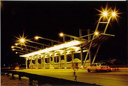
Landstrasse 44
| 44 כביש (Highway 44) in Israel | ||||||||||||||||||||||||||||||||||||||||||||||||||||

|
||||||||||||||||||||||||||||||||||||||||||||||||||||
| map | ||||||||||||||||||||||||||||||||||||||||||||||||||||
| Basic data | ||||||||||||||||||||||||||||||||||||||||||||||||||||
| Operator: | National Transport Infrastructure Company Ltd. | |||||||||||||||||||||||||||||||||||||||||||||||||||
| Start of the street: |
Tel Aviv-Jaffa ( 32 ° 2 ′ N , 34 ° 47 ′ E ) |
|||||||||||||||||||||||||||||||||||||||||||||||||||
| End of street: |
Eschtaol ( 31 ° 46 ′ N , 35 ° 0 ′ E ) |
|||||||||||||||||||||||||||||||||||||||||||||||||||
| Overall length: | 41 km | |||||||||||||||||||||||||||||||||||||||||||||||||||
|
מחוזות ( District ): |
||||||||||||||||||||||||||||||||||||||||||||||||||||
| Bus stops on Landstrasse 44 | ||||||||||||||||||||||||||||||||||||||||||||||||||||
|
Course of the road
|
||||||||||||||||||||||||||||||||||||||||||||||||||||
The highway 44 ( Hebrew כביש 44, Eng .: Highway 44 ) is a main road in Israel . It connects Tel Aviv-Jaffa and Holon with Ramla , Lod and the Schefela .
course
Highway 44 begins in the southwest of the city of Tel Aviv on Highway 20 . From there it leads in a south-westerly direction and in this section of the route is developed like a motorway. The route thus opens up the industrial area of Holon . After 5 km the Autobahn 4 crosses and the route continues to Ramla . Originally the route went through the center of Ramla, but a new route was built to bypass the town center , which, however, opens up the eastern part of the city. East of Ramla crosses highway 40 , from there the route is back on its original course.
To the east of Ramla, the route meets the motorways 431 and 6 , at the intersection of which the connection to the highway 44 is interwoven. The route continues through agriculturally used area, from there it continues to the Schefela , the hill country that is in front of the Judean mountains. There it meets the Landstrasse 38 and ends there.

