Langouyrou
| Langouyrou | ||
|
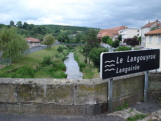
The river in Langogne |
||
| Data | ||
| Water code | FR : K2064000 | |
| location | France , Occitania region | |
| River system | Loire | |
| Drain over | Allier → Loire → Atlantic Ocean | |
| source | in the municipality of Cheylard-l'Évêque 44 ° 35 ′ 44 ″ N , 3 ° 48 ′ 49 ″ E |
|
| Source height | approx. 1450 m | |
| muzzle | in the local area of Langogne in the Allier coordinates: 44 ° 43 ′ 57 " N , 3 ° 51 ′ 35" E 44 ° 43 ′ 57 " N , 3 ° 51 ′ 35" E |
|
| Mouth height | approx. 890 m | |
| Height difference | approx. 560 m | |
| Bottom slope | approx. 29 ‰ | |
| length | 19 km | |
| Catchment area | 65 km² | |
| Left tributaries | Cheylard | |
The Langouyrou is a river in France that runs in the Lozère department in the Occitanie region . It rises in the northern Cevennes , between the peaks of Moure de la Gardille and Moure des Coufours in the municipal area of Cheylard-l'Évêque . It changes its name several times in the upper reaches ( Valat des Amarinios, Valat de Valescure, Ruisseau des Rébaudes ), generally drains in a northerly direction and after 19 kilometers flows into the Allier as a left tributary in the local area of Langogne . At the entrance to Langogne, the Langouyrou passes the Lac de Naussac reservoir just to the southeast .
Places on the river
- Espradels, municipality of Luc
- Saint-Flour-de-Mercoire
- Langogne
Web links
Commons : Langouyrou - collection of images, videos and audio files
Individual evidence
- ↑ Source geoportail.fr (1: 32,000)
- ↑ mouth geoportail.fr (1: 32,000)
- ↑ a b c The information on the river length is based on the information about the Langouyrou at SANDRE (French), accessed on February 7, 2012, rounded to full kilometers.
