Langogne
| Langogne | ||
|---|---|---|

|
|
|
| region | Occitania | |
| Department | Lozère | |
| Arrondissement | Mende | |
| Canton | Langogne (main town) | |
| Community association | Skin allier | |
| Coordinates | 44 ° 44 ′ N , 3 ° 51 ′ E | |
| height | 886–1,097 m | |
| surface | 31.37 km 2 | |
| Residents | 2,891 (January 1, 2017) | |
| Population density | 92 inhabitants / km 2 | |
| Post Code | 48300 | |
| INSEE code | 48080 | |
| Website | http://www.langogne.com/ Site de l'office de tourisme de Langogne | |
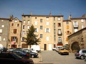
 Historic market place |
||
Langogne is a French commune with 2,891 inhabitants (at January 1, 2017) in the department of Lozère in the region Occitania .
geography
Langogne is a village on the upper reaches of the Allier river north of the Cevennes . The Langouyrou River flows into the Allier in the north of the village. The artificial reservoir Lac de Naussac lies west of the municipality.
traffic
The heart of the Cevennes Railway begins in Langogne .
Web links
Commons : Langogne - collection of images, videos and audio files


